
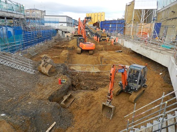
Whitechapel Station (Crossrail XSH10)
Museum of London Archaeology, 2019. https://doi.org/10.5284/1055118. How to cite using this DOI
Data copyright © Museum of London Archaeology, Crossrail Ltd unless otherwise stated
This work is licensed under a Creative Commons Attribution 4.0 International License.

Primary contact
Karen
Thomas
Head of Archive
Museum of London Archaeology
Resource identifiers
- ADS Collection: 2869
- DOI:https://doi.org/10.5284/1055118
- How to cite using this DOI
Introduction
Adjacent to Swanlea School, Durward Street - Three evaluation trenches were opened at the Cambridge Heath worksite (located to the E of Brady Street, TQ 3486 8195), while watching briefs were conducted at both that site and the Essex Wharf worksite (on the N side of Durward Street, TQ 3461 8196). In the evaluation trenches on the first site, natural sand and gravel were recorded. In the trench on the W side of the site, foundations associated with the 19th-20th-century Albion Brewery had removed all deposits above the natural. In the central area of the site, natural deposits were overlain by a sandy clay deposit which was cut by a 19th/20th-century artesian well associated with the brewery. On the E side of the site, natural sand was recorded beneath reworked brickearth which was cut by possible quarry pits containing 18th-19th-century material. A subsequent watching brief on drainage works near the N perimeter of the same site exposed naturally reworked brickearth cut by a feature containing undated alluvium, possibly associated with the Common sewer or 'Black Ditch', was exposed in areas adjacent to the projected line of the sewer. A length of this sewer was recorded during previous work under the site code ABR93. The foundations of the Albion Brewery had removed all remains earlier than 18th-century. Modern hardcore and concrete sealed the archaeological layers. A watching brief at the Essex Wharf (Durward Street) site revealed clean natural brickearth. An area of dark brickearth on the W side of the shaft was observed but not excavated. The nature of this deposit is uncertain. Modern deposits and concrete completed the sequence.
Vallance Road Gardens - Natural Taplow terrace gravels were recorded at each borehole location between 3.25 and 4.90m below street level. In the extreme eastern edge of the gardens, waterlain deposits were recorded possibly from an undated ditch or paloechannel. Immediately to the north two phases of brick floor, possibly delineating yard surfaces and associated deposits were exposed in a starter pit. One particular context containing fine Chinese porcelain, a wig curler and imported German stoneware gives us a snapshot of daily life at the time. A subsequent borehole suggested that substantial brick foundations survived to a considerable depth in this area, most likely associated with 18th-19th century terraced buildings that had been levelled following World War II. Little in situ remains survived from the period when the gardens were in use as a (Quaker) burial ground, from the late 17th to 19th centuries. Only tentative evidence was recorded of in situ remains. Disarticulated human bone was documented in each intervention, generally in the higher deposits, implying that the remains had been well disturbed and subsequently redistributed across the site. Chalk and sandstone inclusions drilled from one borehole may have been from an in situ structure of unknown date, but are just as likely arbitrary inclusions. The majority of the deposits were dated by inclusions (ceramics and tobacco pipes) from the 18th-19th centuries, and were recorded within substantial levelling/ make up dumps. The watching brief demonstrated that there is extensive survival of low grade post medieval deposits across the site, the majority formed once the burial ground had gone into disuse. 18th-19th century domestic buildings survive at a shallow depth in the north of the gardens, as predicted through contemporary mapping. There is limited evidence of Victorian and latter disturbance, again supported by documentation that shows little change following the gardens establishment in the 19th century.
Durward Street Shaft (Essex Wharf worksite) - The natural brickearth was cut by two undated ditches which may relate to the division of the area into planned plots for intensive agriculture as shown on Rocque's 18th century map. A circular brick-lined structure set into natural gravel is in the same position as a feature marked 'tank' on the 1873 Ordnance Survey map midway between the contemporary rail head and a superphosphate fertiliser works. It may relate to water supply for the former or water disposal for the latter. A part of the 19th century railway cutting retaining wall which had remained in use until the present day was recorded during demolition.
