ADS 3D Viewer is a two year project funded under the ‘Marie Curie Actions’ Seventh Framework Programme, and benefits from the collaboration with the Italian Visual Computing Lab in the framework of the ARIADNE European project. In the past ten years the use of new technologies for the 3D documentation and reconstruction of cultural heritage has changed how we approach archaeological research.
The growth of information technology in 3D documentation tools, including electronic surveying instruments, laser scanners, photogrammetric cameras, and even CAD modellers, has brought an exponential increase in the use of digital data. The use of “real-time” survey software and hardware such as total stations, global positioning systems (GPS), photogrammetry and laser scanners has had a remarkable impact on archaeological recording as well as important implications for archaeological survey. The use of these techniques, by improving the accuracy and precision of the documentation process, is considerably changing the nature and implications of the word “digital” in archaeology. Presently, the main challenge for archaeologists and information and communication technology specialists consists in the preservation and dissemination of 3D data in archaeology. Up to now, a large number of 3D digital data archives have been produced and most focus on the preservation of the information over time without thinking about the accessibility of these data on the part of the scientific community.
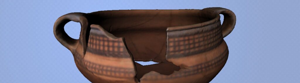
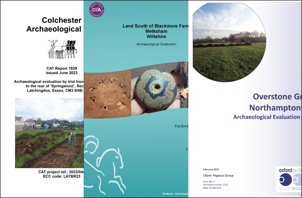
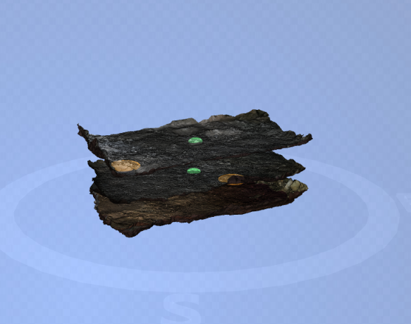
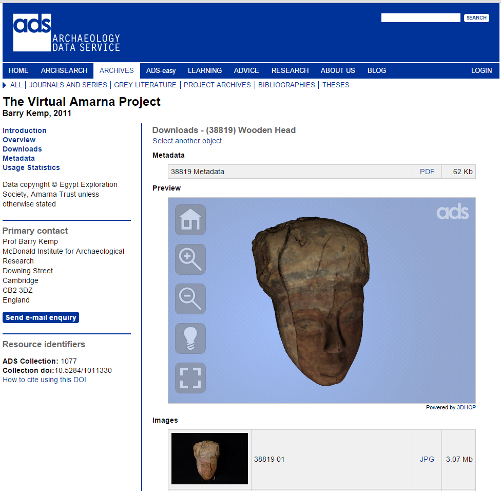
The aim of the ADS 3D Viewer project is to fill this gap, by developing an interactive 3D webbased working environment for the management and analysis of archaeological data within the ADS website infrastructure, for all kinds of users, including those who are unfamiliar with these technologies. The first accomplishment of the ADS 3D Viewer project was the development of a beta version of the viewer that extends the webbased browsing functionality of the ADS project archives. Each ADS project archive has a short introduction about the project and a download section. In the download section it is possible to view project data produced in different file formats, such as JPG (2D images) and ASCII and OBJ (3D data). Before the development of the ADS 3D Viewer it was only possible to interrogate excavation archives by downloading individual files and reassembling the 3D geometry of the site, which demands a high level of IT skills and access to software by the end user. The ADS 3D viewer developed, exploits the 3DHOP tool developed by the Visual Computing Lab, and now enables users to browse 3D geometry directly in the webpage containing all the information related to the digital model and can try out the 3D viewer in the Virtual Amarna Project archive. The 3D viewer not only offers users the possibility to interact with and analyse the 3D model in the 3D window embedded in the web-page of the project, but also in full-screen mode using a trackball and different features (viewpoint, zoom and lighting).
The final aim of the project is to improve the viewer allowing the visualization and analysis of a very specific kind of “aggregated” data such as different layers of the archaeological stratigraphy. Currently the ADS stores 3D models of each stratigraphic unit as single objects, without the possibility to explore their spatial and temporal relationship. Future developments of the 3D Viewer will aggregate different geometric layers in a single 3D environment, where the user may turn layers on and off according to different patterns (single layer, all layers under this one, two layer comparison, etc.), control their transparency, and explore the layered geometry using a specialized trackball. The ADS 3D viewer will not only allow the exploration and interaction with the different stratigraphic layers, but will also give users the possibility to measure the 3D models and select hyperlinks that provide extra information on all the features contained in the layer (i.e. text, pictures, stratigraphic unit sheet, etc.). Increasing the accessibility of 3D metric reproductions of the excavation process and the interpretations made by different scholars of the same context on the web, this new tool will be a usable and useful instrument for the remote, collaborative study of complex archaeological datasets promoting the use of 3D representations for the analysis, interpretation and knowledge production in archaeology. The progress of this research will be reported on the project webpage.