
Hello all! Teagan here to tell you about my first exciting month at the ADS. First a bit about myself. Yes, that is a ship on my head. What better way to get myself in ship shape to bring you the best blog possible?
I was born and raised in sunny California where I pursued my dream of becoming a pirate archaeologist by completing a BS in Civil Engineering (ok, I had a bit of trouble reading the treasure map). From there I flew over the seven seas to arrive in York where I received my MSc in Archaeological Information Systems before I struck gold and began working here at the ADS as a digital archives assistant.
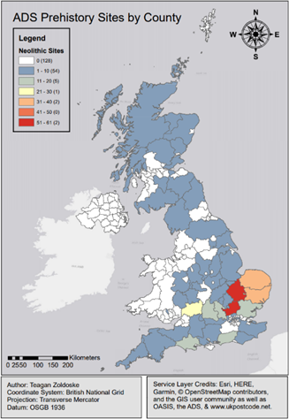
I’ve worked on a few projects since I started here, one of which is shown below. I was given an export of all the prehistoric sites found in OASIS to see what could be done with them and as I worked with GIS extensively in my undergraduate and graduate work, I was excited to see what I could do.
My first month here has felt both a bit like wading through golden syrup and as if the tide was going to rise and swallow me whole at any moment. Overall it’s been a blast.
While I’m no prehistorian (I enjoy my buildings too much) it was interesting to see what kind of work could be done with the data that the ADS helps preserve before actually digging in to normal operating procedures. Plus who doesn’t love maps? Especially informative ones that don’t make you use witchcraft a compass to find things. Exactly, no one.
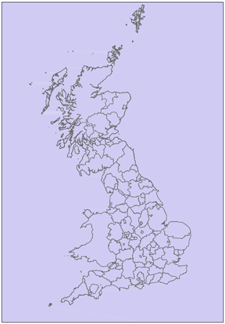
Another task I go to complete was this significantly less informative but equally lovely map of Scotland, England, and Wales on the left. This map was a bit different because output didn’t matter as much, it was the attribute table and geocoordinates that we were really after.
What this purple map allows us to do is help create an interface to where we will (eventually) be able to geospatially search and archive sites on the ADS. This should help with user intractability and dissemination of the information so more maps like the first one can be made. No, the purple colour has no significance except to be lovely, which I think it does quite well.
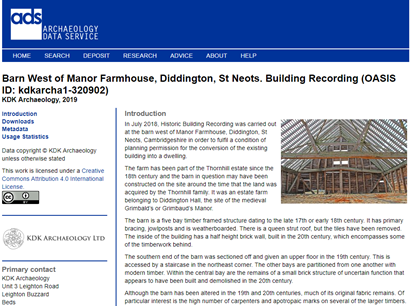
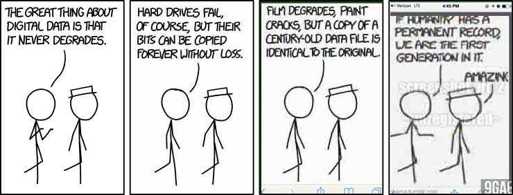
I did actually do some actual archival work though (shocking isn’t it). The first archive that I had the pleasure of preparing for the world was a building recording of an old farmhouse. Ah it felt good to dust off the old engineering degree and look at a building again. In all seriousness though, archival work is quite interesting. It requires far more coding then most people likely realise and all documentation that is submitted has to be formatted into a format that will prevent as much degradation as possible to help prevent things from devolving into an xkcd comic.
Well that’s me then. This ship wont sail itself into my second month. Till next time!
