
Yorkshire Dales National Park Historic Environment Record
Yorkshire Dales National Park Authority, 2005.
Data copyright © Yorkshire Dales National Park Authority unless otherwise stated
This work is licensed under the ADS Terms of Use and Access.

Primary contact
Yorkshire Dales National Park Authority
Yorebridge House
Bainbridge
LEYBURN
DL8 3BP
Tel: 0300 456 0030
Resource identifiers
- ADS Collection: 420
The Yorkshire Dales National Park
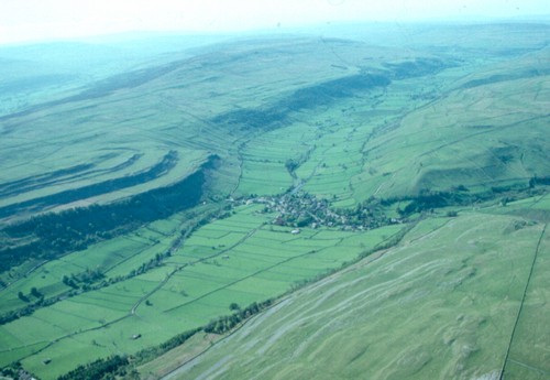
The Yorkshire Dales National Park is one of 12 National Parks in England and Wales. The National Park, most of which is privately owned, occupies an area of some 1762 km of mainly upland countryside, part of the central Pennines chain of hills which runs up the spine of Northern England. A small part of the National Park lies in the county of Cumbria, most is within the county of North Yorkshire. The National Park was designated in 1954 and is now administered by the Yorkshire Dales National Park Authority. Most of the National Park, however, is privately owned.
The National Park Authority has two statutory duties "to conserve and enhance the natural beauty, wildlife and cultural heritage" and "to promote opportunities for the understanding and enjoyment of the special qualities of the park". In carrying out these purposes, the Authority has a duty to "seek to foster the economic and social well being of local communities". It is also the local planning authority.
The historic environment of the Yorkshire Dales is particularly rich. The extensive pastoral agriculture practised in recent centuries has enabled the survival above ground of a wide range of medieval and prehistoric settlements and field systems while creating significant features in its own right - the thousands of kilometres of dry stone walls which divide the valleys and moorland into manageable plots; and, in some dales, the dense scatter of stone field barns set amongst the walled meadows and pastures. Exploitation of the rich mineral resources of the area, particularly coal, limestone and lead has also created its own distinctive monuments and landscapes.
The Historic Environment Record (HER)
The National Park Authority's Historic Environment Record (formerly Sites and Monuments Record) aims to be the most comprehensive record of information about the historic environment of the Yorkshire Dales. The core of the record is a computer database, many fields of which are available through the Archaeology Data Service but the Record also comprises material in a range of media including aerial and terrestrial photographs, copies of historic maps and detailed reports of a large number of archaeological and building recording projects and excavations by a wide range of private individuals, local societies, commercial companies and university departments. Material is continually being added to the Record and there is unfortunately a backlog of information awaiting synthesis and input into the electronic record. The National Park Authority is grateful to all those who supply it with information about the historic environment enabling us to expand and develop the HER.
Like most Historic Environment Records the Yorkshire Dales HER has its origins in the Record Cards and archaeological correspondent maps developed by the Ordnance Survey Archaeology Division, mainly in the third quarter of the twentieth century and subsequently incorporated into the National Monuments Record. A considerable advance was made in the early 1990s by the Yorkshire Dales Project, a collaborative effort by the Royal Commission on the Historical Monuments of England, English Heritage, the Yorkshire Dales National Park and North Yorkshire County Council which was designed to expand the National Monuments Record by incorporating the results of a desk based analysis of the first edition 1:10,560 Ordnance Survey maps of the area, a systematic transcription and analysis of aerial photographs and analysis of the relevant sections of the published English Place Name Society volumes for the West Riding and North Riding of Yorkshire. Since the completion of the Yorkshire Dales Project the major input into the development of the record has been work carried out, commissioned or supported by the National Park Authority or required by it as part of its development control function.
The Historic Environment Record is a major tool for the Authority in carrying out its development control and site management functions but the Authority recognises that the HER also has many other uses: in education, tourism and research as well as simply encouraging and assisting understanding and enjoyment of the Yorkshire Dales landscape.
Out of Oblivion
The electronic database of the HER is written primarily for its professional users but in order to encourage a wider audience the National Park Authority, with the financial support of the Heritage Lottery Fund, initiated the web based Out of Oblivion Project: Improving Access to Information about the Historic Environment (www.outofoblivion.org.uk). The core of the Out of Oblivion website is a series of thematic, area and period based essays linked to a small illustrated database of accessible or typical sites and features, each of which has details about access. A kid's zone enables children to see what other 'Young Archaeologists' have been up to recently in the park and also includes several specially written adventure stories about children living in the Dales in the past for children and grown ups to read together.
What is available here
Data fields available online through the Archaeology Data Service are:
HER number - a unique identifying number for a monument or site.
Site name - name of the monument or site (not all sites have names).
Monument Type and dates (period) - these are based on the English Heritage Thesaurus of Monument Types. Several monuments contain more than one type of feature, often of different periods.
Description - A text description of the site in the form of abstracts of some or all of the sources listed for the site. This is in a cumulative form with new pieces of evidence added at the end of the previous one.
Sources - references to published and unpublished reports etc
National Grid Reference - a central grid reference for the site
Administrative area - civil parish, district council and county
Help us make the HER better
We constantly endeavour to make the Historic Environment Record as accurate and complete as we can. However, the HER will never be a definitive record of the historic environment of the Yorkshire Dales: it will always reflect the extent and nature of the research, site management, survey and excavation work which has been carried out. While every effort is made to ensure that the data is as accurate and up-to-date as possible we can never guarantee that it is error free. If as you use this data, you notice any mistakes please let us know. Similarly if you notice any omissions or if you have any information which you think should be included we would also like to know. We will try to incorporate your contribution as soon as we can. Inclusion on the HER, whilst not a protection in itself, does mean that an archaeological site or historic building can be taken into account by planners, developers and site managers. If a site is not on the HER then, sadly, it is less likely to be protected against damage.
Sites to visit
Please note that the inclusion of a site in the HER does not necessarily mean that there is a right of access to visit it. Most of the sites recorded are in private ownership, with no public right of access. If you want to visit such a site, you must first obtain permission from the occupier of the land, generally the landowner or tenant. However many other sites and buildings in the Yorkshire Dales are visible from the extensive rights of way network and details are provided for the sites featured on the Out of Oblivion website. The Countryside and Rights of Way Act 2000 (CRoW) permits access on foot to many upland areas in the Yorkshire Dales National Park (see www.countrysideaccess.gov.uk for up-to-date information on Open Access areas). Many of the sites in the Yorkshire Dales National Park are Scheduled Monuments and it is a criminal offence to cause any damage to them. Others are legally protected from damage by designation as a Site of Special Scientific Interest or through being covered by Environmental Stewardship agreements.
How you may use the information available through ADS
All the information from the Yorkshire Dales HER available through ADS is provided on the understanding that it is solely for private study or research, individual use or private research provided that the source is acknowledged. It must not be copied or otherwise reproduced in the public domain without the express permission of the copyright holder(s). The Yorkshire Dales HER is produced by and is copyright of the Yorkshire Dales National Park Authority, but the copyright to many of the sources used or held by the HER remains with the individual originators.
How to Contact us
Write to us at the address in the sidebar above
Note that an appointment is necessary to access the paper records etc of the HER.
Further visitor information on the Yorkshire Dales National Park can be found on www.yorkshiredales.org.
