
Beechbrook Wood, Westwell, Kent - Integrated Site Report
Oxford Archaeology (South), 2009. (updated 2017) https://doi.org/10.5284/1044818. How to cite using this DOI
Data copyright © High Speed 1 unless otherwise stated
This work is licensed under the ADS Terms of Use and Access.

Primary contact
Stuart
Foreman
Senior Project Manager
Oxford Archaeology (South)
Janus House
Osney Mead
Oxford
OX2 0ES
UK
Tel: 01865 263800
Fax: 01865 793496
Resource identifiers
- ADS Collection: 2462
- DOI:https://doi.org/10.5284/1044818
- How to cite using this DOI

Introduction
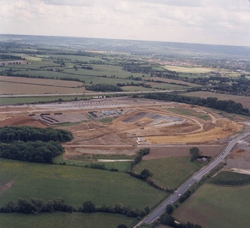
As part of an extensive programme of archaeological investigation carried out in advance of the construction of the Channel Tunnel Rail Link (CTRL), Oxford Archaeology (formerly Oxford Archaeological Unit) was commissioned to undertake a watching brief at Beechbrook Wood in Kent. In the course of the watching brief, a concentration of archaeological features was exposed and subjected to detailed excavation.
The features recorded range in date from the late Mesolithic through to the middle Roman.
A brief period of occupation during the late Mesolithic period is demonstrated by a utilised tree throw hole, which contained a large lithic assemblage. A single radiocarbon date on charred material derived from a second tree throw hole indicates broadly contemporaneous activity involving burning on the site.
Early Neolithic activity includes an isolated flint rich pit deposit, which also contained a complete quern and the remains of at least two plain bowls. Other early Neolithic material was recovered as redeposited material from the ring ditches of two round barrows.
The ring ditches of four barrows were excavated, although no direct evidence for human burial or extant earthworks survived. A complete Beaker was found in a pit within one of these ring ditches and is interpreted as a possible votive offering. A radiocarbon date on a deposit of charred hazelnuts indicates that at least one of the remaining ring ditches is of similar Beaker period date. A very similar Beaker vessel was recovered from a pit deposit that was rich in pottery, flint and charred plant remains. Given the similarity between these vessels, it is possible that the two depositional events are linked in some way.
During the middle Bronze Age, two spatially separate activity areas developed. One, situated in the east of Area C was a group of cremation burials and pits and a possible building, possibly enclosed on two sides by ditches. Activity in the area included metalworking. In the northern part of Area A, a group of pits contained large amounts of fired clay, mainly from ovens or hearths, indicating cooking or cereal drying.
The late Bronze Age saw the development of an E-W and N-S aligned field system. Pottery was recovered from only a few of the ditch segments, but several others have been assigned to this phase by their alignment and spatial relationships. Several pits were also sited along these boundaries. A cremation burial dating to this phase was also cut into the fill of the Mesolithic pit.
Middle Iron Age activity was concentrated in the far south east of the site. A double ditched concentric settlement enclosure was constructed, the fills of which contained a very important middle Iron Age pottery assemblage. A group of pits was situated c. 100 m to the east of the entrance. This type of settlement evidence is very rare for Kent at this date. Activity in the west of the site is demonstrated by a fragmentary rectilinear enclosure, the function of which is not clear, but it may have been an animal corral.
Two contemporaneous industrial enclosures containing features such as furnaces and pits related to metalworking activity are assigned to the late Iron Age to early Roman phase. This activity may possibly be associated with a natural spring. A small cremation burial cemetery was established just outside the entrance of the middle Iron Age enclosure, marking a change in the function of it or the end of its use. Subsequently, the expansion and extended use of the area to the south west of the middle Iron Age enclosure during this phase included possible drove-ways and was probably now functioning as a pastoral enclosure.
Activity continued to the south west of the middle Iron Age enclosure and included the construction of a new enclosure in the Roman period. Small scale land division, cremation burial and pit digging was undertaken in area A. Use of the site probably ceased at around AD 250.
Sherds of medieval pottery, recovered from the subsoil, suggest peripheral activity related to the nearby Parsonage Farm and Yonsea Farm manorial complexes.
The fieldwork events incorporated in this report are:
- Beechbrook Wood Watching Brief (ARC BBW00) - Watching Brief
- Beechbrook Farm Watching Brief - Area 430 (ARC WB430/85+350-85+900) - Watching Brief
- South of Beechbrook Wood (ARC BWD98) - Excavation
- South of Beechbrook Wood Watching Brief - Area 430 (ARC WB430/85+900-86+200) - Watching Brief
