
Defence of Britain Archive
Council for British Archaeology, 2002. (updated 2006) https://doi.org/10.5284/1000327. How to cite using this DOI
Data copyright © Council for British Archaeology unless otherwise stated
This work is licensed under the ADS Terms of Use and Access.

Primary contact
Council for British Archaeology
92 Micklegate
York
YO1 6JX
England
Tel: +44 (0)1904
Fax: 671417
Resource identifiers
- ADS Collection: 324
- DOI:https://doi.org/10.5284/1000327
- How to cite using this DOI
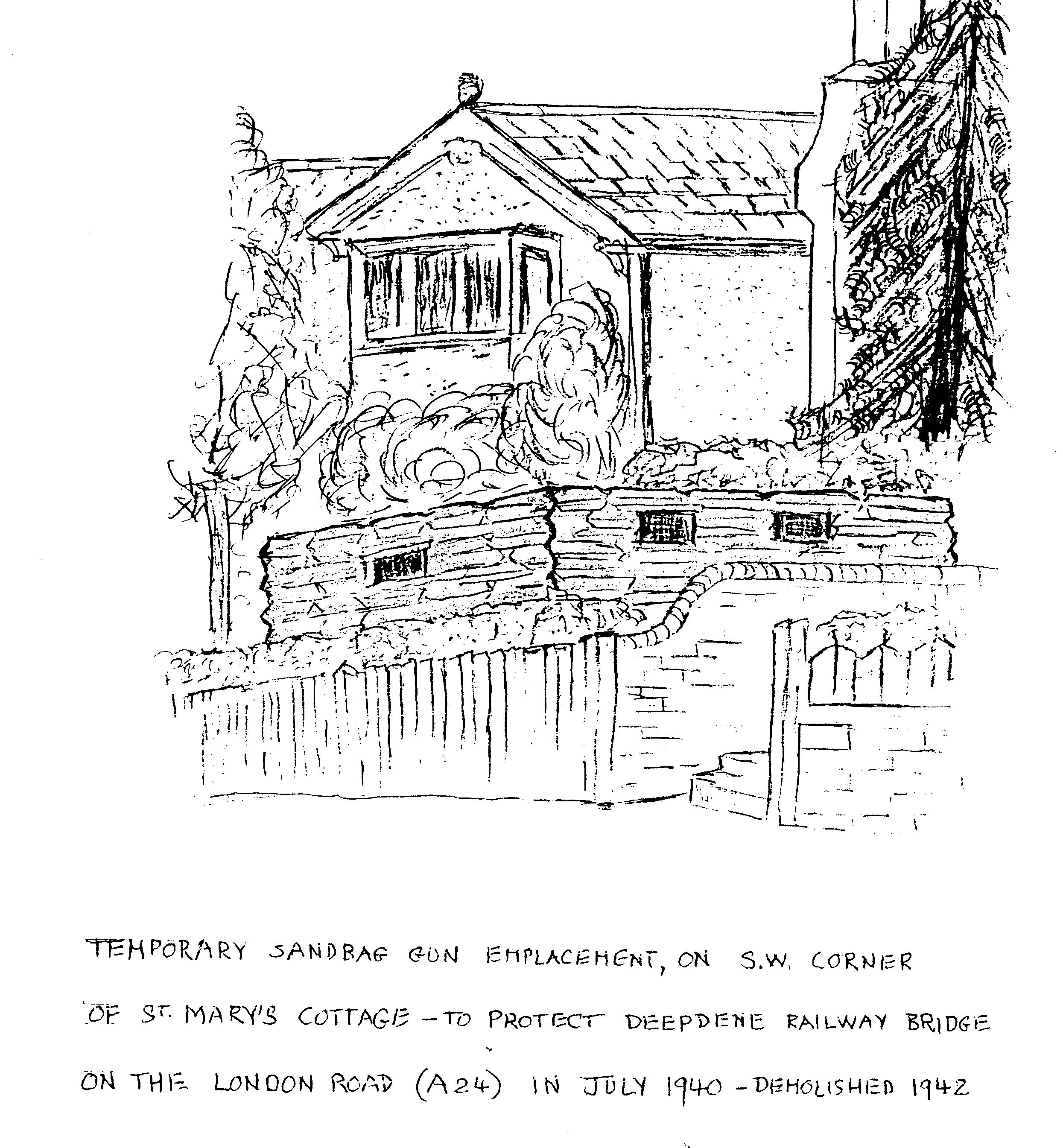
Sandbagged 'pillbox' site in garden of St. Mary's Cottage
(Source: Field Visit )
A sandbag-constructed infantry position on London Road, Dorking, close to the main railway lines (it protected Deepdene railway bridge), and adjacent to concrete roadblocks. It was demolished in 1942.
(Source: Field Visit 2000/01)
| Type of site | INFANTRY POST |
|---|---|
| Location | St. Mary's Cottage, London Road (A24), Dorking. |
| Area |
Dorking, Surrey, England |
| Grid reference |
TQ 1703 5024
(Scale: 1:10000
, 1961)
|
| Period | WW2 |
| Condition | Removed |
| Materials | Sandbags |
| Recorder | Shackel, Michael |
| Defence grouping |
Dorking Gap defences - Defences (associated with the GHQ Line) of the Dorking Gap (valley of the River Mole passing between the North Downs). Dorking nodal point - Defences of Dorking Category 'A' nodal point. Cassini ref. Q6068. [Source: List of Nodal Points in Eastern Command, 1940 - PRO WO 199/544]. |
| Attached Sheets | (2) - drawing of the infantry position as it was in July 1940 (DIGITISED), and sheet with further information. |
| Photographs |
(1) - view of the location as it is today. |
| DOB site reference: | S0010673 |
| Event |
Construction, During 1940/07 Field Visit, During 2000/01 Demolition, During 1942 |
