
Defence of Britain Archive
Council for British Archaeology, 2002. (updated 2006) https://doi.org/10.5284/1000327. How to cite using this DOI
Data copyright © Council for British Archaeology unless otherwise stated
This work is licensed under the ADS Terms of Use and Access.

Primary contact
Council for British Archaeology
92 Micklegate
York
YO1 6JX
England
Tel: +44 (0)1904
Fax: 671417
Resource identifiers
- ADS Collection: 324
- DOI:https://doi.org/10.5284/1000327
- How to cite using this DOI
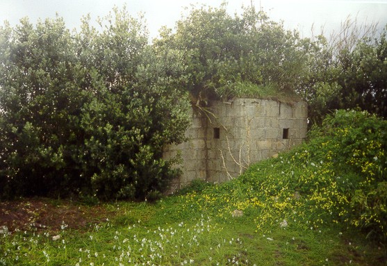
Pillbox 14, according to documentary evidence (Royal Fusiliers' map). Immediately behind coastal cliff; scheduled as SM 15534, AI 147184. Of hexagonal plan and of concrete block construction, its rear face and entrance is now exposed at the back of the enlarged boatyard area that the Duchy is creating here. Square embrasures. Entrance passage. Turf-covered concrete roof. Overgrown.
(Source: Field Visit 1999)
| Type of site | PILLBOX (VARIANT) |
|---|---|
| Location | Headland between Thomas's Porth and Porthloo, on NE corner of St. Mary's Harbour. |
| Area |
St. Mary's, Cornwall, England |
| Grid reference |
SV 9085 1120
(Scale: 1:25000
, 1964)
|
| Period | WW2 |
| Condition | Fair |
| Materials | Concrete Block |
| Threats |
Type: Plant growth (Long Term) Detail: The pillbox is heavily overgrown. |
| Recorder | Harvey, Alwyn (Fortress Study Group) |
| Defence grouping |
Scilly Isles defences - Defences of the Isles of Scilly. |
| Attached Sheets | (10) - site location map; print-outs of site descriptions from NMR; pages with attached photographs. |
| Photographs |
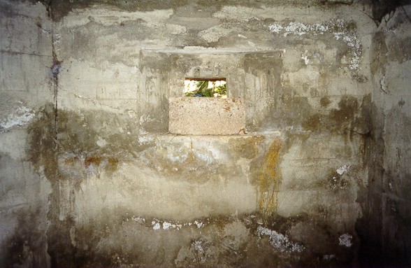
(8) - 2 interior views: 6 exterior and site views (2 DIGITISED). |
| DOB site reference: | S0012521 |
| Associated Identifier | Scheduled Monument (ref: SM 15534, AI 147184) |
| Event |
Construction, In the period 1940 1941 Field Visit, During 1999 |
