
Defence of Britain Archive
Council for British Archaeology, 2002. (updated 2006) https://doi.org/10.5284/1000327. How to cite using this DOI
Data copyright © Council for British Archaeology unless otherwise stated
This work is licensed under the ADS Terms of Use and Access.

Primary contact
Council for British Archaeology
92 Micklegate
York
YO1 6JX
England
Tel: +44 (0)1904
Fax: 671417
Resource identifiers
- ADS Collection: 324
- DOI:https://doi.org/10.5284/1000327
- How to cite using this DOI
Length of anti-tank ditch [plotted from German aerial photograph].
(Source: Air Photograph 1940)
Anti-tank ditch plotted from air photographs. It had been infilled by January 1946.
(Source: Air Photograph 1946/01/15)
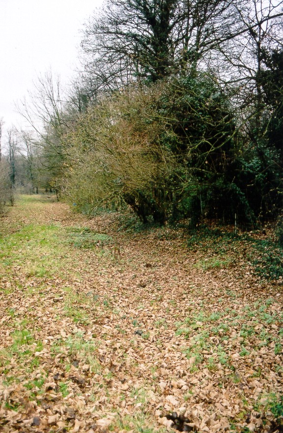
The hollow of the infilled anit-tank ditch where it runs parallel with the railway embankment can be clearly seen [close to pillbox UORN 2642].
(Source: Field Visit 2003/12/05)
| Type of site | ANTI TANK DITCH |
|---|---|
| Location | Running SW-NE across open land E of Lansdown Lane South to the Drift Bridge. |
| Area |
Epsom, Surrey, England |
| Grid reference |
TQ 2248 5962
TQ 2270 5971 TQ 2275 5993 TQ 2302 6007 TQ 2314 6016 |
| Period | WW2 |
| Condition | Infilled |
| Materials | Earthwork |
| Recorder | |
| Defence grouping |
London Stop Line: Outer - Line A (outer suburbs) of London defence rings. |
| Photographs |

|
| DOB site reference: | S0012923 |
| Reference |
1946/01/15 3G/TUD/UK/27 (fr.5298) 1946/01/15 3G/TUD/UK/27 (fr.5299) 1944/08/07 106G/LA/30 (fr.3191) 1947/05/28 CPE/UK/2101 (fr.5444) 1940/10/23 Taktisches Luftbildbuch Nr.3 |
| Event |
Infill, By 1946/01 Construction, Between 1940/06 1940/10 Infill, In the period 1944 1950 Field Visit, On 2003/12/05 |
