
England's Historic Seascapes: Scarborough to Hartlepool
Cornwall Council, 2007. https://doi.org/10.5284/1000201. How to cite using this DOI
Data copyright © Historic England unless otherwise stated
This work is licensed under the ADS Terms of Use and Access.


Primary contact
Charlie
Johns
Cornwall Council
Kennall Building, Old County Hall
Station Road
Truro
TR1 3AY
UK
Tel: 01872 322056
Resource identifiers
- ADS Collection: 744
- ALSF Project Number: 4731
- DOI:https://doi.org/10.5284/1000201
- How to cite using this DOI
Introduction | Seascapes Character Types
Salt Marsh and Sandflats
- Introduction: defining/distinguishing attributes and principal locations
- Historical processes; components, features and variability
- Values and perceptions
- Research, amenity and education
- Condition & forces for change
- Rarity and vulnerability
- Sources
Introduction: defining/distinguishing attributes and principal locations
This Type includes the following sub-types:
- Salt Marsh;
- Sandflats;
- Mudflats.
Historical processes; components, features and variability
Salt marshes are common along areas of coastal rough ground in this area. They are a type of marsh that is a transitional zone between land and salty or brackish water (e.g., sloughs, bays, estuaries). It is dominated by halophytic (salt tolerant) herbaceous plants. Historically, salt marshes have been used for grazing or have sometimes been treated as 'wastelands', along with other wetlands. The tide is the dominating characteristic of a salt marsh. The salinity of the tide defines the plants and animals that can survive in the marsh area. They usually are developed on a sinking coastline, originating as mud flats in the shallow water of sheltered bays, lagoons, and estuaries, or behind sandbars.
The salt marsh serves as a sediment sink, a nursery habitat for fishes and crustaceans, a feeding and nesting site for waterfowl and shorebirds, a habitat for numerous unique plants and animals, a nutrient source, a reservoir for storm water, an erosion control mechanism, and a site for aesthetic pleasures. Appreciation for the importance of salt marshes has led to legislation aimed at their protection.
Salt marshes are one of the most biologically productive habitats on the planet, rivaling tropical rainforests. This is partly due to the daily tidal surges that bring in nutrients, the natural chemical activity of salty (or brackish) water, the tendency of nutrients to settle in roots of the plants there, and the tendency of algae to bloom in the shallow unshaded water.
Coatham Marsh (Figure 9.57) is used by over 200 species of bird, including heron, coot and kestrel which are present throughout the year. In winter large flocks of Lapwing, Teal, Widgeon and Shovelar can be seen. Many of the old street names of nearby Warrenby echo the importance of this area for birds, names included Snipe Street, Teal Street and Wigeon Street. Skylark, lapwing and meadow pipit thrive on the insect-rich coastal grasslands.
Inter-tidal mudflats and sandflats are also encompassed in this Type. These are generally located in tidal estuaries and can contain important archaeological remains either at surface (eg quays, breakwaters, wrecks) or buried (eg old land surfaces, overwhelmed quays). Most human activities that have left remains in these areas were connected with maritime affairs but there may also be prehistoric material from when land that is now inter-tidal was dry ground.
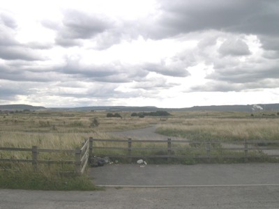
Figure 9.57. Coatham Salt Marsh, Warrenby
Values and Perceptions
Salt marshes are highly valued ecologically: many important species of fauna and flora thrive or at least survive in these. Many are now nature reserves or have been given national or county nature conservation designations (e.g. Coatham Marsh). As yet, they have not been given much attention by historians or archaeologists despite contributing much to our understanding of past communities' full and varied use of their landscape.
Research, amenity and education
Survey, excavation and analysis of the well-preserved archaeological sites has already yielded valuable information and will continue to do so. Archaeological research of the coastal peat bogs has also been carried out and should continue in light of the important palaeo-environmental information these contain.
Potential for amenity and education is great. The semi-natural vegetation is itself of interest to many people, supporting insects, birds and mammals.
Relatively little research has been undertaken on the palaeo-environmental potential of studying profiles taken from salt marshes. Further historical analysis of the uses made of these marshes and wet areas can be expected to yield useful information.
Presentation of any coherent and well-preserved historical remains to the public should be made wherever possible
Condition & forces for change
Survival is generally good as most marsh and estuarine areas have been difficult to improve agriculturally but as this is increasingly neglected except for wildfowling and some grazing; some archaeological sites are becoming obscured.
In the past, substantial areas of saltmarsh have been reclaimed as agricultural land and for urban development, but they are now accorded a high level of protection. There is growing interest in restoring salt marshes, through a process of managed retreat. Conversely, many of these areas are under threat from 'coastal squeeze', excelerated by rising sea levels and increased wave energy and storminess.
Rarity and vulnerability
This Type is subject to numerous protective designations. The Wetlands at Seaton Sands and Greatham Creek are recognised as wetlands of international importance (RAMSAR sites) for wintering wildfowl and waders and as a result are designated as Special Protection Areas (SPAs). Seal Sands are also designated as a National Nature Reserve (NNR).
Waterfowl that winter on estuaries are vulnerable to land claim and other developments that would disturb or damage the existing ecology of these sites. Other human influences, such as recreational disturbance, commercial exploitation of shellfish and worms, and oil and industrial pollution, are also potentially damaging to the conservation interest of estuaries.
Recommendations
Further agricultural improvements to salt marshes by draining, while increasingly achievable with modern machinery, should be discouraged. This would ideally be done by raising farmers' awareness of the value of the Type, but if necessary might be achieved either by designation and protection or through developing financial disincentives (eg through agri-environmental schemes).
It appears reasonable to suggest that there should be positive encouragement for re-establishing lowland marshes, where feasible, alongside the main rivers and their tributaries. This may be expected to further reduce input of nutrients into the river systems and have considerable benefits in terms of biodiversity and historic landscape character.
Continued palaeo-environmental research on the mudflats and sandflats should inform our understanding of their recent as well as medieval and earlier development. The potential existence of buried features in these areas should be considered when dealing with proposed developments.
The good maintenance of extant features should be encouraged and if they are protected statutory constraints should be enforced. More research into this Type is required and good management will be made easier through the production and implementation of integrated management plans. Both natural and historical interests should be fully considered. As well as protecting vulnerable but important remains, these plans should aim to improve the interpretation of this Type and thus increase public enjoyment of it.
Closely control further expansion of sea and riverside settlements. Identify and secure key features.
Sources
Publications:
Herring P, 1998. Cornwall's Historic Landscape. Cornwall Archaeological Unit, Truro
Websites:
http://www.defra.gov.uk/erdp/pdfs/programme/ne/section1_2.pdf
http://www.english-nature.org.uk/
