
England's Historic Seascapes: Withernsea to Skegness
Museum of London Archaeology, 2010. https://doi.org/10.5284/1000104. How to cite using this DOI
Data copyright © Historic England unless otherwise stated
This work is licensed under the ADS Terms of Use and Access.


Primary contact
David
Bowsher
Director of Research
Museum of London Archaeology
Mortimer Wheeler House
46 Eagle Wharf Road
London
N1 7ED
UK
Tel: 020 7410 2285
Resource identifiers
- ADS Collection: 935
- ALSF Project Number: 4730
- DOI:https://doi.org/10.5284/1000104
- How to cite using this DOI
Skegness and Mablethorpe Coastal Waters Character Area
Present Day Form
The Skegness and Mablethorpe coastal waters character area lies at the western extent of the study area and is immediately adjacent to the Cleethorpes to Mabelthorpe Coast and Skegness and Mablethorpe coast character areas. The area is located partly in the intertidal area and partly in open water. As a result of this it contains a mixture of beaches, drying areas and fishing areas.
The character area lies in the Lincolnshire coastal plain and is situated in the north-east part of the county. The geology of the area is the wave cut platform of Cretaceous Chalk overlain by glacial till (clay, sand and gravel debris deposited from ice sheets) called the Upper Marsh Till along with some early Holocene deposits of peat known as the Huttoft Beds. The Huttoft Beds formed in the hollows of the Mesolithic land surface which developed on the Upper Marsh Till. The early land surface was inundated by a marine transgression leaving a clay deposit known as the Ingoldmells Beds. The Beds have been dated to periods between the Bronze Age and the Roman period and represent localised marine flooding over the area as the sea level rose.
The action of the sea in this area causes extensive erosion of the beaches between Skegness and Mablethorpe. To the north of Mablethorpe and to the south of Skegness, however, the beaches are accreting. These different actions have strongly influenced patterns of historic land/sea use in the area. For instance, the Mablethorpe to Skegness coast is characterised by many phases of historic flood defence embankments and beaches that are regularly replenished, using material dredged from offshore contexts. The area is strongly associated with beach holiday activity. By contrast, the area north of Mablethorpe and to the south of Skegness is characterised by wide sandy beaches, dunes and salt marsh where lots of mariculture activities take place along with recreational activities.
Sea Use: Present
This character area has an overall dominant character associated with recreation because of the holiday resort activities that take place in the area. All the towns and villages along the coast, in the adjacent Mablethorpe and Skegness coast character area, are largely associated with tourism.
Mablethorpe has a wide flat beach, as does Chapel St Leonards. The beaches in this area are regularly replenished using material dredged from offshore contexts.
The offshore part of the character area is also actively fished. There is sole and herring spawning along with cod, plaice and lemon sole nurseries. A modern shipping channel called the Wainfleet road is located in the southern part of the character area. The area also falls with a military practice area zone.
Sea Use: Past
Although the current dominant character of this area is recreation the area has a history of sea defence and reclamation activity that probably dates back to the medieval period (University of Hull 1994). This has strongly influenced patterns of land/sea use that can be seen in the area today.
Prior to the medieval period this area would have been subject to accretion. There is evidence that prior to the 13th century the coastline was protected by a series of small islands, formed of boulder clay, that protected the coastline and caused sediment build up. The barrier was eroded during the stormy weather of the 13th century and because of this and gradual sea level rise, the coastline has become less and less protected from the full force of the North Sea and so is eroding. The remains of these islands can be seen today in Theddelthorpe and Protector Overfalls (see character area descriptions). The areas that have been subject to erosion since the medieval period were probably only reclaimed from the sea during Roman and prehistoric periods.
As a consequence of the ever changing coastline, many of the towns that are now located quite far inland, in the adjacent land based character areas, were originally coastal towns and have ancient origins and strong historic links with fishing and salt making. The waters in this character area were, therefore, traditionally used for fishing and other maritime industries until the tourist industry began to gain prominence in the Victorian period.
This area of coast became a popular destination for tourists during the Victorian period because of a belief that visits to the seaside were medicinal and health giving (Cleethorpes history. Com). This was facilitated by the advent of the railways which made it possible for day-trippers to visit regularly. The tourist trade boomed on the east coast during the Victorian period (ibid). Many of the buildings and seafronts that exist in the seaside towns of this area today were constructed during this period.
Archaeological Potential
The area has potential for the presence of drowned land surfaces resulting from the fact that sea level has fluctuated between -120 metres and +10 metres over the past 500,000 years. From the period 500,000 BP to 22,000 BP (before present), human population levels were low, and little more than stray finds may be expected, although these may still be of considerable archaeological importance. From 22,000 BP to 2100 BP parts of the North Sea were dry land and human population levels were higher. Over the last 6000 years (if not more), humans have used sea faring vessels and so wrecks and related material may lie buried in the intertidal area or be buried beneath the sea floor.
Character Perceptions
The area is perceived as being very important for tourism and recreation associated with the seaside. It is also important for fishing.
References
University of Hull, 1994, Humber Estuary and Coast, Institute of Estuarine and Coastal Studies, University of Hull, November 1994
http://www.cleethorpesholidays.com/cleethorpes_history.html
Images
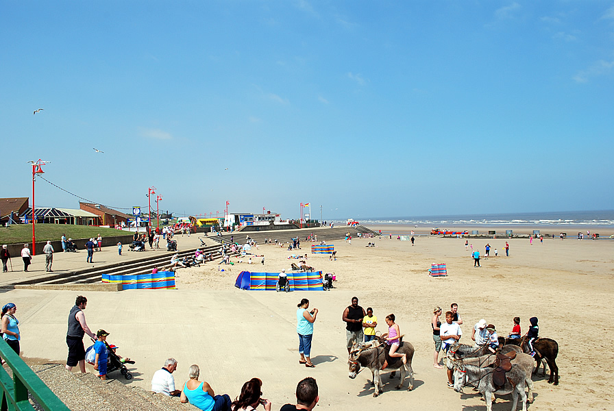
Mablethorpe beach
Web: http://www.mablethorpe.info/around/2008pix/beach0018-600.jpg
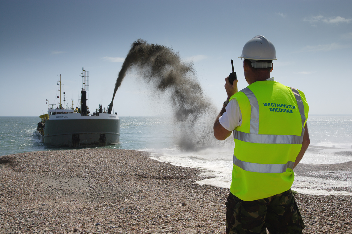
Beach replenishment underway in Lincolnshire
Web: http://www.maritimejournal.com
