
Ridge Cross, Stockland, Devon
Charles Clarke, 2014. https://doi.org/10.5284/1028301. How to cite using this DOI
Data copyright © Arrowhead Archaeology unless otherwise stated
This work is licensed under the ADS Terms of Use and Access.
Primary contact
Charles
Clarke
Director
Arrowhead Archaeology
10 West Allington
Bridport
Dorset
DT6 5BG
UK
Resource identifiers
- ADS Collection: 1723
- DOI:https://doi.org/10.5284/1028301
- How to cite using this DOI
Introduction
SUMMARY
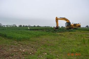
An area measuring approximately 40 x 35 m was stripped over an area in which an agricultural building was to be built. An area of c. 7 ha had been surveyed by gradiometry by Substrata Limited indicating the presence of a number of anomalies possibly indicating archaeological features. The footprint of the new building was over one of these anomalies: no. 39.
Anomaly 39 (archaeological features Pit F2 and linear F5) was a large roughly circular pit with clear signs of burning in situ on the bottom and sides to the surface. An adjacent small linear slot joining the pit in its northeast corner was interpreted as a vent. A radiocarbon sample from the main fill of Pit 2 (context 4) produced a calibrated date of AD 80 - 250 (at 95% confidence rating).
BACKGROUND
The archaeological work was recommended because the area of proposed development (APD) lies in an area of archaeological potential, particularly with reference to its proximity to Stockland Great Castle and the recovery over time of an assemblage of flint artefacts across the field. A gradiometry survey was undertaken over a larger area including the positions of B1 and B2 by Substrata Archaeological Geophysical Surveyors in late February and early March 2013.
