
The Sutton Hoo Research Project 1983-2001
Martin Carver, 2004. https://doi.org/10.5284/1000266. How to cite using this DOI
Data copyright © Prof Martin Carver unless otherwise stated
This work is licensed under the ADS Terms of Use and Access.

Primary contact
Prof
Martin
Carver
Department of Archaeology
University of York
King's Manor
Exhibition Square
York
YO1 7EP
England
Resource identifiers
- ADS Collection: 404
- DOI:https://doi.org/10.5284/1000266
- How to cite using this DOI
Downloads
Site Atlas
(Details of the property rights relating to data accessible via this archive can be found on the Overview page)
General Site Plans
| Detailed Site Plan | 569Kb | ||
| General Site Plan | Preview Image | JPG | 601Kb |
Site plans (by intervention)
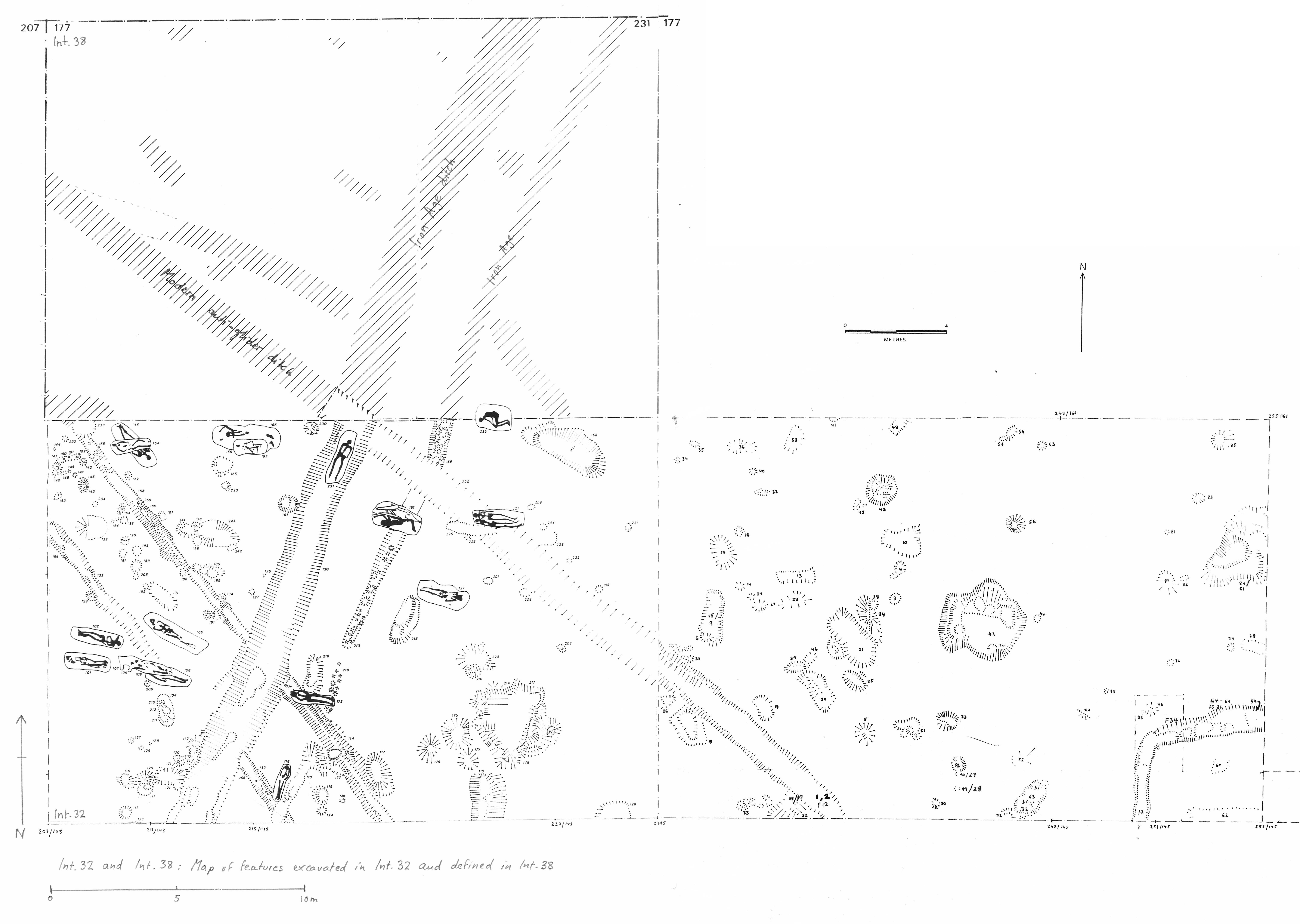
Intervention 32 (1985)
Excavation of an area in Zone F by M O H Carver and P Leach for Sutton Hoo Research Trust.
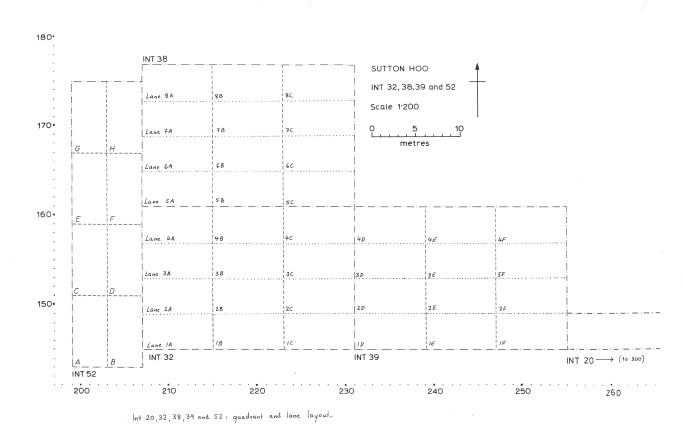
| Plan of Interventions 32, 38, 39, 52 quadrants | Preview Image | JPG | 407Kb |
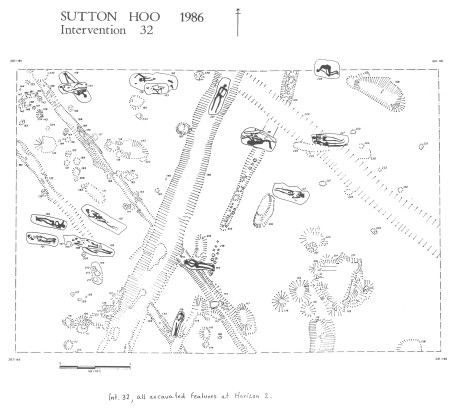
| Plan of Intervention 32, Horizon 2 (excavated) | Preview Image | JPG | 672Kb |
| Plan of Interventions 32, 38, 39, 52 Phases | Preview Image | JPG | 740Kb |
|
|||
Intervention 38 (1986)
Stripping and recording of Horizon 1 of an area in Zone F, north of Int 32, by M O H Carver for Sutton Hoo Research Trust.
| Intervention 38 Defined Features | Preview Image | JPG | 1,132Kb |
| Plan of Interventions 32, 38, 39, 52 Quadrants | Preview Image | JPG | 407Kb |
| Plan of Interventions 32, 38, 39, 52 Phases | Preview Image | JPG | 740Kb |
|
|||
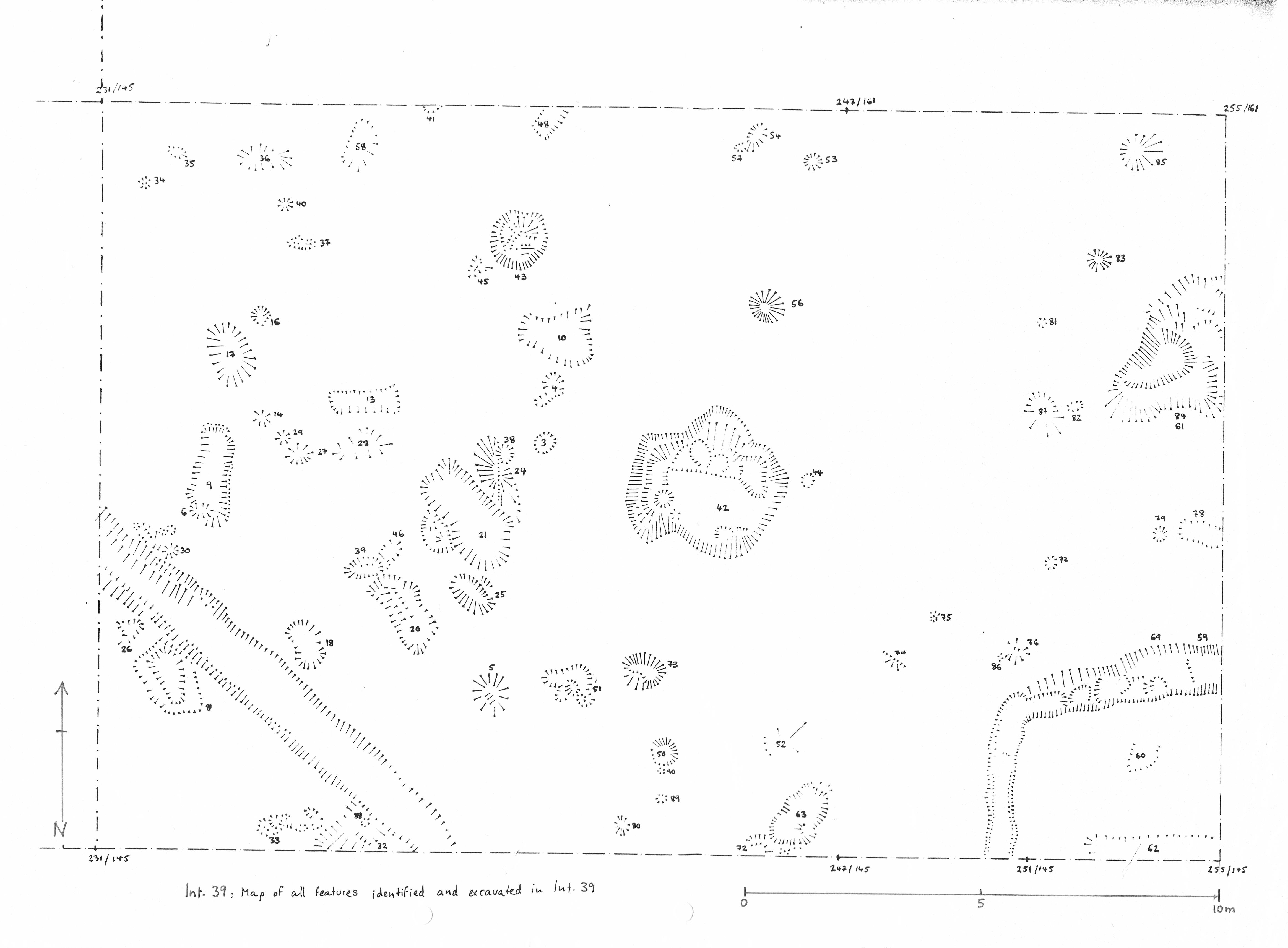
Intervention 39 (1986)
Excavation of an area in Zone F east of Int 32 by M O H Carver for Sutton Hoo Research Trust.
| Plan of Intervention 39, horizon 2 (excavated) | Preview Image | JPG | 632Kb |
| Plan of Interventions 32, 38, 39, 52 quadrants | Preview Image | JPG | 407Kb |
| Plan of Interventions 32, 38, 39, 52 phases | Preview Image | JPG | 740Kb |
|
|||
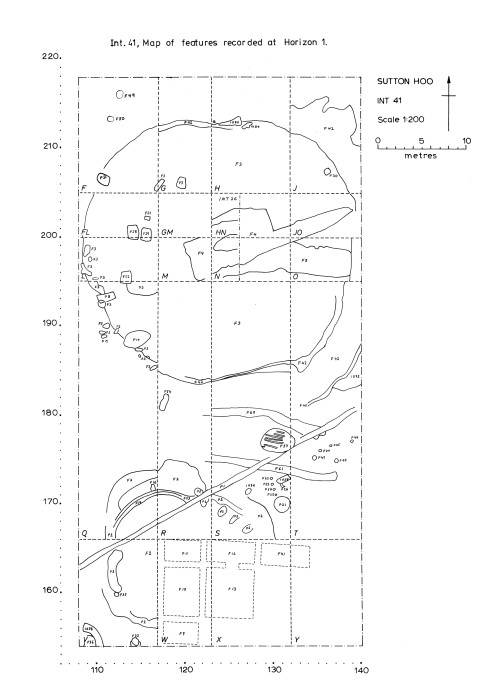
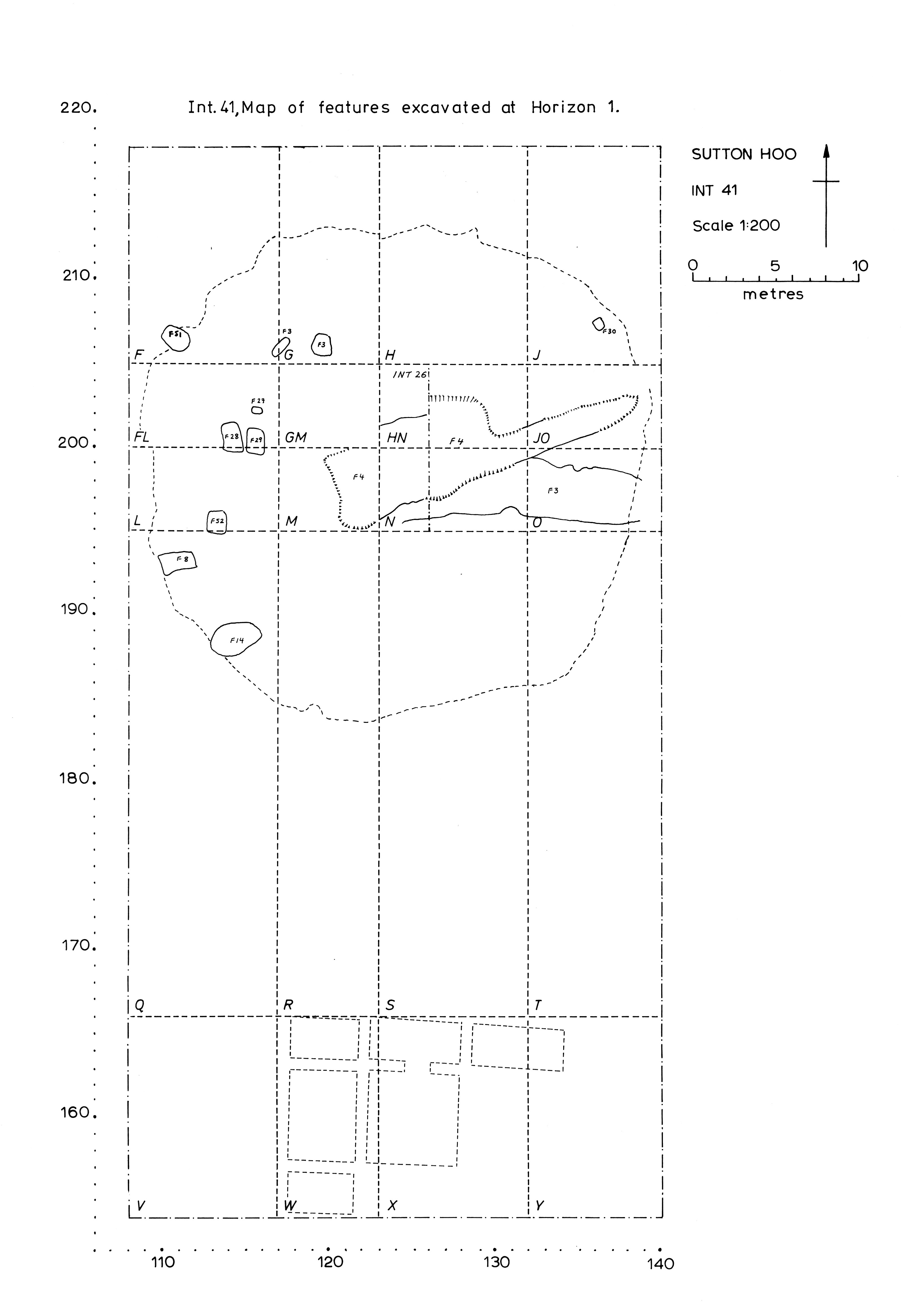
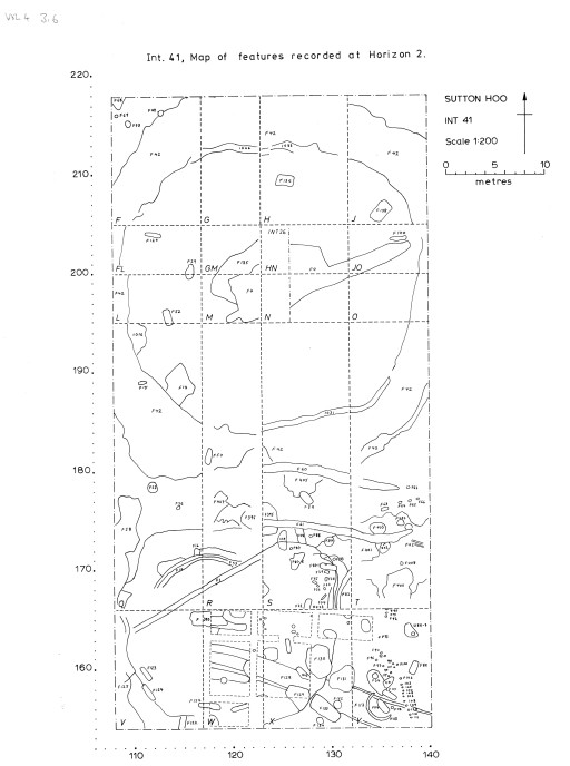
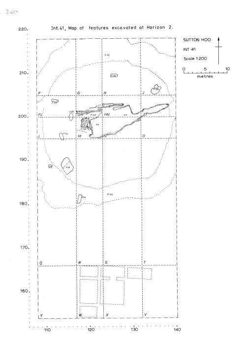
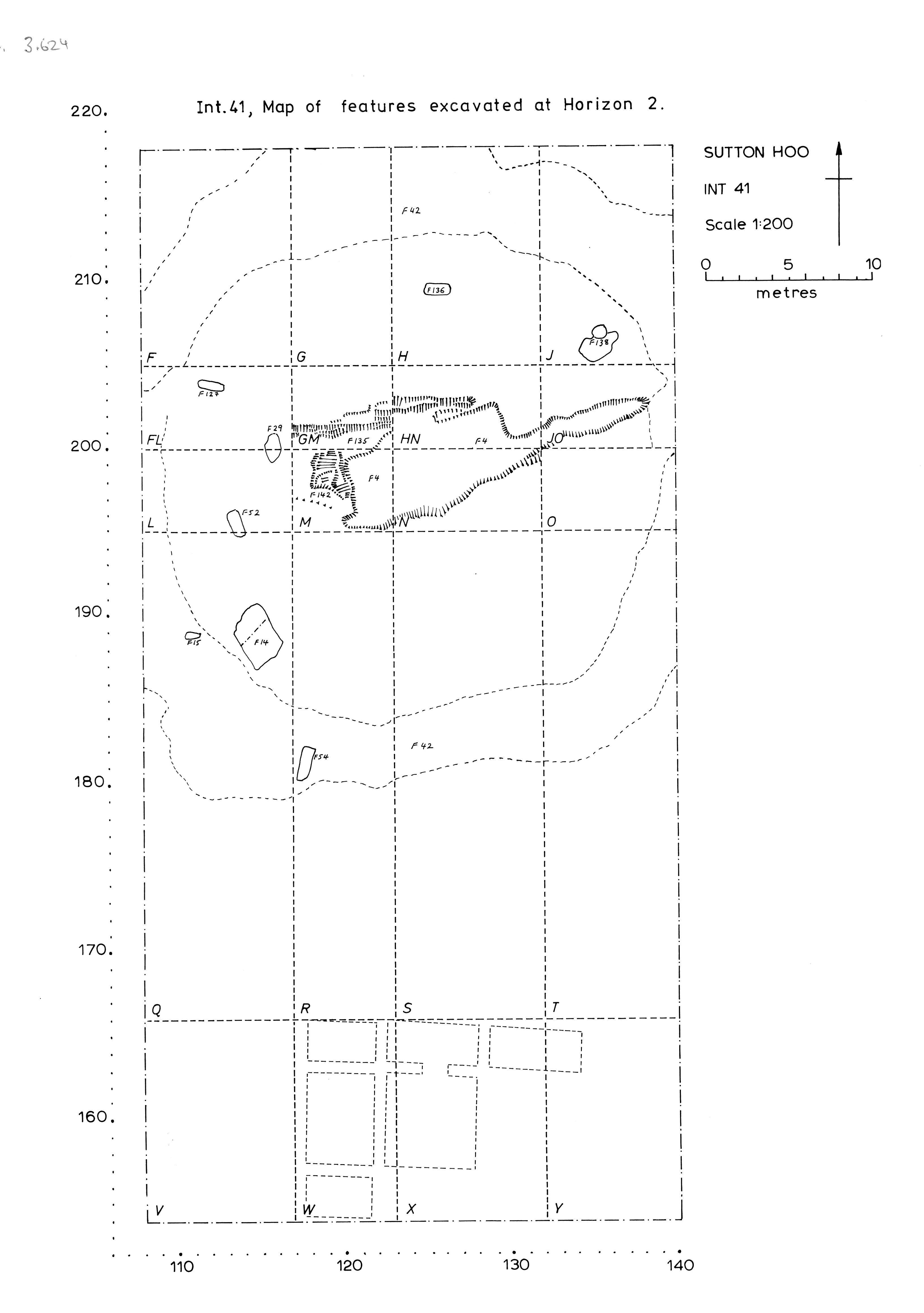
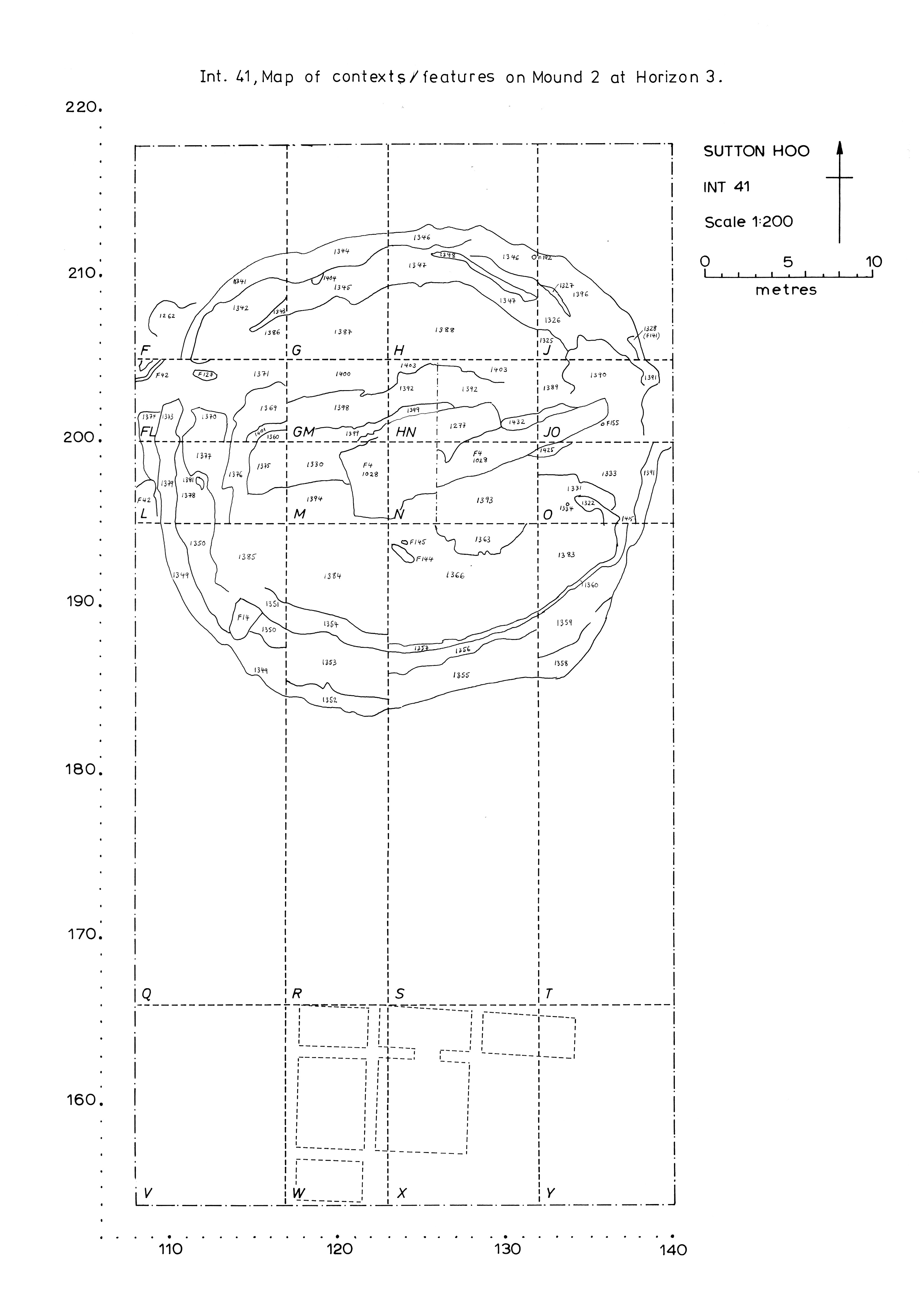
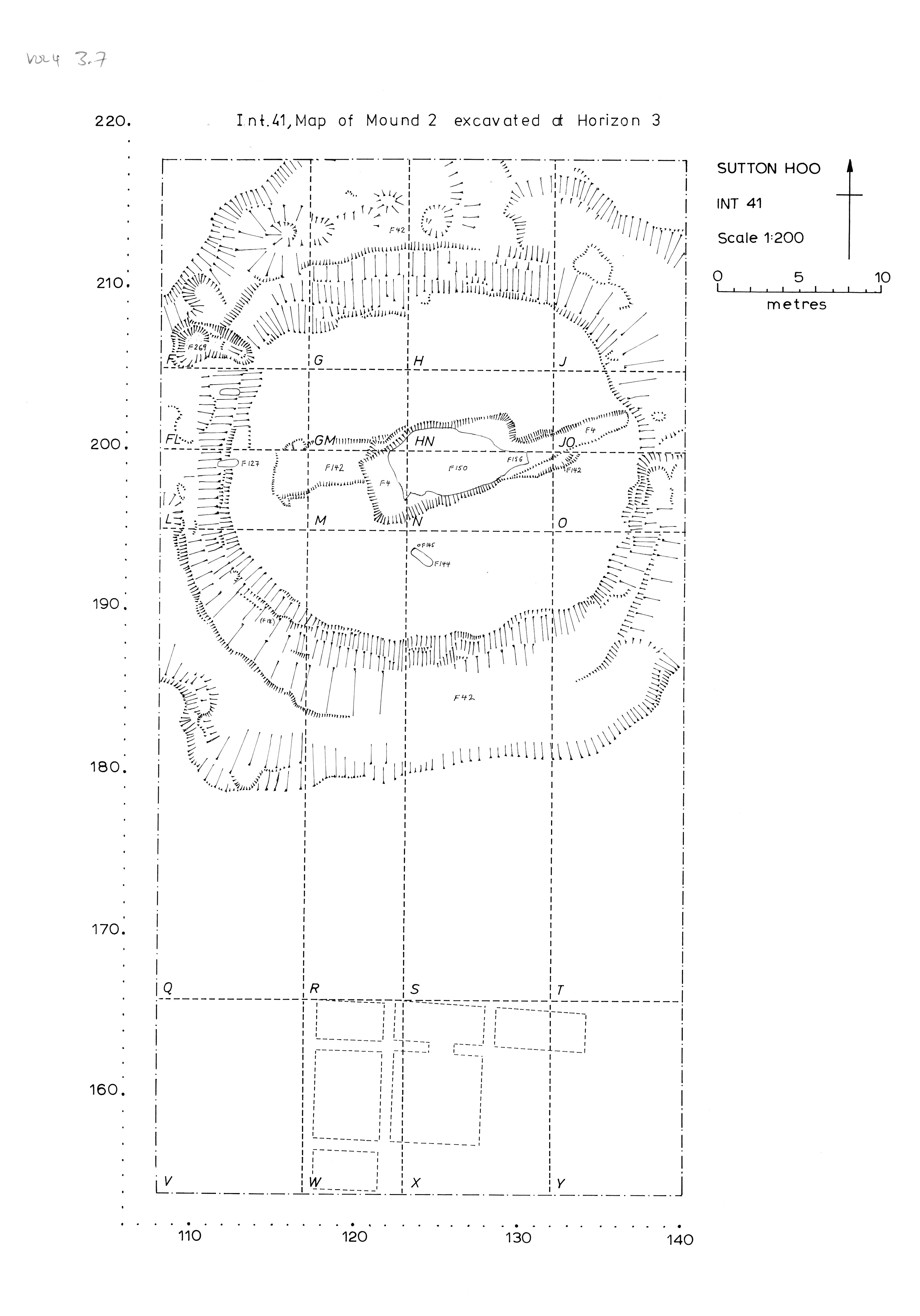
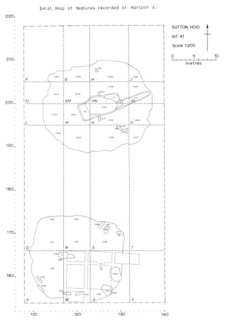
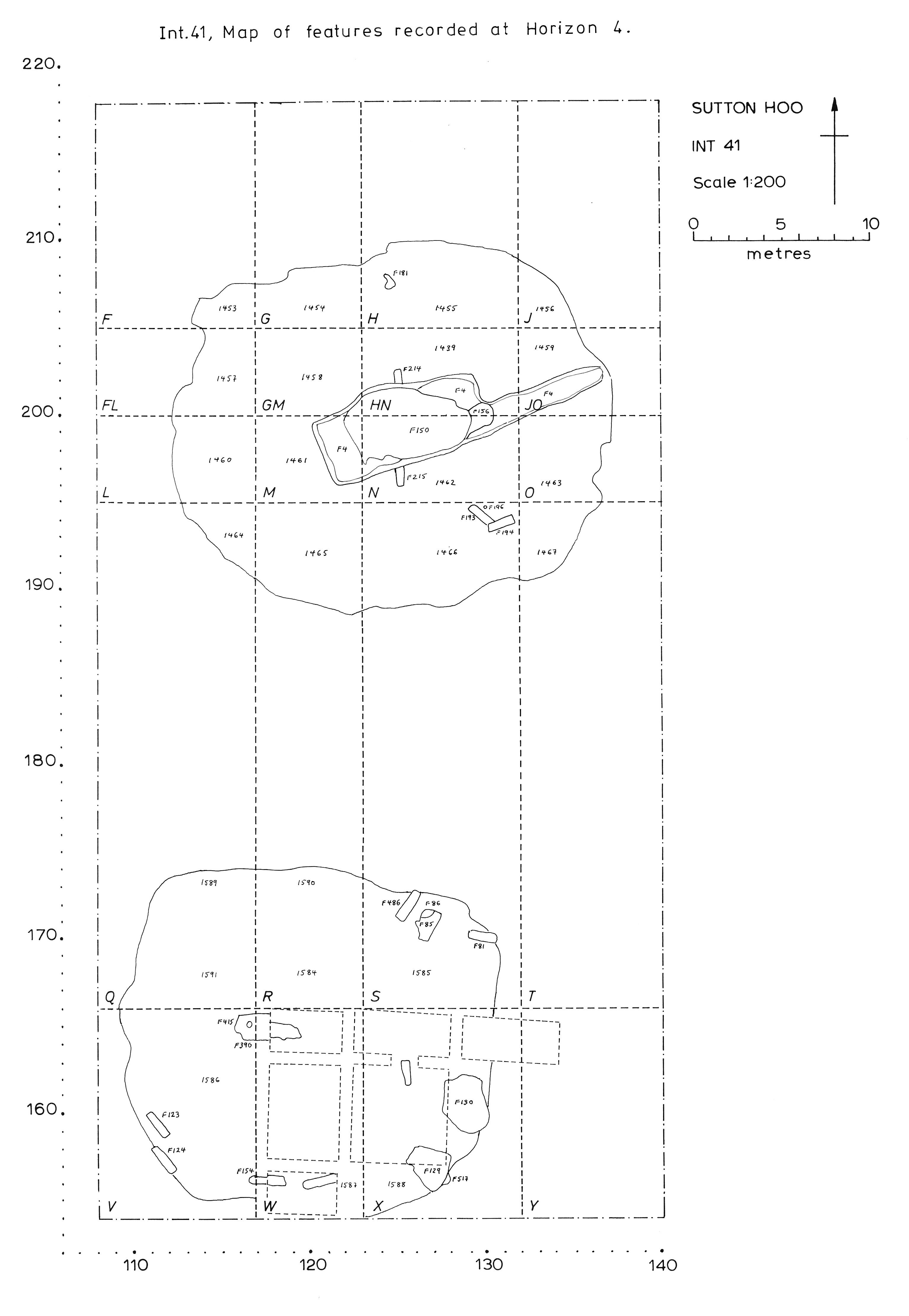
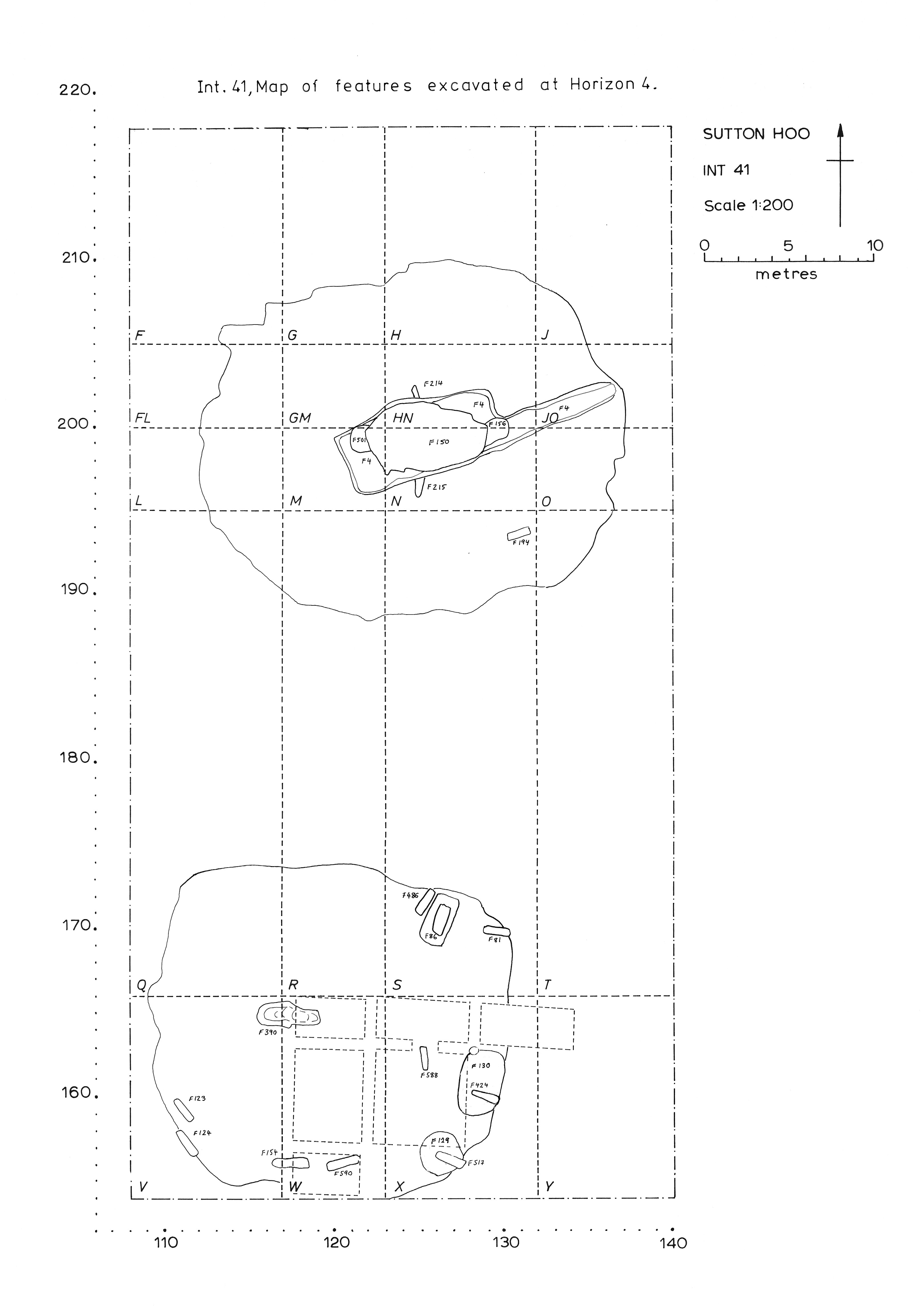
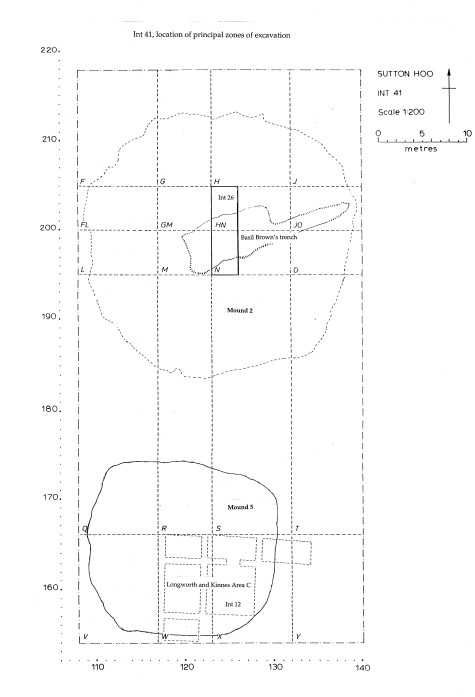
Intervention 41 (1986-8)
Excavation of an area in Zone A containing Mounds 2 and 5, by M O H Carver and A J Copp, with A C Evans (Mound 5).
| Plan of Intervention 41, horizon 1 (pre-excavation) | Preview Image | JPG | 792Kb |
| Plan of Intervention 41, horizon 1 (excavated) | Preview Image | JPG | 582Kb |
| Plan of Intervention 41, horizon 2 (pre-excavation) | Preview Image | JPG | 969Kb |
| Plan of Intervention 41, horizon 2 (excavated) | Preview Image | JPG | 645Kb |
| Plan of Intervention 41, horizon 3 (pre-excavation) | Preview Image | JPG | 750Kb |
| Plan of Intervention 41, horizon 3 (excavated) | Preview Image | JPG | 987Kb |
| Plan of Intervention 41, horizon 4 (pre-excavation) | Preview Image | JPG | 605Kb |
| Plan of Intervention 41, horizon 4 (excavated) | Preview Image | JPG | 640Kb |
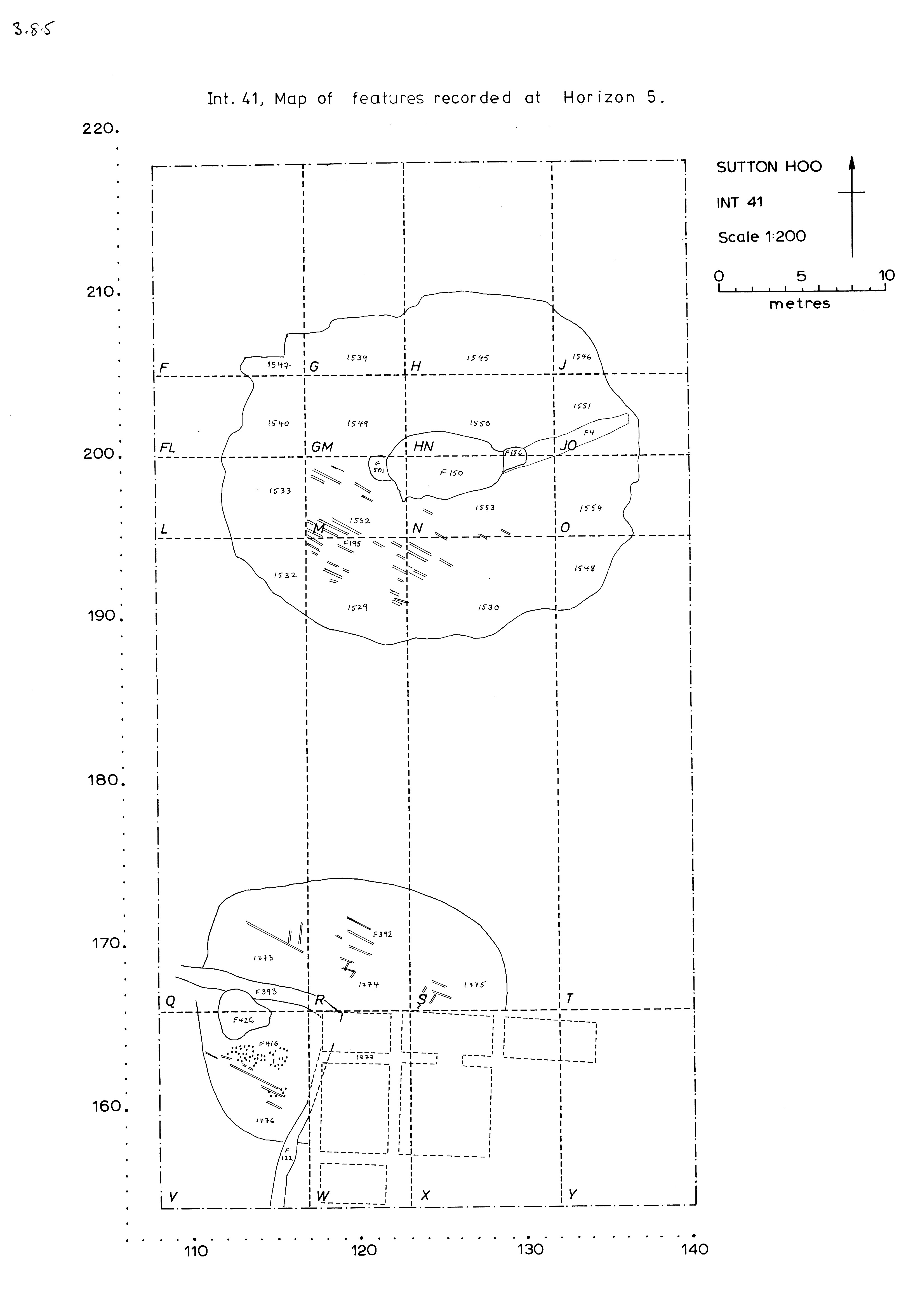
| Plan of Intervention 41, horizon 5 (pre-excavation) | Preview Image | JPG | 680Kb |
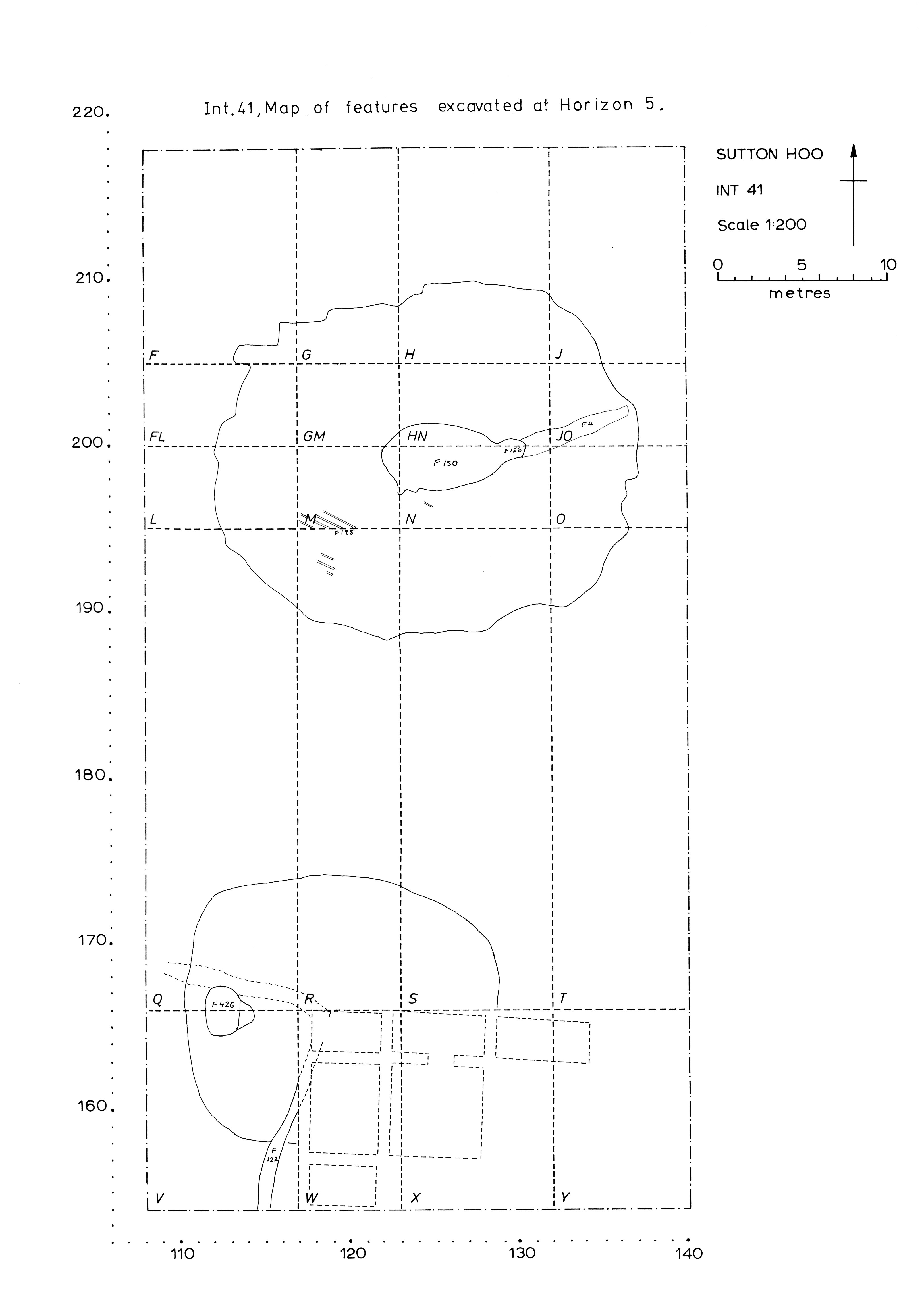
| Plan of Intervention 41, horizon 5 (excavated) | Preview Image | JPG | 568Kb |
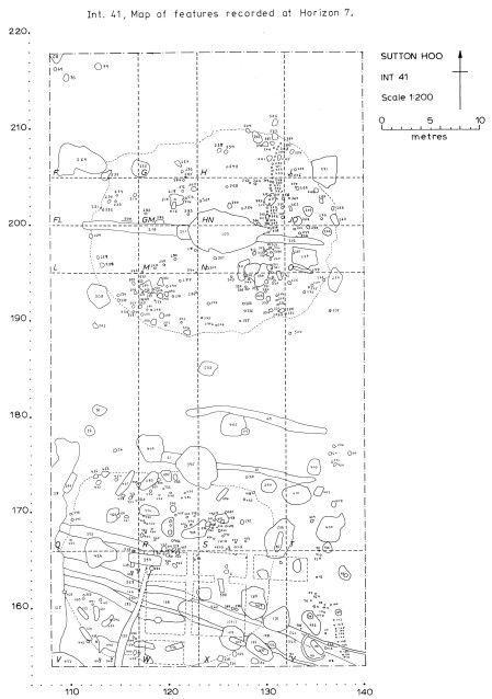
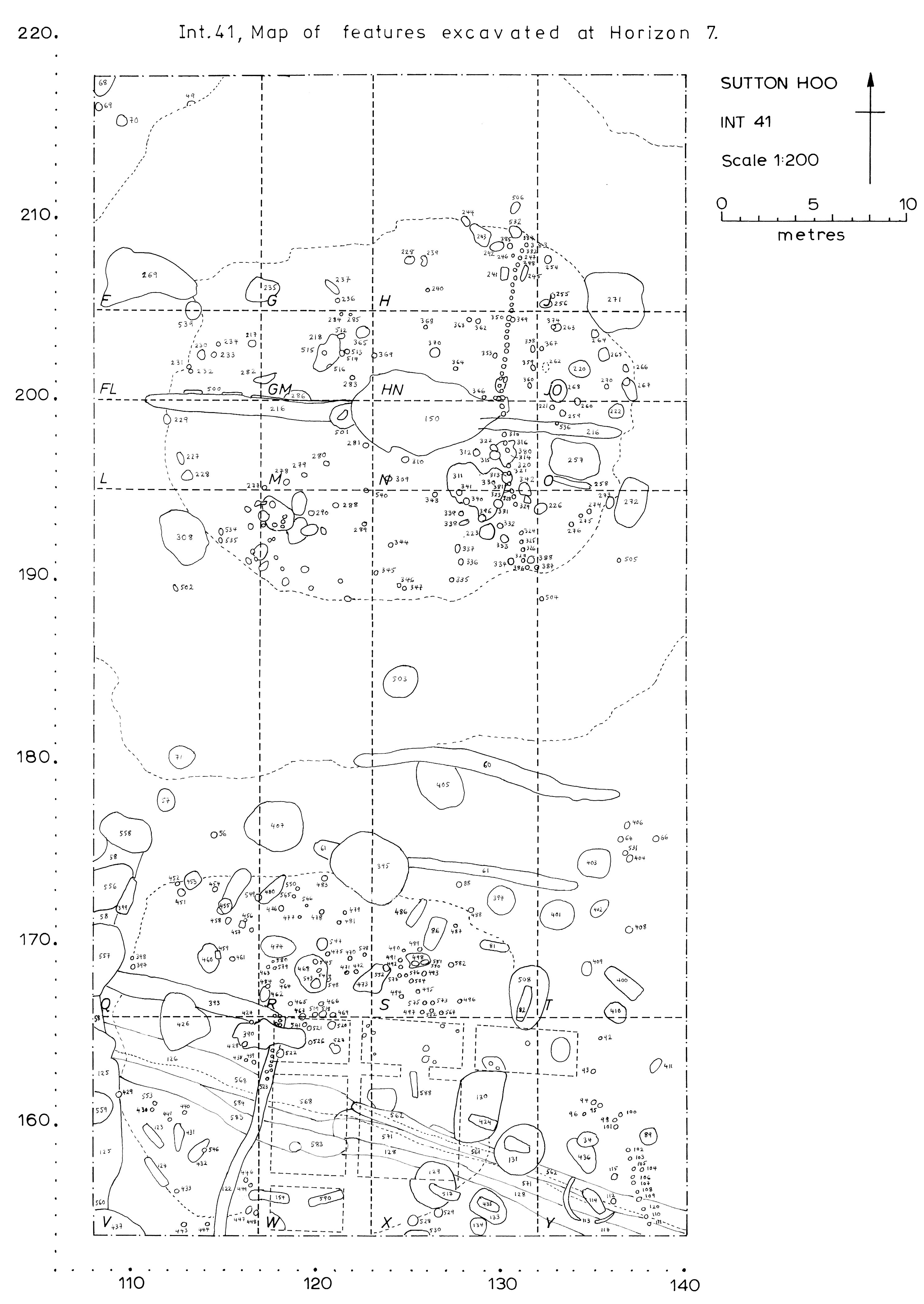
| Plan of Intervention 41, horizon 7 (pre-excavation) | Preview Image | JPG | 975Kb |
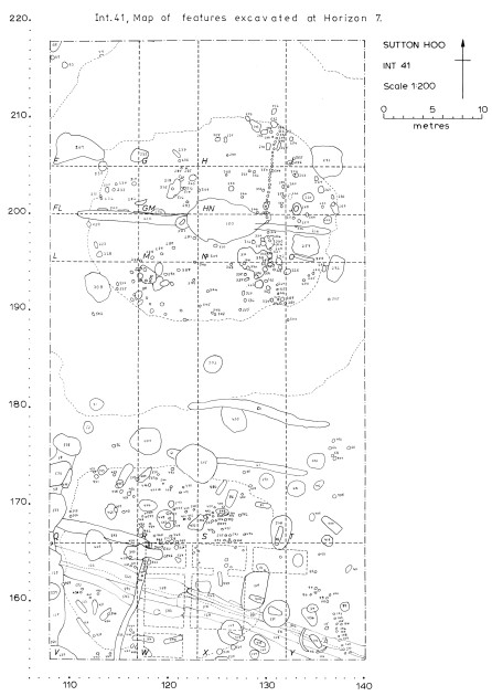
| Plan of Intervention 41, horizon 7 (excavated) | Preview Image | JPG | 938Kb |
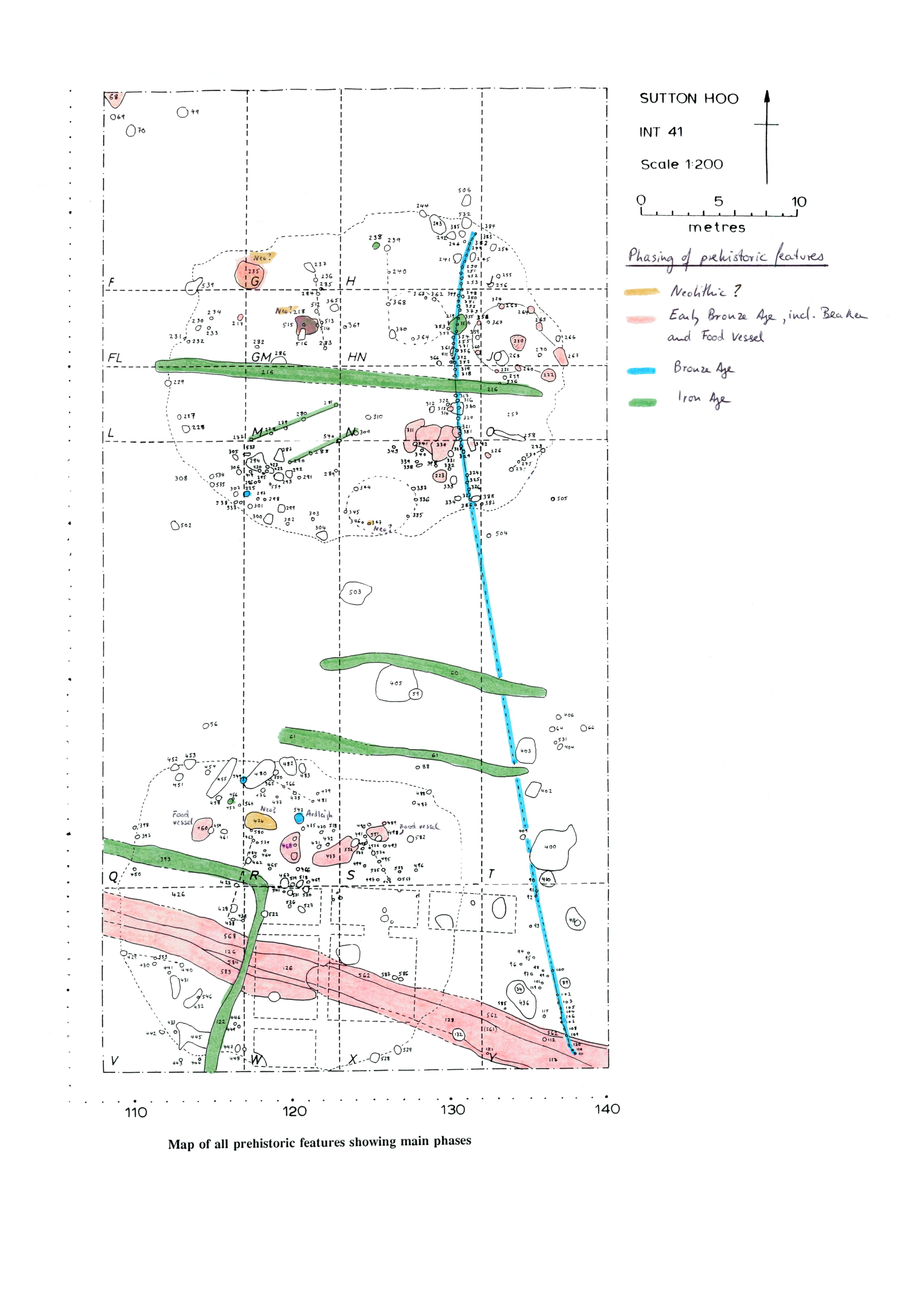
| Phased plan of Prehistoric features | Preview Image | JPG | 812Kb |
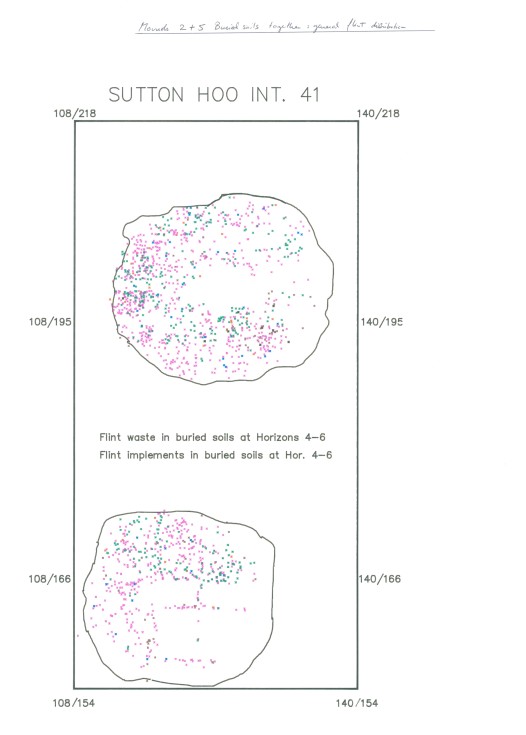
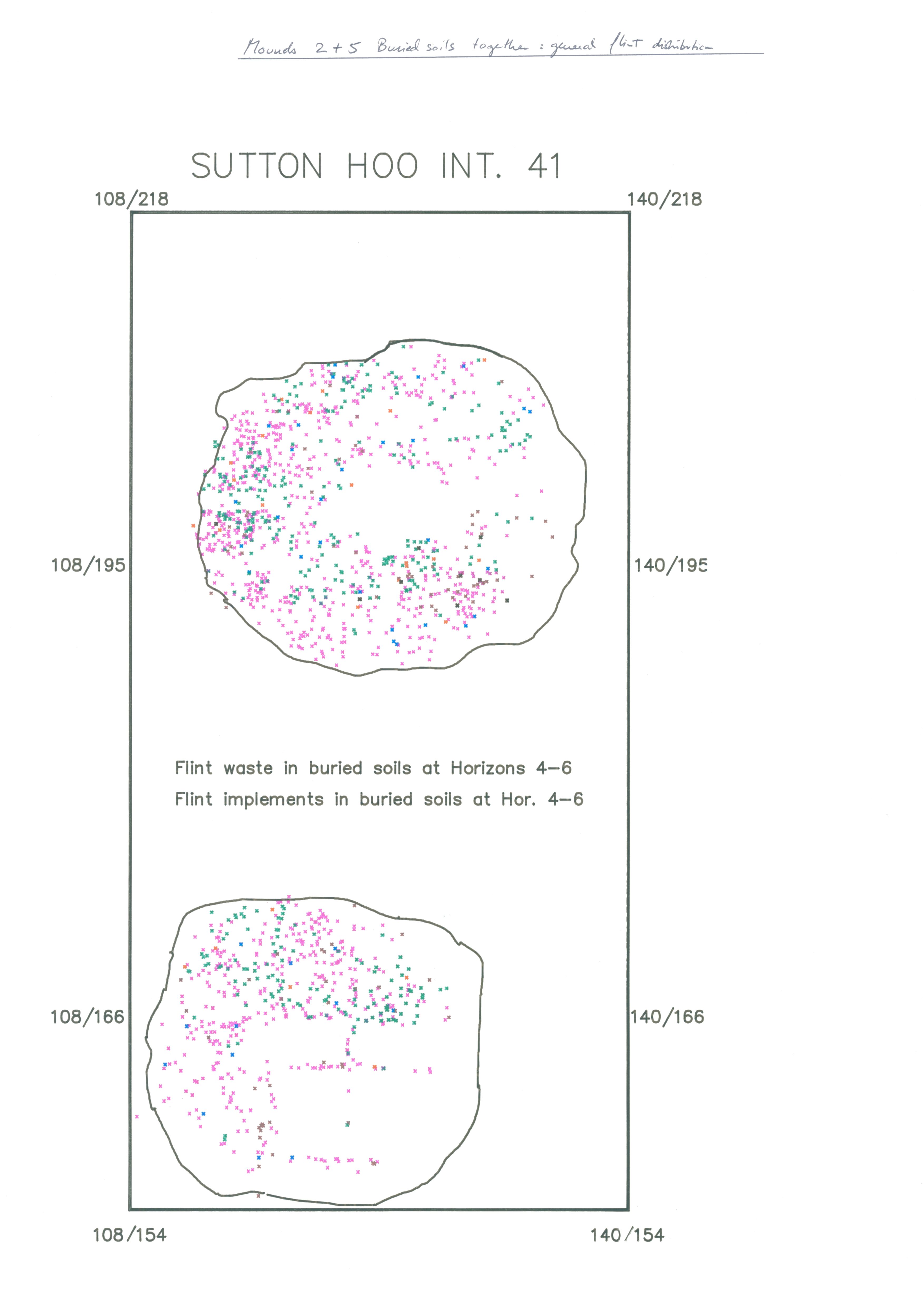
| Plan of flint waste and implements in buried soils in Mounds 2 and 5 | Preview Image | JPG | 589Kb |
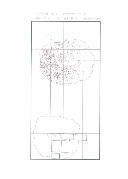
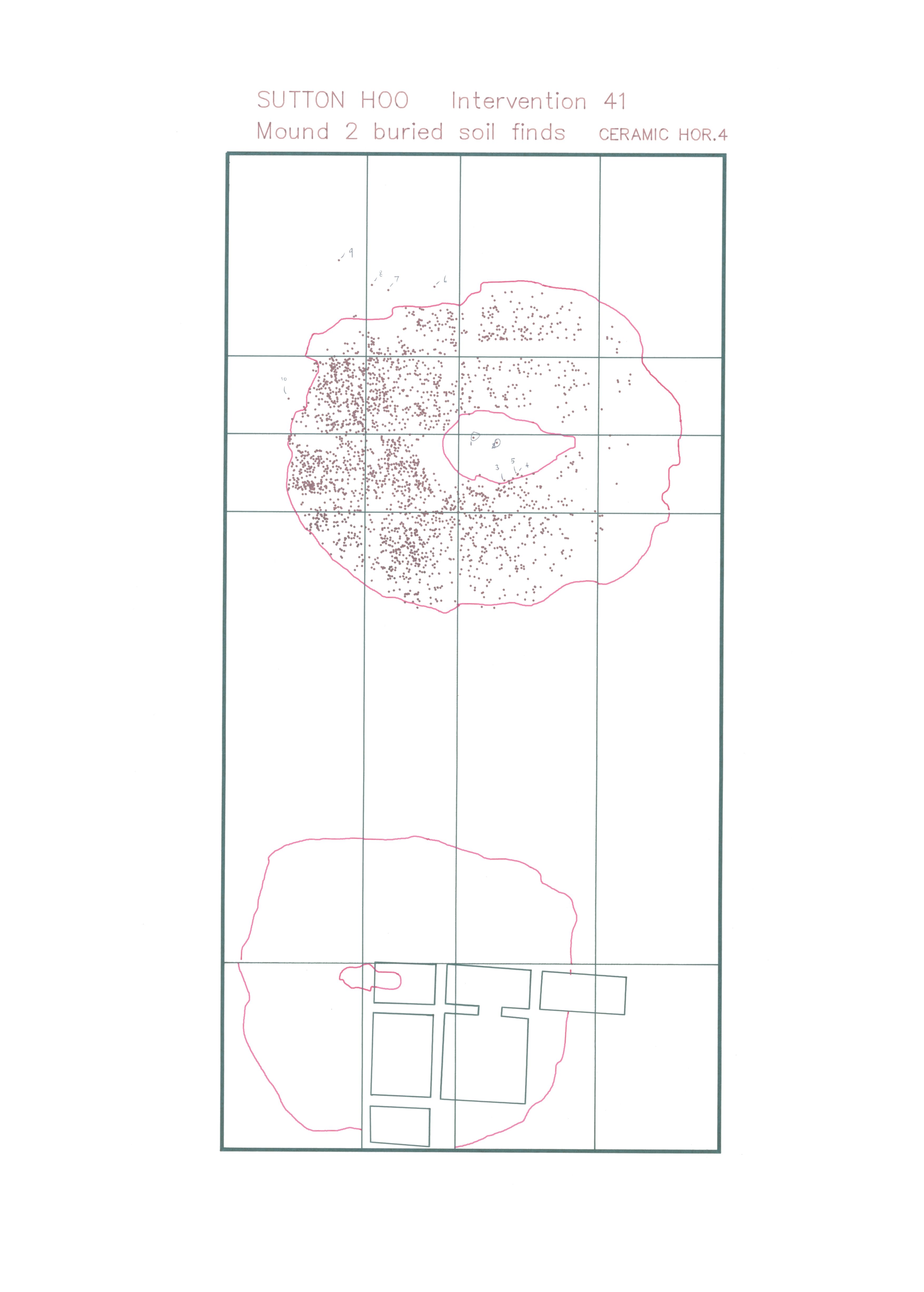
| Distribution plan of ceramics in Mound 2, horizon 4 | Preview Image | JPG | 538Kb |
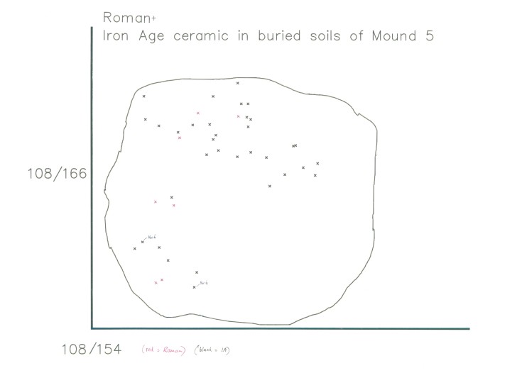
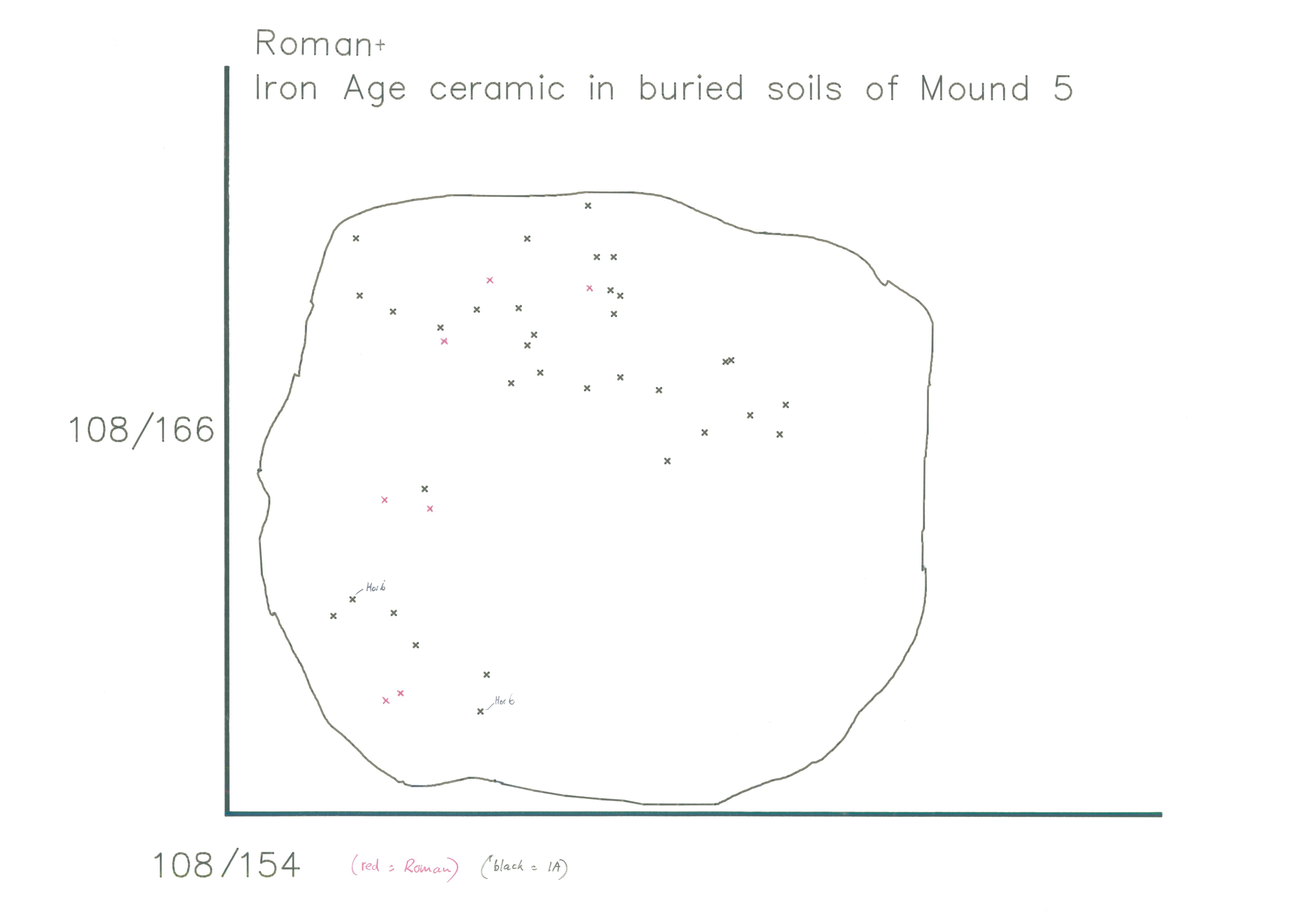
| Distribution plan of Iron Age ceramics in Mound 5 | Preview Image | JPG | 388Kb |
Intervention 42 (1986)
Establishment of a permanent l00 m grid over Zone A by C L Royle for Sutton Hoo Research Trust.
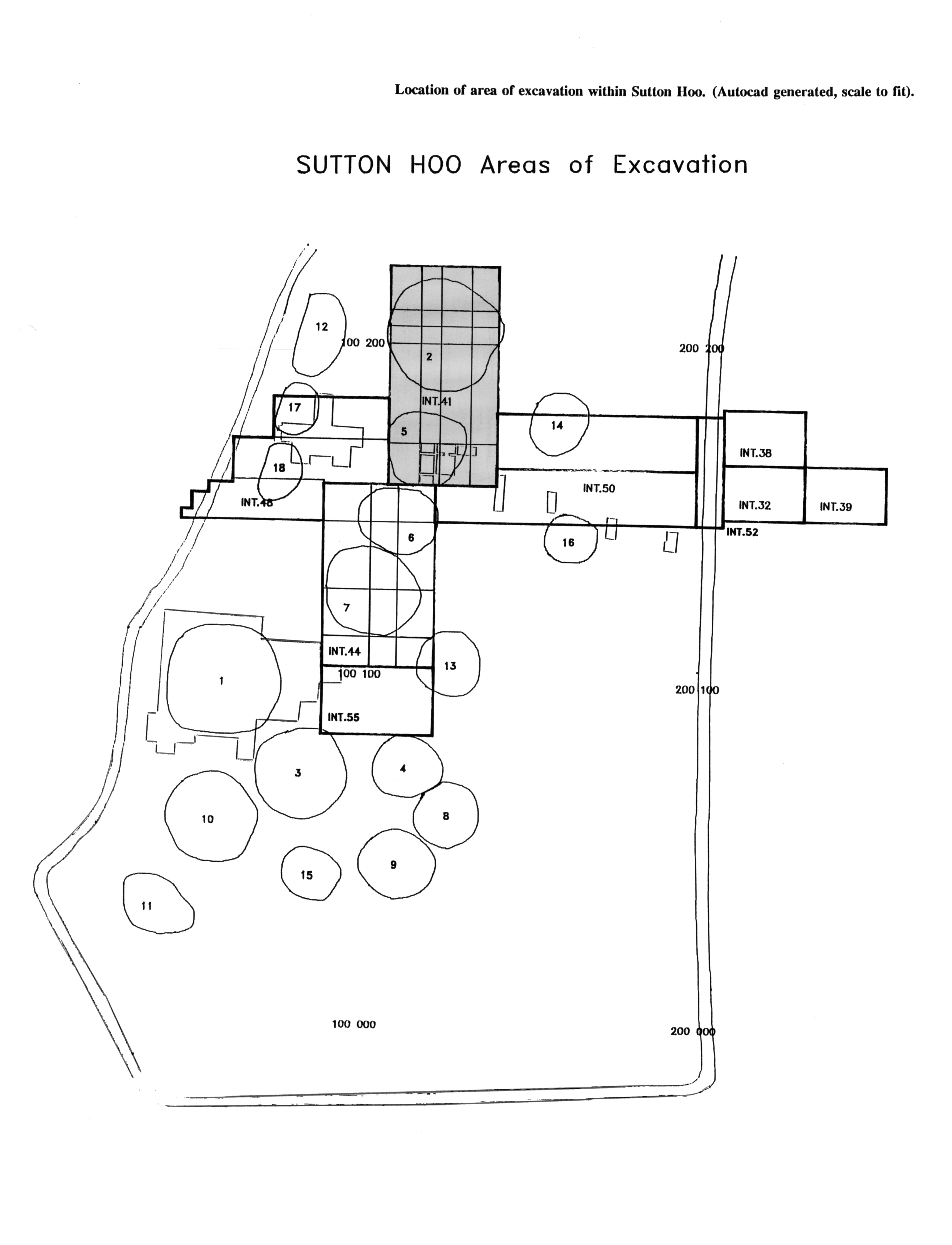
| Location of principal zones of excavation | Preview Image | JPG | 637Kb |
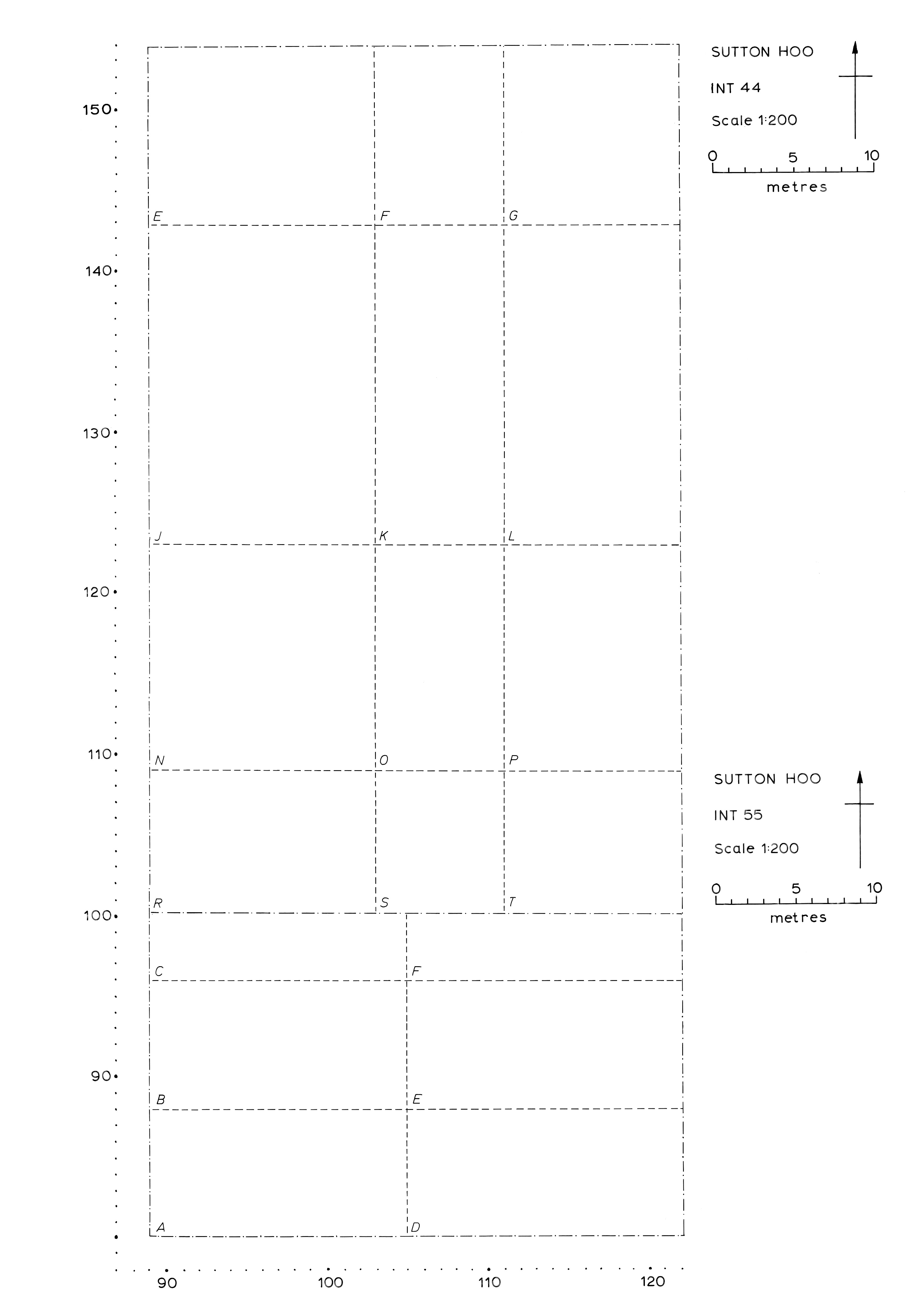
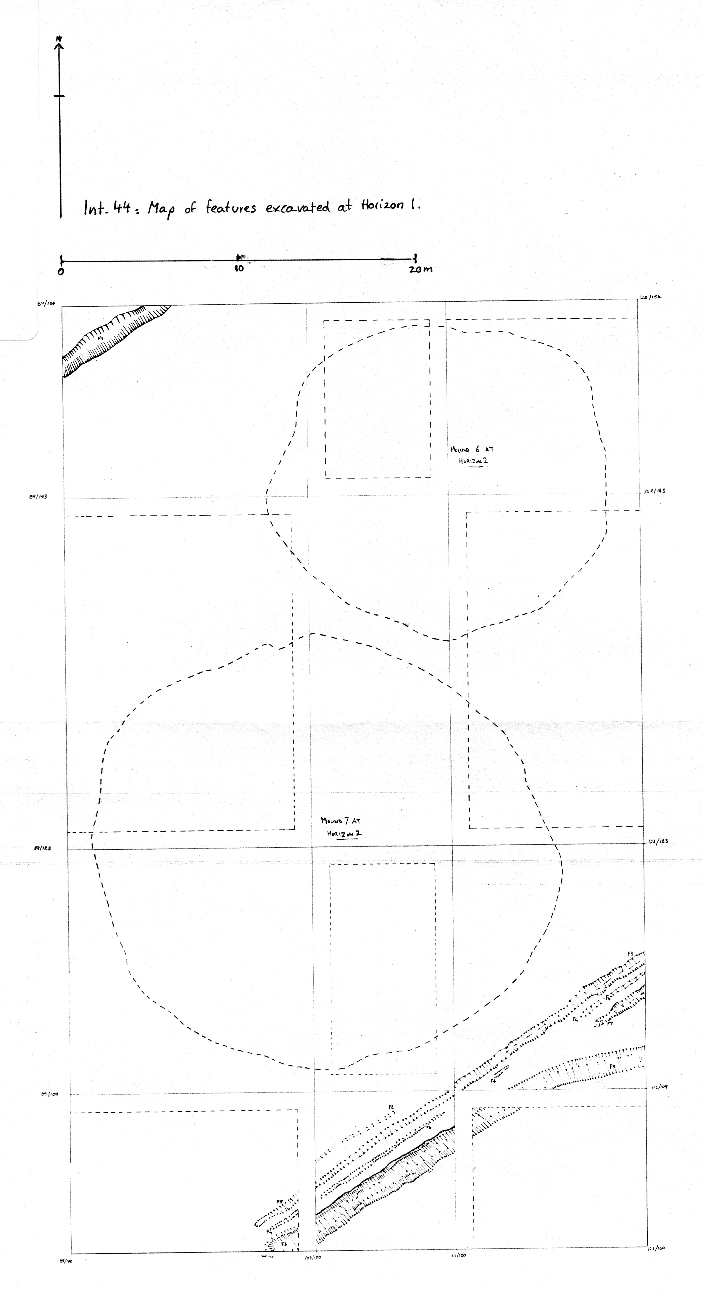
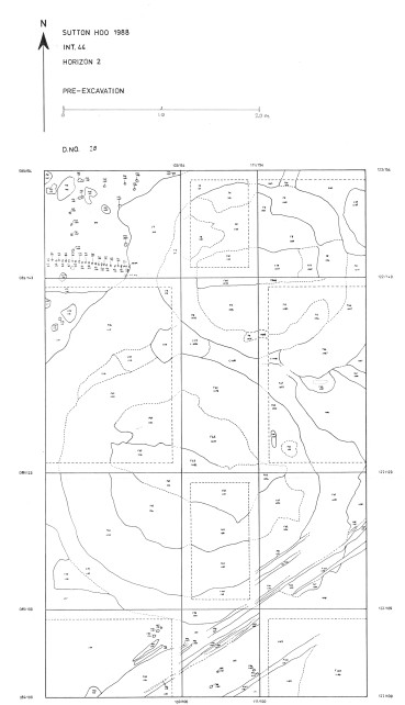
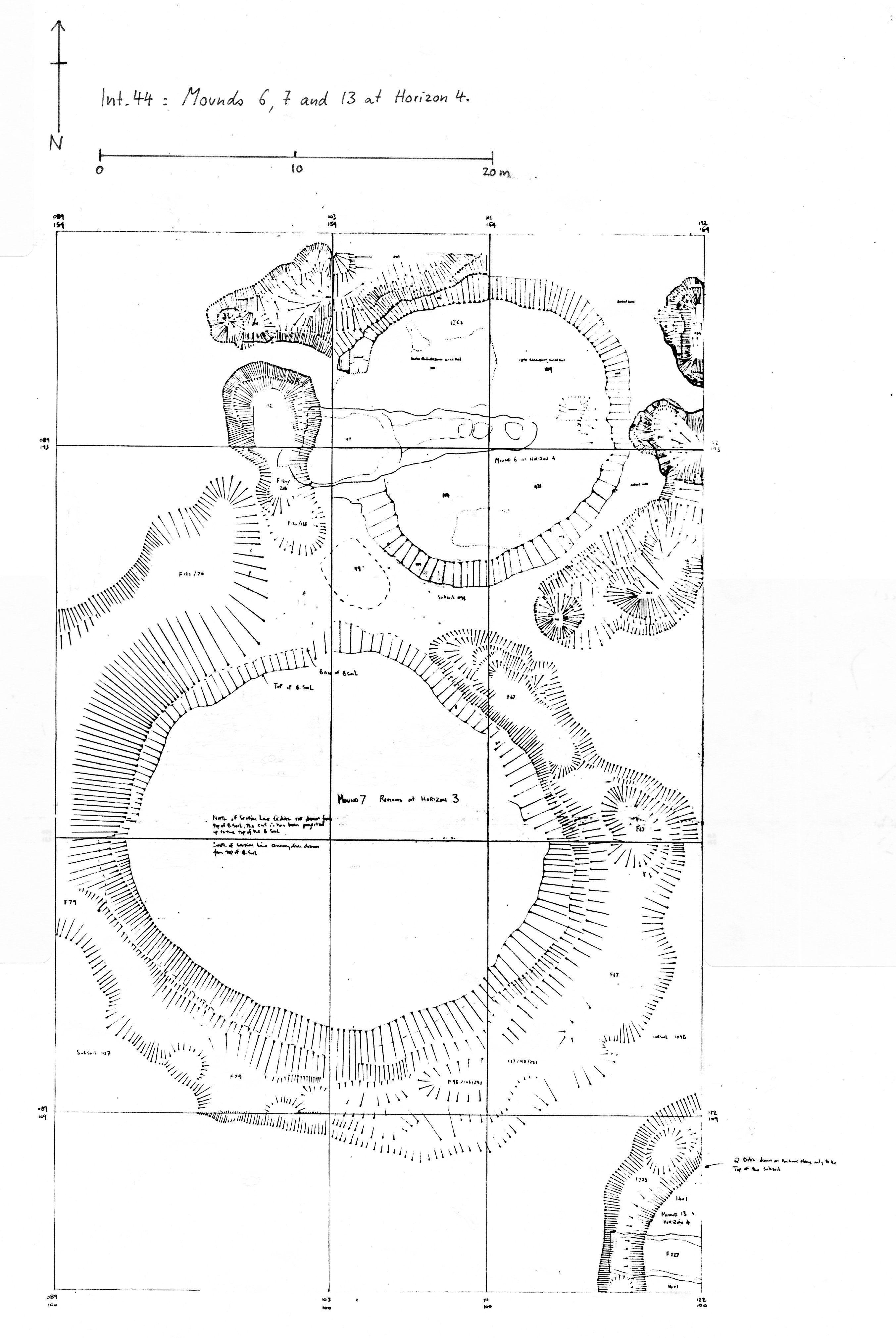
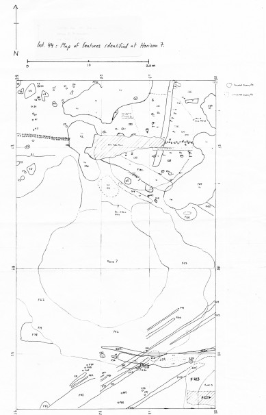
Intervention 44 (1988-9)
Excavation of an area in Zone A containing Mounds 6 and 7 by M O H Carver and A J Copp with A C Evans (Mound 7).
| Plan of Intervention 44 quadrants | Preview Image | JPG | 438Kb |
| Plan showing extent of buried soils, ploughmarks and medieval bank and track, Intervention 44, horizon 1 | Preview Image | JPG | 944Kb |
| Plan of Intervention 44, horizon 2 (pre-excavation) | Preview Image | JPG | 768Kb |
| Plan of Mounds 6, 7 and 13 at horizon 3 (pre-excavation) | Preview Image | JPG | 995Kb |
| Plan of Mounds 6, 7 and 13 at horizon 3 (excavated) | Preview Image | JPG | 418Kb |
| Plan of Intervention 44, horizon 7 (pre-excavation) | Preview Image | JPG | 833Kb |
|
|||
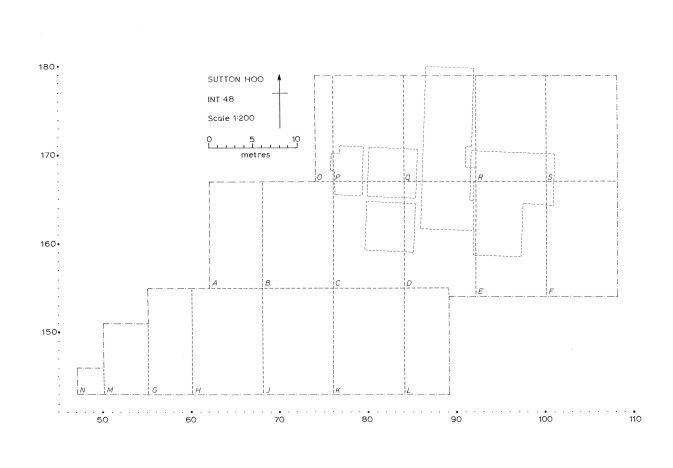
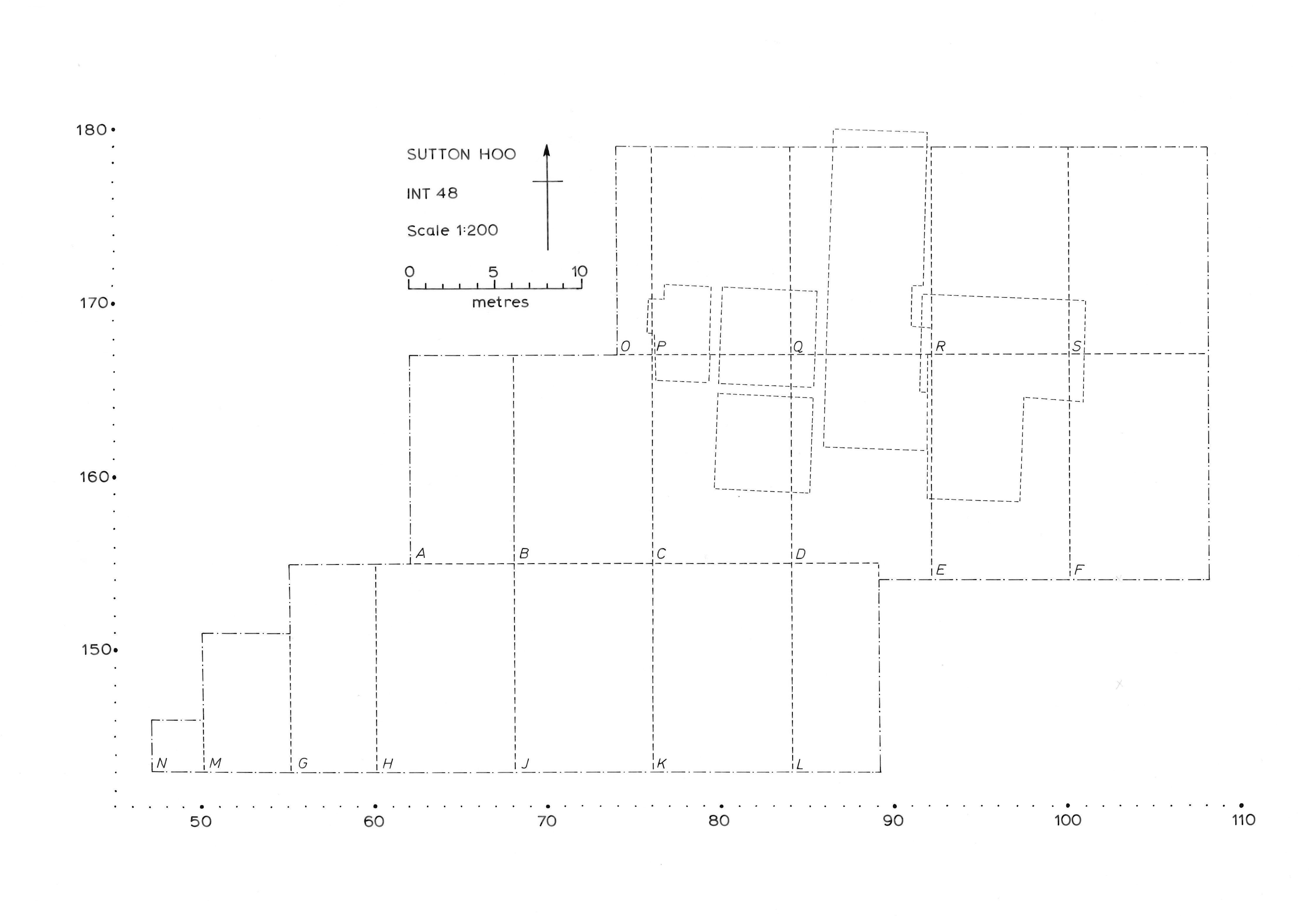
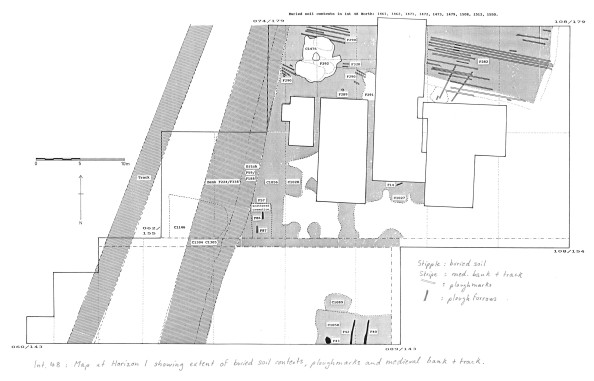
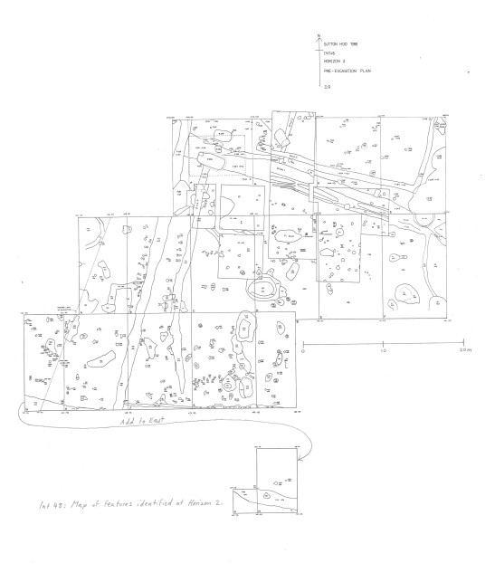
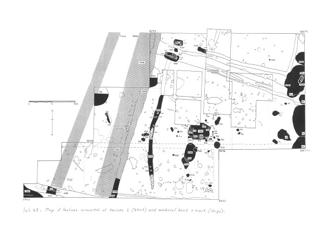
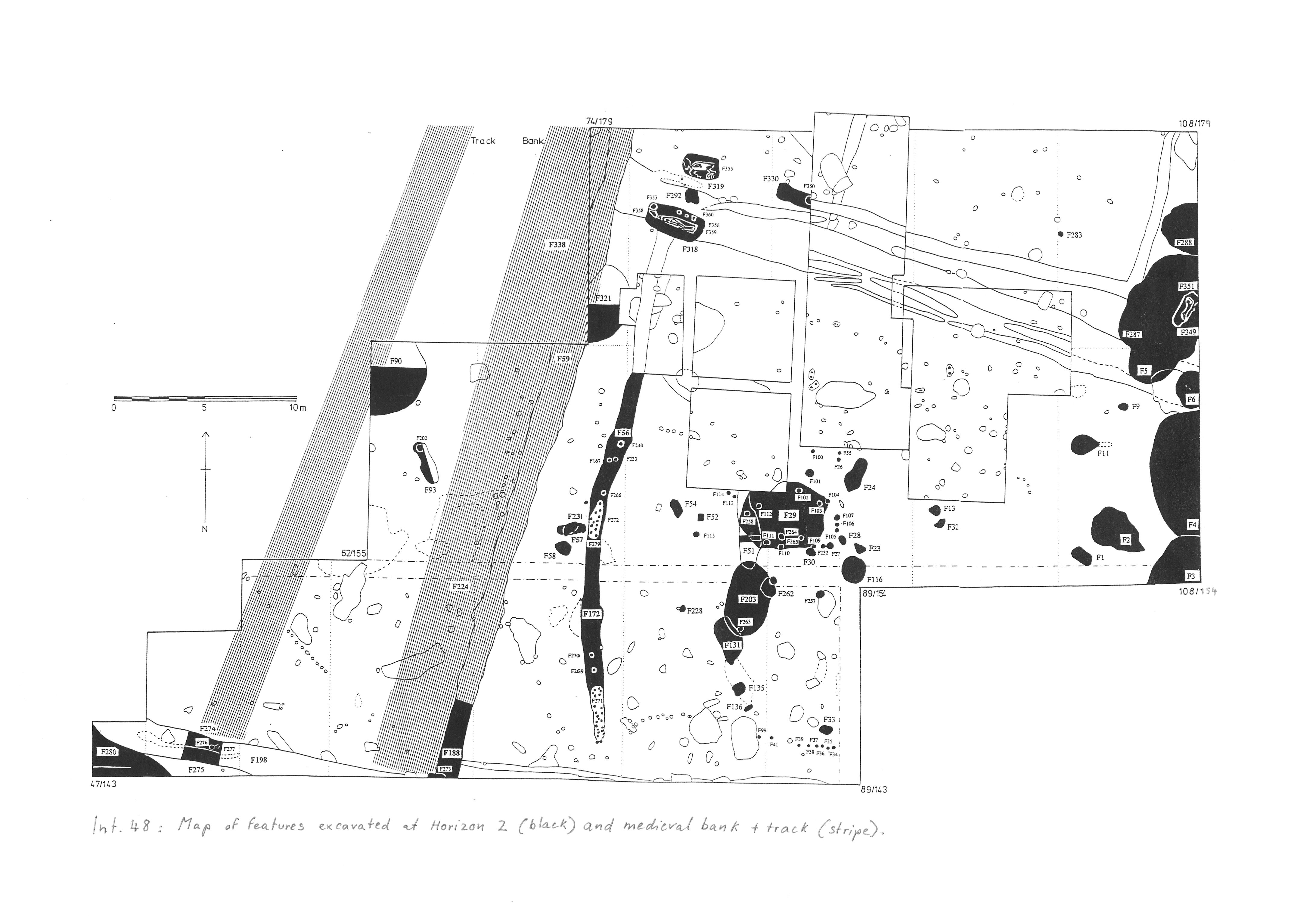
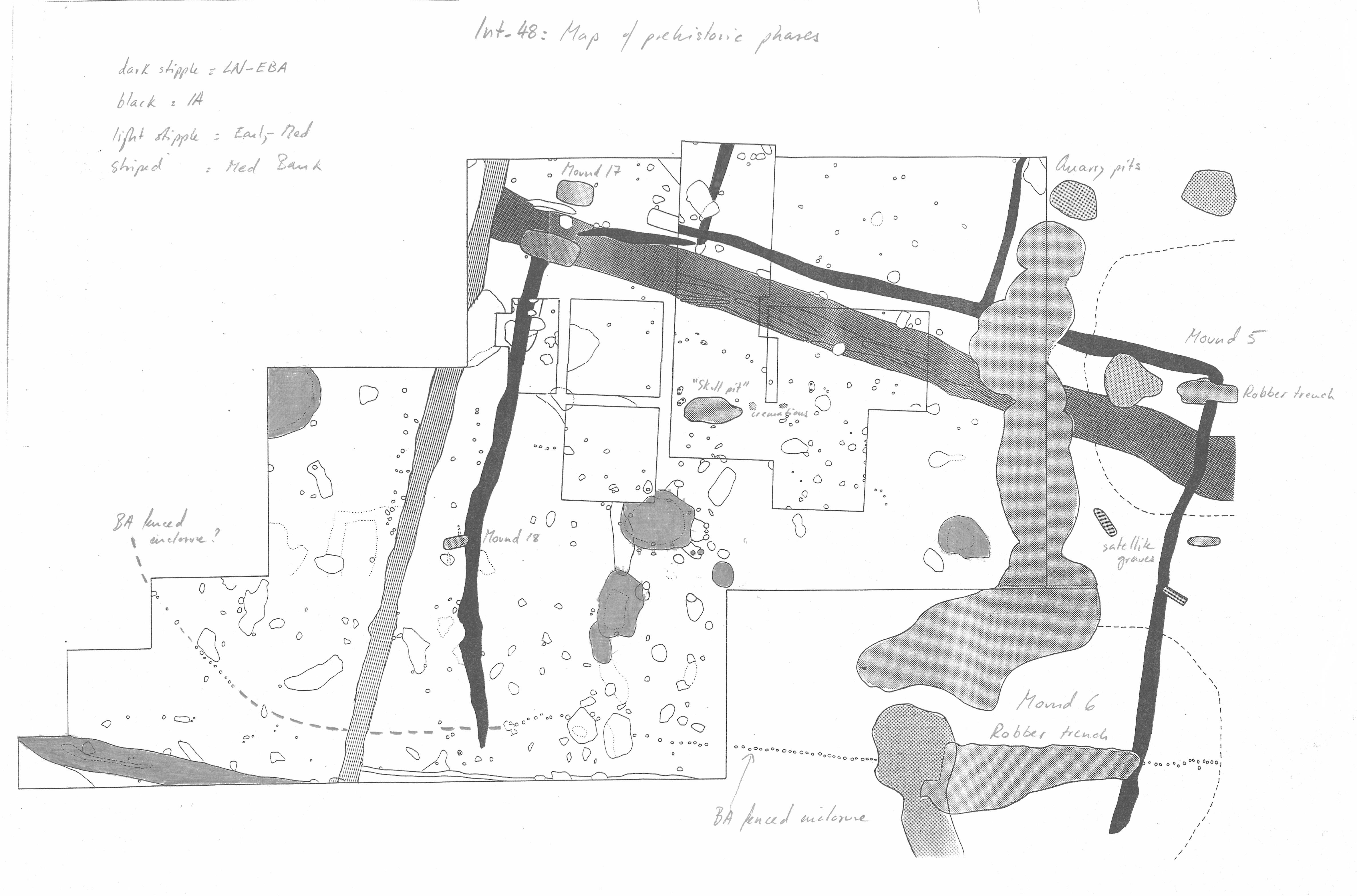
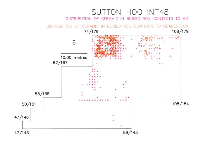
Intervention 48 (1989-92)
Excavation of an area on the west side of Zone A containing Mounds 17 and 18 by M O H Carver and M R Hummler, with A Roe (Mound 17) and A C Evans (Mound 18) for Sutton Hoo Research Trust.
| Plan of Intervention 48 quadrants | Preview Image | JPG | 401Kb |
| Plan of buried soil contexts in Intervention 48, horizon 1 | Preview Image | JPG | 1,024Kb |
| Plan of Intervention 48, horizon 2 (pre-excavation) | Preview Image | JPG | 883Kb |
| Plan of Intervention 48, horizon 2 (excavated) | Preview Image | JPG | 1,007Kb |
| Plan of prehistoric phases, Intervention 48 | Preview Image | JPG | 1,072Kb |
| Plan of distribution of ceramic in buried soil contexts, Intervention 48 | Preview Image | JPG | 567Kb |
| Plan of distribution of flint in buried soil contexts, Intervention 48 | Preview Image | JPG | 559Kb |
|
|||
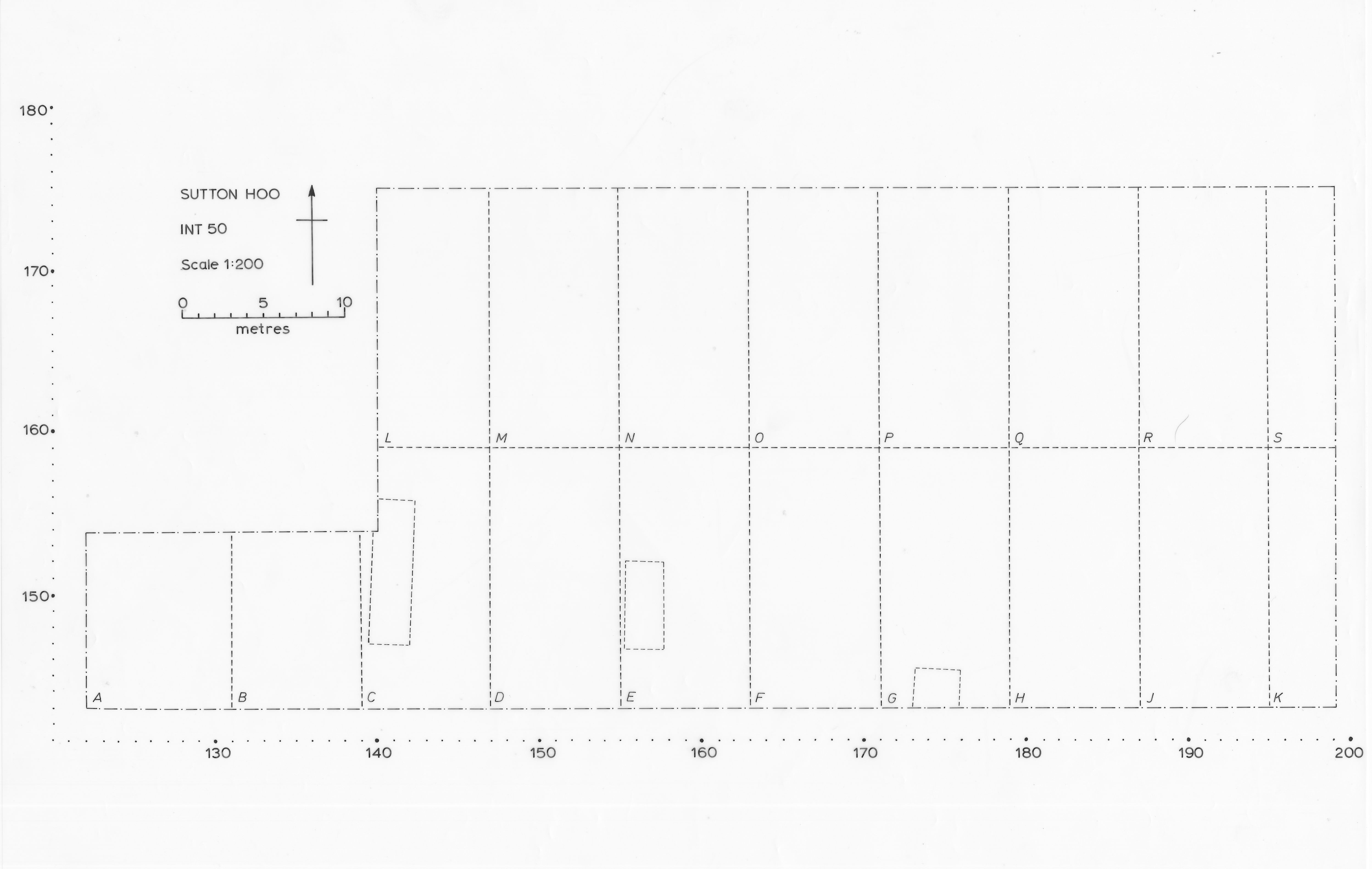
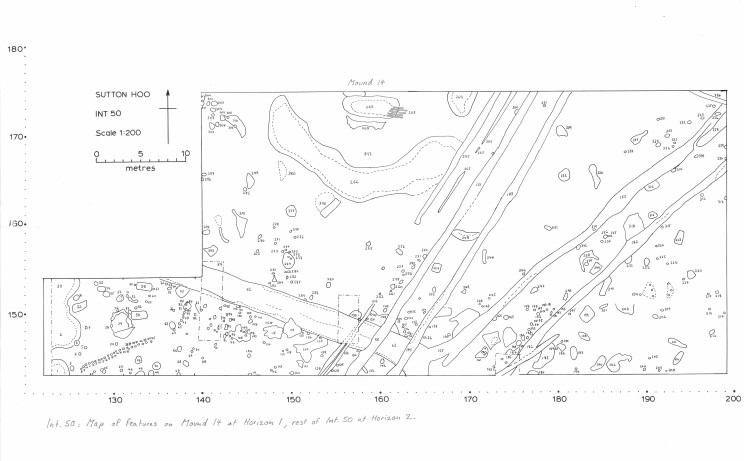
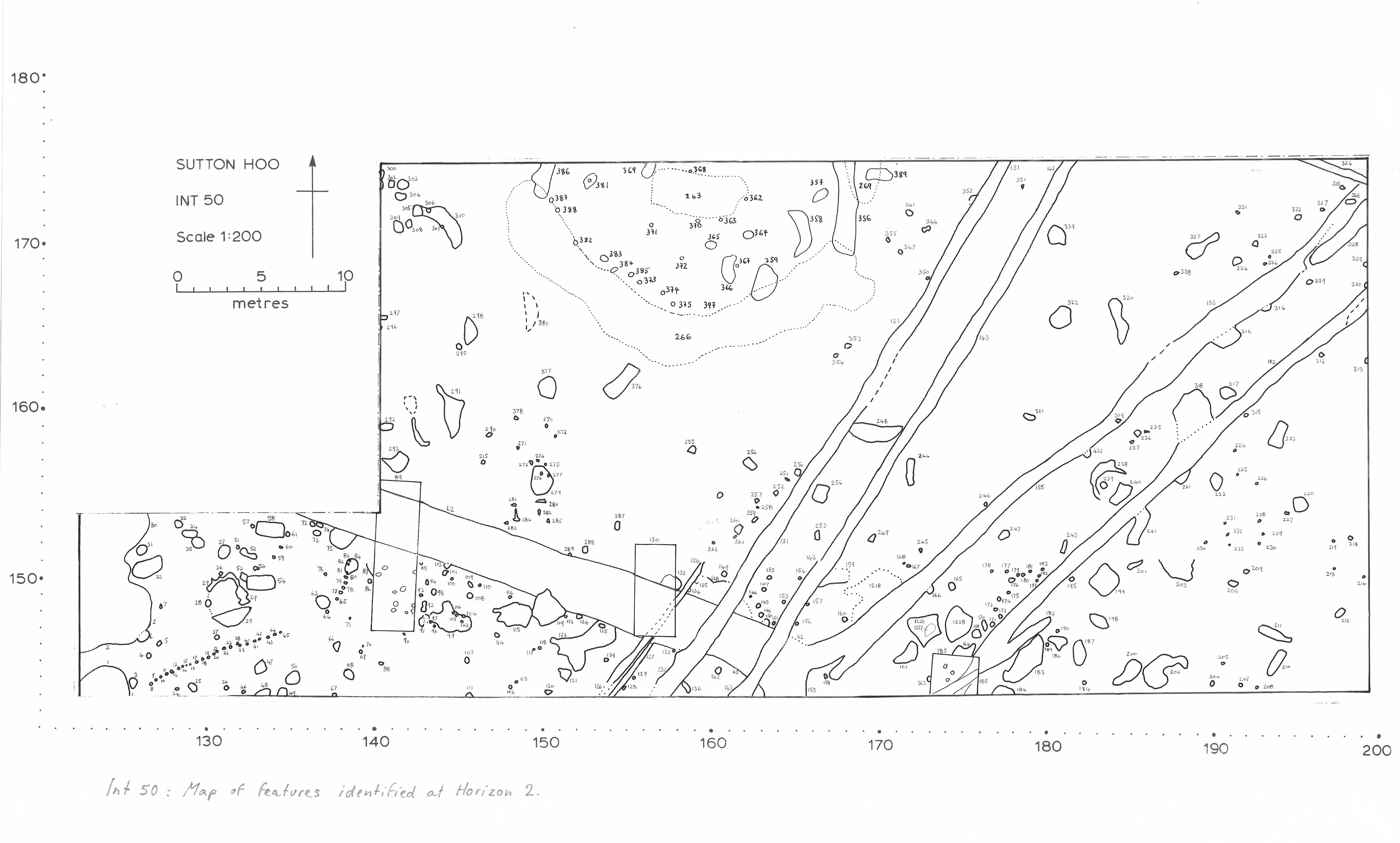
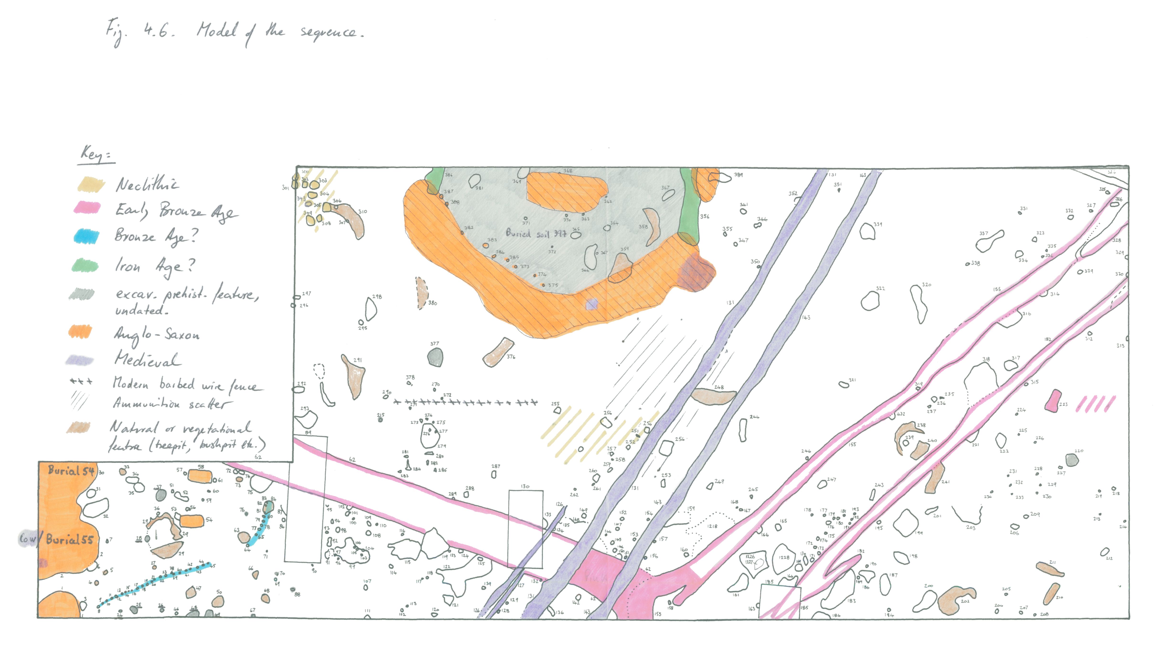
Intervention 50 (1990-1)
Excavation of an area between Int 32 and 41 containing Mound 14, by M O H Carver and J Garner-Lahire with G Bruce (Mound 14) for Sutton Hoo Research Trust.
| Plan of Intervention 50 quadrants | Preview Image | JPG | 407Kb |
| Plan of Intervention 50, horizons 1 and 2 (pre-excavation) | Preview Image | JPG | 815Kb |
| Plan of Intervention 50, horizon 2 (pre-excavation) | Preview Image | JPG | 772Kb |
| Plan of Intervention 50, horizon 2 (excavated) | Preview Image | JPG | 865Kb |
| Phased plan for Intervention 50 | Preview Image | JPG | 743Kb |
|
|||
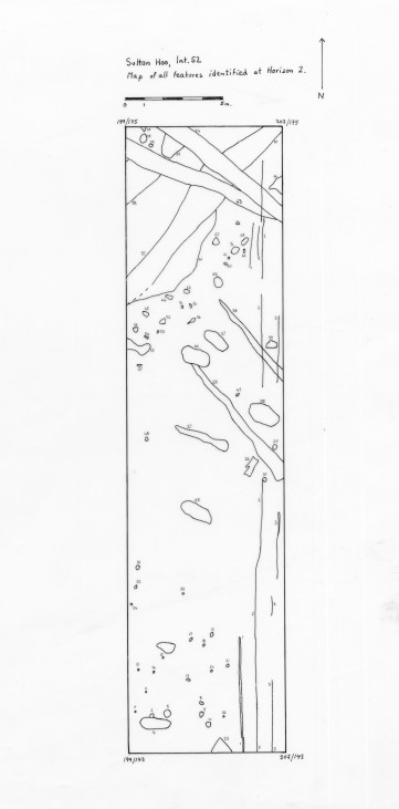
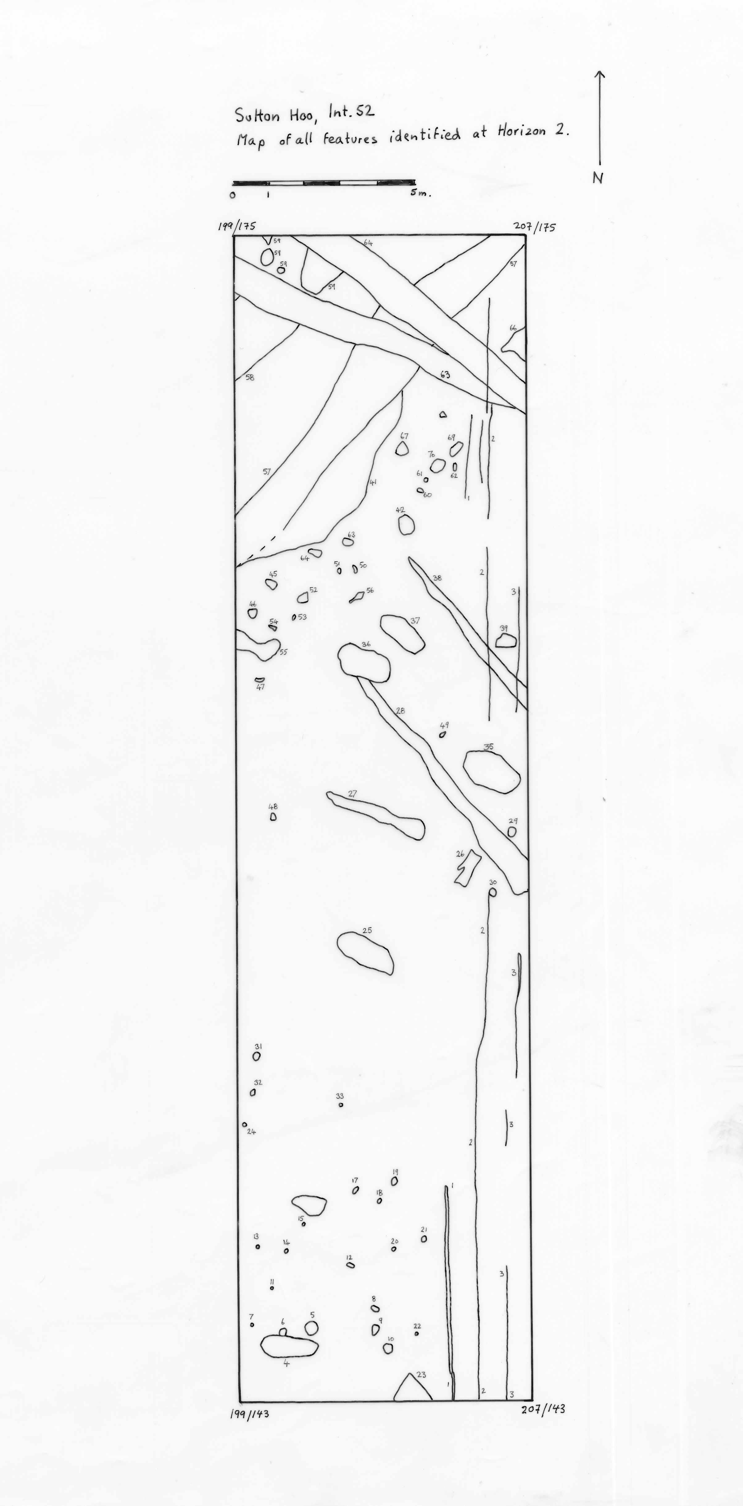
Intervention 52 (1991)
Excavation of the trench between Int 50 and Int 32 by M O H Carver and A J Copp for Sutton Hoo Research Trust.
| Plan of Intervention 52 quadrants | Preview Image | JPG | 3Kb |
| Plan of Intervention 52, horizon 2 (pre-excavation) | Preview Image | JPG | 423Kb |
| Plan of Intervention 32, 38, 39 and 52 quadrants | Preview Image | JPG | 407Kb |
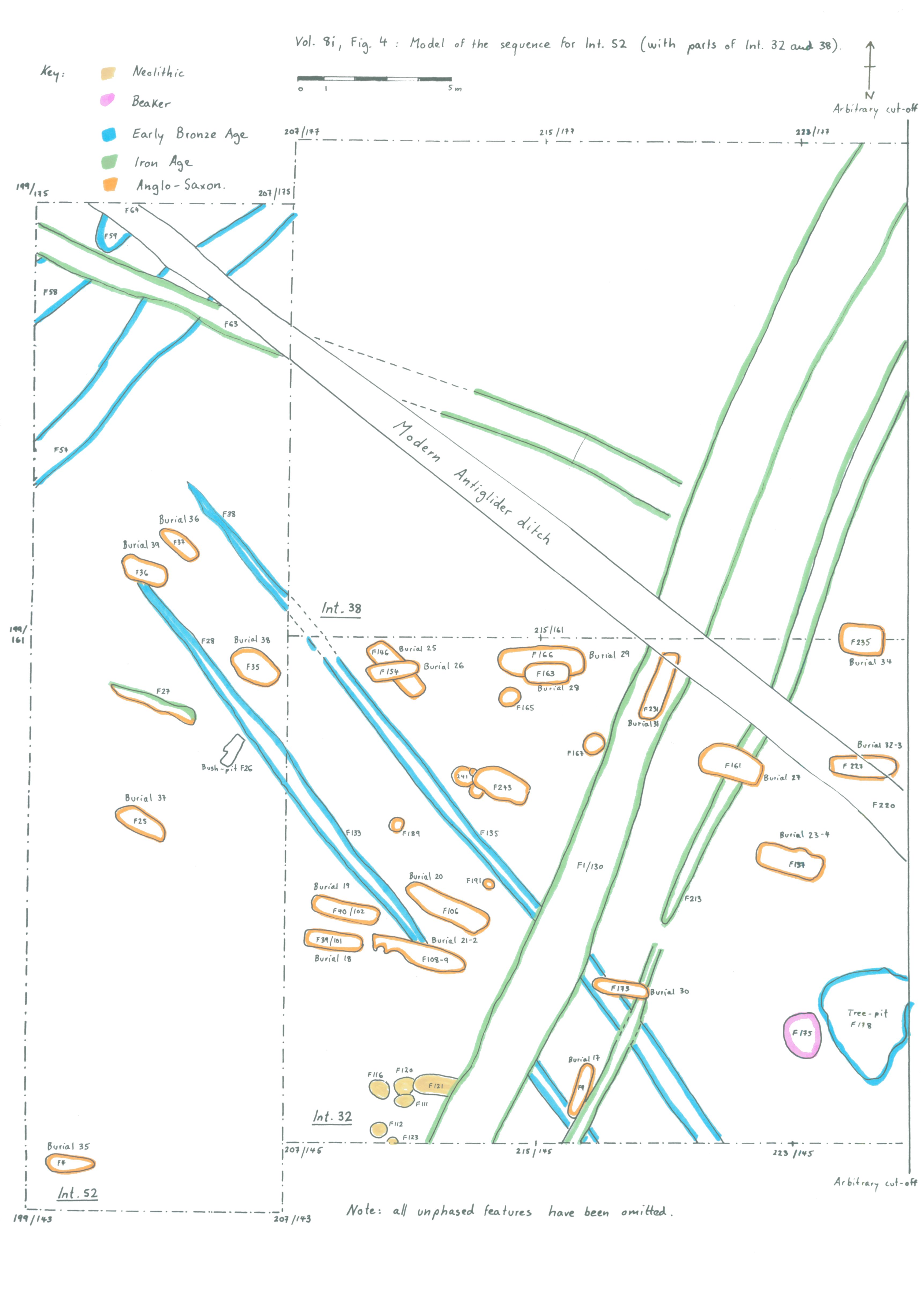
| Plan of Intervention 32, 38, 39 and 52 phases | Preview Image | JPG | 740Kb |
|
|||
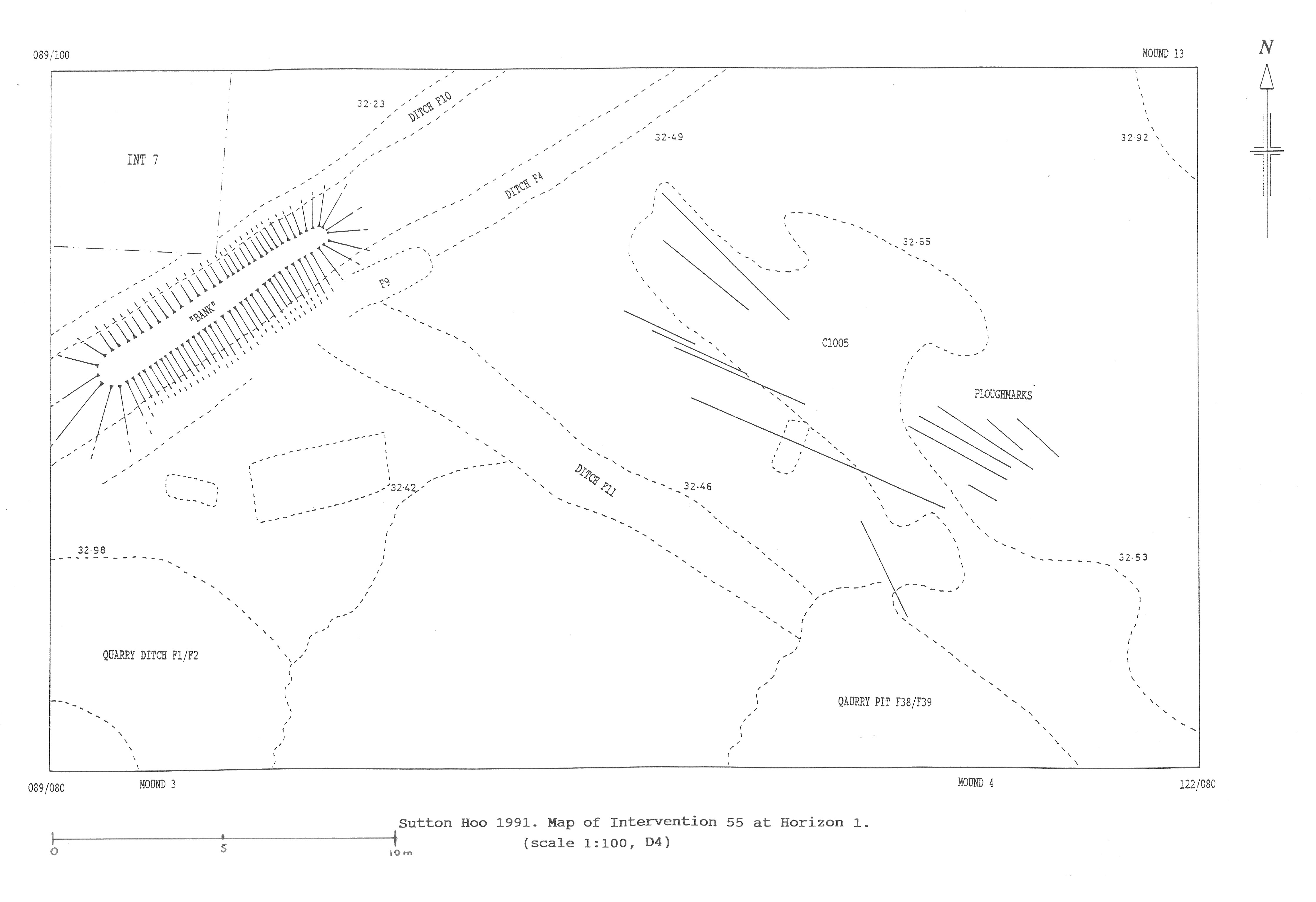
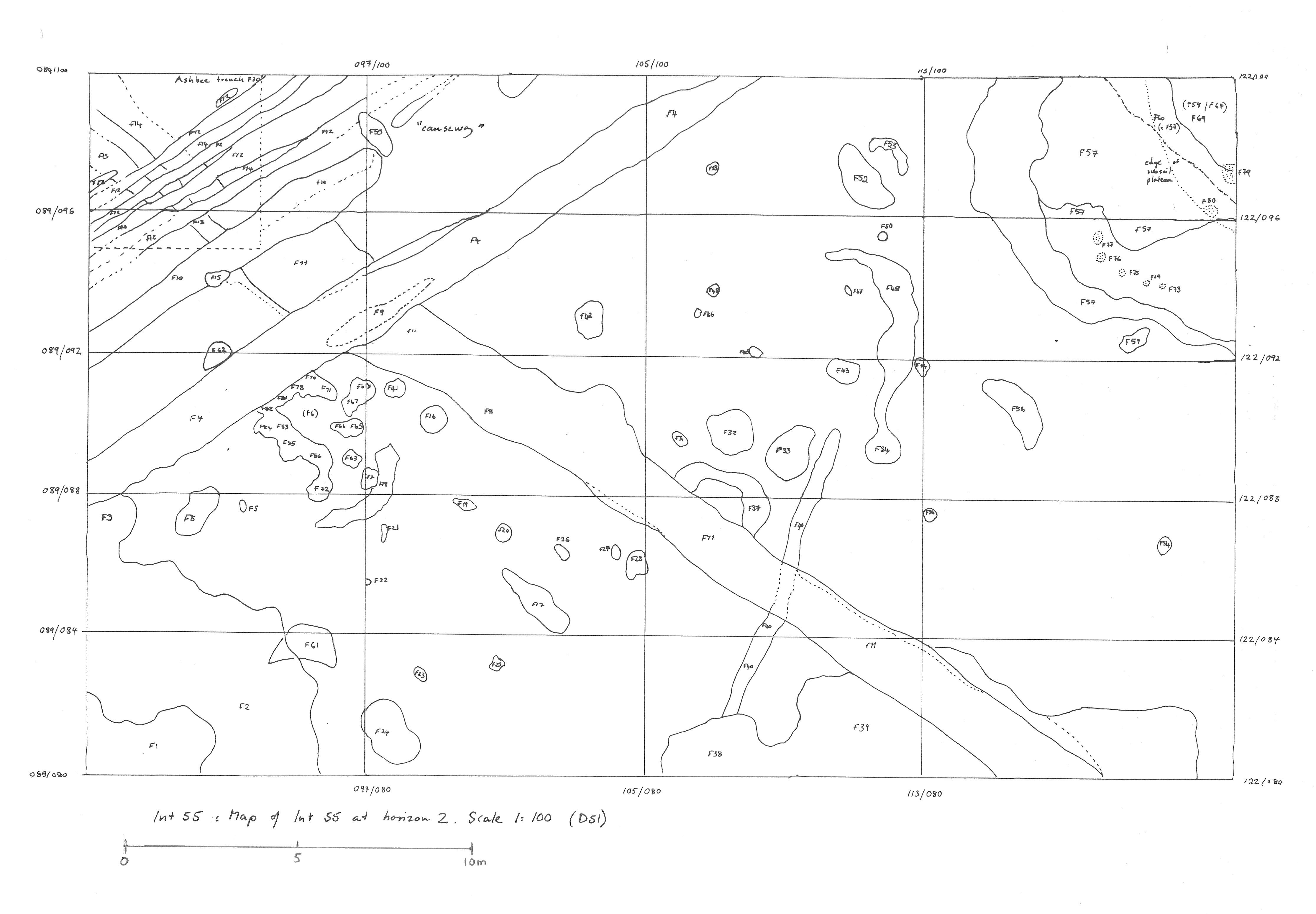
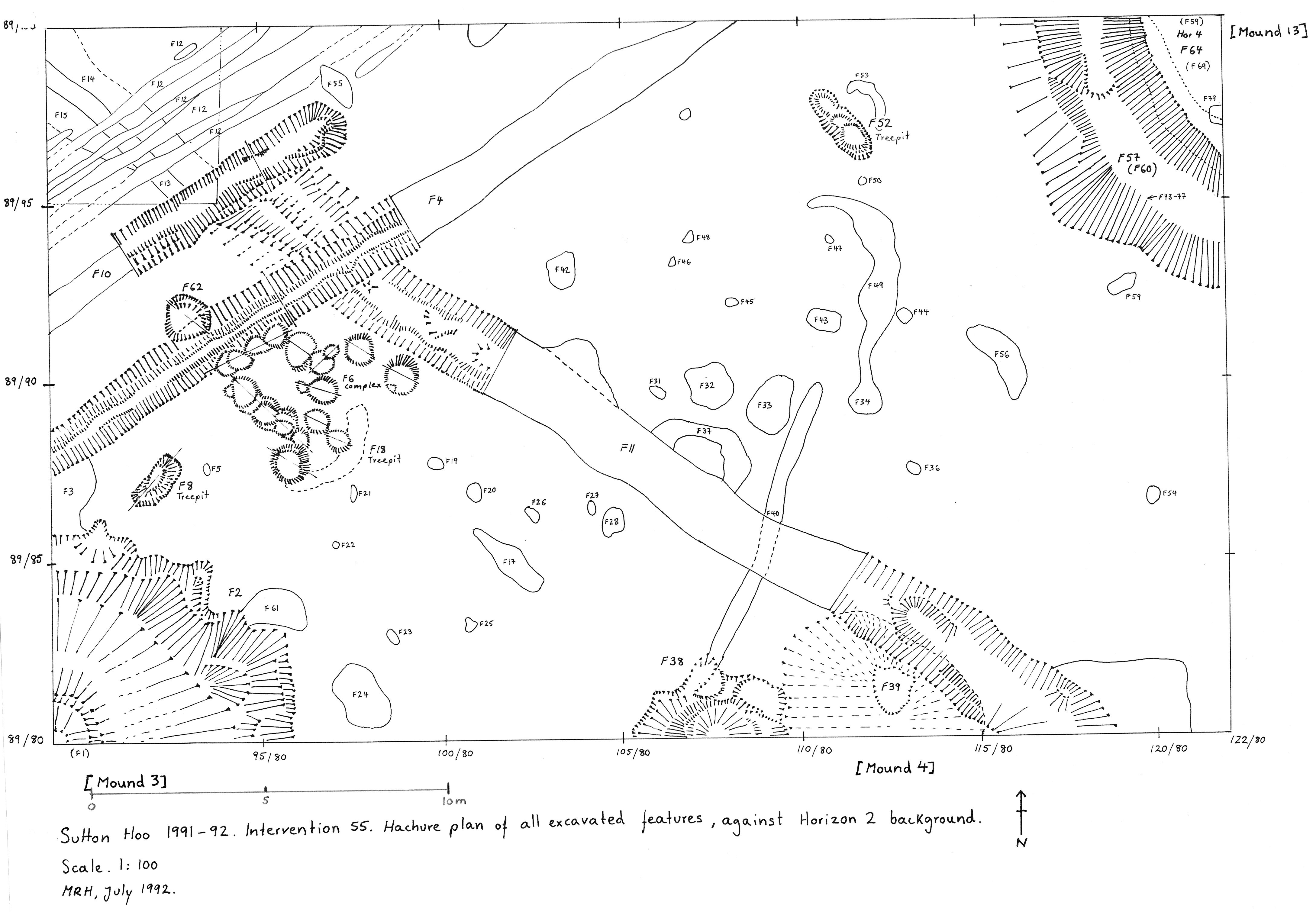
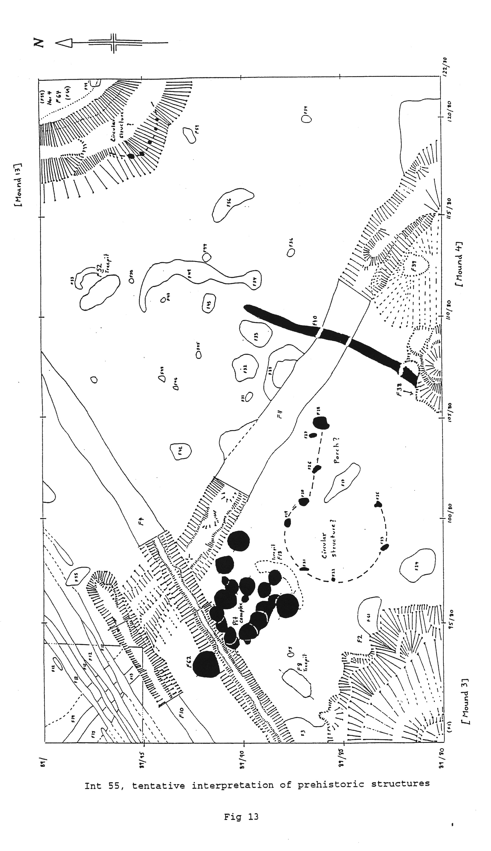
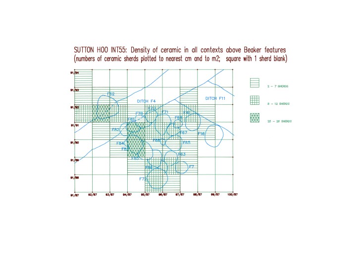
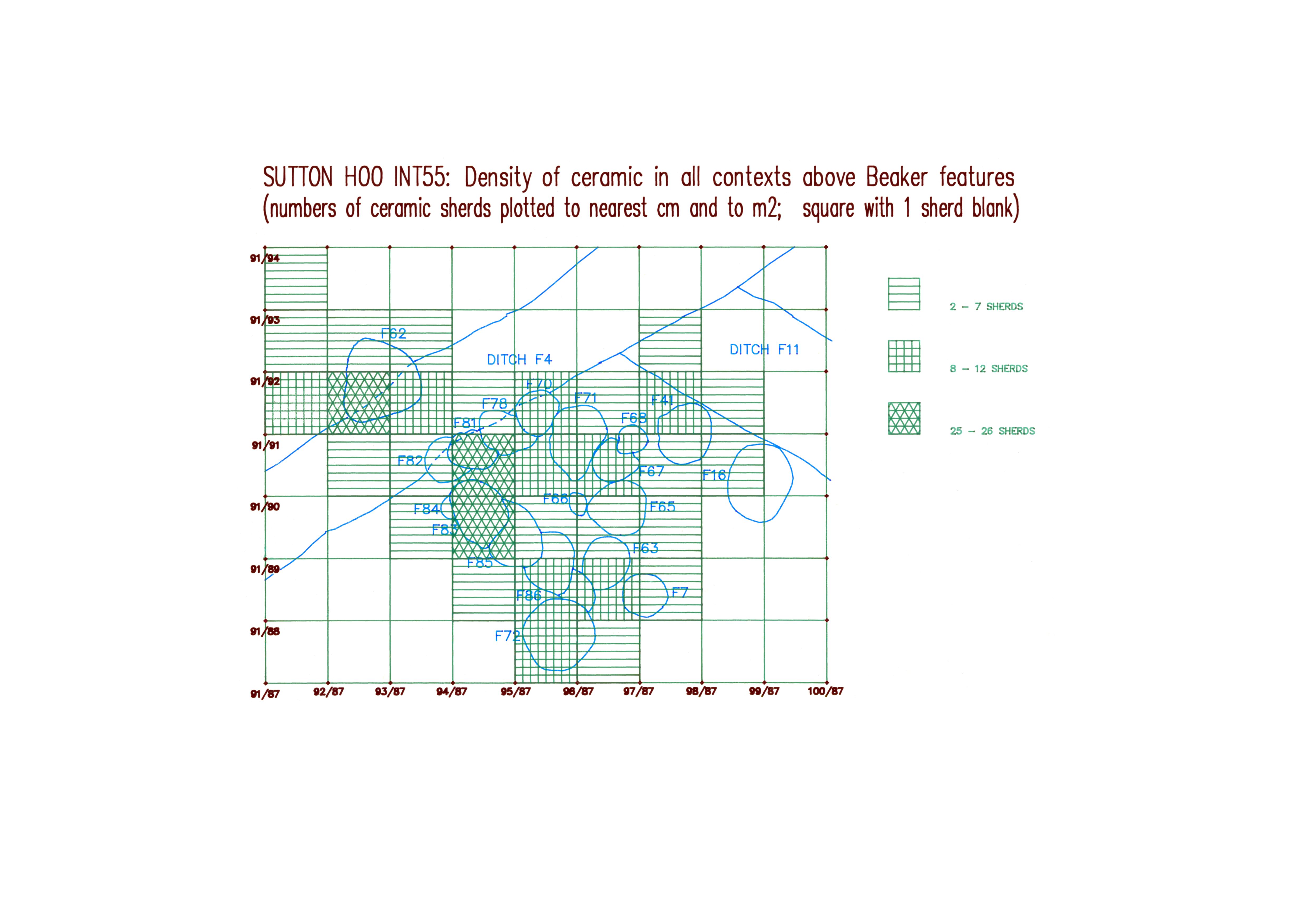
Intervention 55 (1991-2)
Excavation of an area to the south of Mound 7, containing parts of Mound 13, Mound 3 and Mound 4, by M O H Carver and M R Hummler for Sutton Hoo Research Trust.
| Plan of Intervention 55, horizon 1 (pre-excavation) | Preview Image | JPG | 582Kb |
| Plan of Intervention 55, horizon 2 (pre-excavation) | Preview Image | JPG | 868Kb |
| Plan of Intervention 55, horizon 2 (excavated) | Preview Image | JPG | 1,037Kb |
| Interpretation of prehistoric structures in Intervention 55 | Preview Image | JPG | 881Kb |
| Intervention 55: Density of ceramic in all contexts above Beaker features | Preview Image | JPG | 779Kb |
|
|||
