
Sandway Road, Lenham, Kent - Integrated Site Report
Wessex Archaeology, Oxford Archaeology (South), 2009. (updated 2017) https://doi.org/10.5284/1044813. How to cite using this DOI
Data copyright © High Speed 1 unless otherwise stated
This work is licensed under the ADS Terms of Use and Access.

Primary contact
Stuart
Foreman
Senior Project Manager
Oxford Archaeology (South)
Janus House
Osney Mead
Oxford
OX2 0ES
UK
Tel: 01865 263800
Fax: 01865 793496
Resource identifiers
- ADS Collection: 2456
- DOI:https://doi.org/10.5284/1044813
- How to cite using this DOI


Introduction
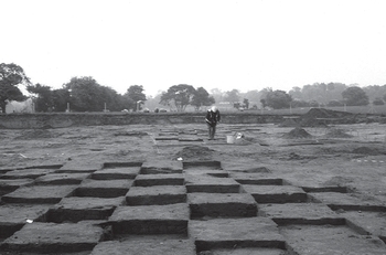
As part of the scheme of archaeological mitigation undertaken prior to construction of the Channel Tunnel Rail Link (CTRL), Rail Link Engineering (RLE), acting on behalf Union Railways (South) Limited (subsequently London and Continental Railways), commissioned Wessex Archaeology and Oxford Archaeology (formerly the Oxford Archaeological Unit) to carry-out a programme of fieldwork on land adjacent to Sandway Road, between the villages of Sandway and Harrietsham, Kent (OS NGR TQ 87975 51642). The works included an evaluation, a 'strip-map-sample' excavation and a watching brief.
There is slight evidence that the site was at least visited in the early Mesolithic. However, the earliest substantial phase of activity belongs to the late Mesolithic (c 6500-4000 BC) and comprised a significant concentration of burnt and worked flint. Microliths, microburins and other tools were recovered with large amounts of knapping waste, mostly from a shallow hollow and two areas of palaeosol. This is interpreted as evidence for a short-term hunting camp, which was perhaps re-visited on a number of occasions. Bioturbation had re-distributed artefacts vertically but little lateral movement had taken place, allowing some reconstruction of activity zones.
Pottery from the site spanned the Neolithic period (c 4000-2300 BC). A large pit contained small amounts of middle Neolithic Peterborough ware pottery, but most of the fragmentary and abraded assemblage either came from tree-throws holes and natural hollows or was residual in later features. The circumstances under which the pottery was deposited remain unknown, but the assemblage as a whole indicates activity over a long time-scale and at a low-intensity. Neolithic flint was limited in occurrence and was also mostly residual or intrusive. Its distribution did not correspond with the Neolithic pottery.
There is slight evidence for arable farming in the early Bronze Age and a charred wheat grain was radiocarbon dated to 1960-1690 cal BC. The development of land-division in the middle Bronze Age (1600-1150 cal BC) is demonstrated by two closely spaced ditch alignments that probably represent successive variations on a single boundary. The larger of these contained a group of Deverel-Rimbury style vessels, amongst which were parts of two globular urns. Several undated ditches recorded in a watching brief may also belong to this phase. Up to 0.5 m of colluvium sealed the site and the early formation of this layer may be attributed directly to mobilisation of hill slope soils by Bronze Age farming activity.
Two parallel late medieval or early post-medieval ditches may also have been land-boundaries. Several tree-throw holes/hollows discovered during the Watching Brief remain undated, as do the majority of such features within the main excavation area.
The fieldwork events incorporated in this report are:
- Sandway Road (ARC SWR99) - Excavation
- Sandway Road Watching Brief - Area 420 (ARC WB420/73+500-73+700) - Watching Brief
