Land off Main Street, Tingewick, Buckinghamshire (OASIS ID: cotswold2-215377)

Cotswold Archaeology, 2015. https://doi.org/10.5284/1035160. How to cite using this DOI

Digital Object Identifiers

Digital Object Identifiers (DOIs) are persistent identifiers which can be used to consistently and accurately reference digital objects and/or content. The DOIs provide a way for the ADS resources to be cited in a similar fashion to traditional scholarly materials. More information on DOIs at the ADS can be found on our help page.

Citing this DOI

The updated Crossref DOI Display guidelines recommend that DOIs should be displayed in the following format:

https://doi.org/10.5284/1035160
Sample Citation for this DOI

Cotswold Archaeology (2015) Land off Main Street, Tingewick, Buckinghamshire (OASIS ID: cotswold2-215377) [data-set]. York: Archaeology Data Service [distributor] https://doi.org/10.5284/1035160

Data copyright © Cotswold Archaeology unless otherwise stated

This work is licensed under the ADS Terms of Use and Access.
Creative Commons License


Cotswold Archaeology logo

Primary contact

Hazel O'Neill
Cotswold Archaeology
Building 11
Kemble Enterprise Park
Cirencester
GL7 6BQ
UK
Tel: 01285 772624

Send e-mail enquiry

Resource identifiers

Digital Object Identifiers

Digital Object Identifiers (DOIs) are persistent identifiers which can be used to consistently and accurately reference digital objects and/or content. The DOIs provide a way for the ADS resources to be cited in a similar fashion to traditional scholarly materials. More information on DOIs at the ADS can be found on our help page.

Citing this DOI

The updated Crossref DOI Display guidelines recommend that DOIs should be displayed in the following format:

https://doi.org/10.5284/1035160
Sample Citation for this DOI

Cotswold Archaeology (2015) Land off Main Street, Tingewick, Buckinghamshire (OASIS ID: cotswold2-215377) [data-set]. York: Archaeology Data Service [distributor] https://doi.org/10.5284/1035160

Introduction

Land off Main Street, Tingewick, Buckinghamshire (OASIS ID: cotswold2-215377)

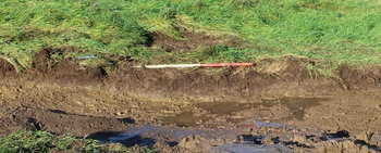
In November 2014, Cotswold Archaeology carried out an archaeological evaluation on land off Main Street Tingewick, Buckinghamshire.

Cropmarks of possible prehistoric date are known to the north of the site, and a possible Roman villa has been recorded c. 200m to the north-west. Aerial photographic evidence indicates that the site contained medieval ridge and furrow earthworks until the 1960s, and a geophysical survey of the site recorded below-ground traces of the ploughed-out furrow bases. The site appears to have remained undeveloped agricultural/pastoral land in the post medieval and modern eras.

The archaeological evaluation results displayed a strong correspondence with the geophysical survey results. The only archaeological features found to pre-date the modern era were the ploughed-out remains of a medieval ridge and furrow agricultural system, indicating that the site has been in agricultural/pastoral use since at least the medieval era. There was no evidence for any earlier activity at the site.


ADS logo
Data Org logo
University of York logo