Site Data from a Geophysical Survey at Gate Burton Energy Park, Lincolnshire February to April 2022

Archaeological Services WYAS, 2022. https://doi.org/10.5284/1095678. How to cite using this DOI

Digital Object Identifiers

Digital Object Identifiers (DOIs) are persistent identifiers which can be used to consistently and accurately reference digital objects and/or content. The DOIs provide a way for the ADS resources to be cited in a similar fashion to traditional scholarly materials. More information on DOIs at the ADS can be found on our help page.

Citing this DOI

The updated Crossref DOI Display guidelines recommend that DOIs should be displayed in the following format:

https://doi.org/10.5284/1095678
Sample Citation for this DOI

Archaeological Services WYAS (2022) Site Data from a Geophysical Survey at Gate Burton Energy Park, Lincolnshire February to April 2022 [data-set]. York: Archaeology Data Service [distributor] https://doi.org/10.5284/1095678

Data copyright © Archaeological Services WYAS unless otherwise stated

This work is licensed under a Creative Commons Attribution 4.0 International License.
Creative Commons License


Archaeological Services WYAS logo

Primary contact

Archaeological Services WYAS
Nepshaw Lane South
Morley
Leeds
LS27 7JQ
UK
Tel: 0113 535 0163

Resource identifiers

Digital Object Identifiers

Digital Object Identifiers (DOIs) are persistent identifiers which can be used to consistently and accurately reference digital objects and/or content. The DOIs provide a way for the ADS resources to be cited in a similar fashion to traditional scholarly materials. More information on DOIs at the ADS can be found on our help page.

Citing this DOI

The updated Crossref DOI Display guidelines recommend that DOIs should be displayed in the following format:

https://doi.org/10.5284/1095678
Sample Citation for this DOI

Archaeological Services WYAS (2022) Site Data from a Geophysical Survey at Gate Burton Energy Park, Lincolnshire February to April 2022 [data-set]. York: Archaeology Data Service [distributor] https://doi.org/10.5284/1095678

Overview

Overview processed gradiometer greyscales

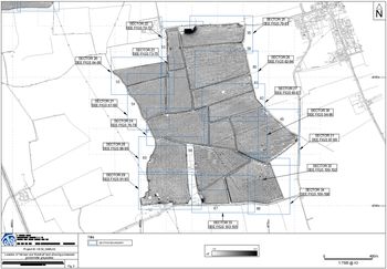
A geophysical (magnetometer) survey was undertaken on approximately 280 hectares of land located to the south-east of Gainsborough, Lincolnshire.

The majority of the anomalies recorded are agricultural including field drains, ridge and furrow cultivation, modern ploughing and former field boundaries. Archaeological anomalies have been recorded which show what appear to be a set of enclosures of a likely medieval date. Possible archaeological anomalies have also been recorded which may indicate further areas of activity.

Based on the geophysical survey, the archaeological potential of the Site is deemed to be high in Field 45 and low elsewhere.


ADS logo
Data Org logo
University of York logo