Images and GIS Data from an Archaeological Watching Brief at Cirencester Primary School, Victoria Road, Cirencester, Gloucestershire March 2021

Cotswold Archaeology, 2022. https://doi.org/10.5284/1100772. How to cite using this DOI

Digital Object Identifiers

Digital Object Identifiers (DOIs) are persistent identifiers which can be used to consistently and accurately reference digital objects and/or content. The DOIs provide a way for the ADS resources to be cited in a similar fashion to traditional scholarly materials. More information on DOIs at the ADS can be found on our help page.

Citing this DOI

The updated Crossref DOI Display guidelines recommend that DOIs should be displayed in the following format:

https://doi.org/10.5284/1100772
Sample Citation for this DOI

Cotswold Archaeology (2022) Images and GIS Data from an Archaeological Watching Brief at Cirencester Primary School, Victoria Road, Cirencester, Gloucestershire March 2021 [data-set]. York: Archaeology Data Service [distributor] https://doi.org/10.5284/1100772

Data copyright © Cotswold Archaeology unless otherwise stated

This work is licensed under a Creative Commons Attribution 4.0 International License.
Creative Commons License


Cotswold Archaeology logo

Primary contact

Cotswold Archaeology
Building 11
Kemble Enterprise Park
Cirencester
GL7 6BQ
UK
Tel: 01285 771022
Fax: 01285 771033

Send e-mail enquiry

Resource identifiers

Digital Object Identifiers

Digital Object Identifiers (DOIs) are persistent identifiers which can be used to consistently and accurately reference digital objects and/or content. The DOIs provide a way for the ADS resources to be cited in a similar fashion to traditional scholarly materials. More information on DOIs at the ADS can be found on our help page.

Citing this DOI

The updated Crossref DOI Display guidelines recommend that DOIs should be displayed in the following format:

https://doi.org/10.5284/1100772
Sample Citation for this DOI

Cotswold Archaeology (2022) Images and GIS Data from an Archaeological Watching Brief at Cirencester Primary School, Victoria Road, Cirencester, Gloucestershire March 2021 [data-set]. York: Archaeology Data Service [distributor] https://doi.org/10.5284/1100772

Introduction

General site shot looking North

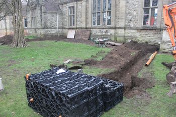
This collection comprises images and GIS data from an archaeological watching brief during groundworks associated with the excavation of three soakaways at Cirencester Primary School, Victoria Road, Cirencester, Gloucestershire. This work was undertaken in March 2021 by Cotswold Archaeology.

A mortar and metalled limestone surface was identified in the northern-most soakaway c.0.73m below present ground level. This is potentially Roman Intramural Street D which was predicted to be within this area. The two soakaways to the south contained Roman demolition deposits at c. 0.95m below present ground level. Both the surface and the demolition deposits were sealed by 'dark earth' deposits which were in turn overlain by topsoil.


ADS logo
Data Org logo
University of York logo