
Images and Site Records from Multiple Fieldwork Investigations on the route of the Poynton Relief Road, Cheshire, 2020 to 2022
Oxford Archaeology North, Karen Barker, 2023. https://doi.org/10.5284/1101995. How to cite using this DOI
Data copyright © Fraser Brown unless otherwise stated
This work is licensed under a Creative Commons Attribution 4.0 International License.

Primary contact
Oxford Archaeology North
Mill 3
Moor Lane Mills
Moor Lane
Lancaster
LA1 1QD
UK
Resource identifiers
- ADS Collection: 5025
- DOI:https://doi.org/10.5284/1101995
- How to cite using this DOI
Introduction
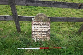
This collection comprises images and site records from various work undertaken along the route of Poynton Relief Road by Oxford Archaeology North, 2020. Photographic Surveys were undertaken at eleven assets along the route of Poynton Relief Road. Three assets were protected during construction, and earthwork surveys undertaken at two assets. Archaeological evaluation was undertaken at one asset and targeted archaeological excavation undertaken on two assets in the location of field and township boundaries affected by the construction works. Strip, Map and Record Excavation and watching brief were undertaken at one location, land affected by the A523/Bonis Hall Lane junction works in the areas around the Scheduled Bowl Barrow.
At Asset 21 there was no evidence of the field boundary earthwork in the targeted excavation area, although the analytical landscape survey identified it as almost imperceptible at the location the area was excavated. However, a shallow palaeochannel was identified at the northern end of the area, crossing it on an east/west-alignment, this did appear to be entirely natural in origin, having likely formed from a natural depression in the field. Asset 27: the township boundary, between the Townships of Woodford and Adlington, recorded through analytical landscape survey, had been heavily truncated by being cleaned out as part of the installation of the haul road. As such, only limited remains of the township boundary survived to be excavated. What was excavated did not produce any remains of significance, although a section was recorded through the feature. Asset 28: related to the putative location of a Roman road leading between Buxton and Cheadle. Although evidence of cobbles were identified in the base of all five trenches, these did not appear to form a surface and likely related to the base of an earlier track leading to Shirdfold Farm, as depicted on historic mapping, due to the presence of brick rubble mixed with the cobbles in the deposit. There was no evidence of any Roman activity related to the remains identified. Area around Asset 35: limited archaeological remains were identified in the strip, map and record area around Asset 35, a scheduled bowl barrow (NMR: 1007379), comprising two discrete features and two linear features. Only one of the features contained any dating evidence, ditch 3503 to the south of Bonis Hall Lane, which contained a small assemblage of post-medieval ceramics. The three remaining features were entirely undated, and their function could not be discerned, they were unlikely to relate to the nearby scheduled bowl barrow, however, this cannot be entirely discounted.
