
Images and GIS Data from an Archaeological Evaluation at Laynes Wood Solar Farm, Highleadon, Gloucestershire 2022
Cotswold Archaeology, 2023. https://doi.org/10.5284/1103320. How to cite using this DOI
Data copyright © Cotswold Archaeology unless otherwise stated
This work is licensed under a Creative Commons Attribution 4.0 International License.

Primary contact
Cotswold Archaeology
Building 11
Cotswold Business Park
Cirencester
GL7 6BQ
UK
Tel: 01285 771022
Fax: 01285 771033
Resource identifiers
- ADS Collection: 5179
- DOI:https://doi.org/10.5284/1103320
- How to cite using this DOI
Introduction
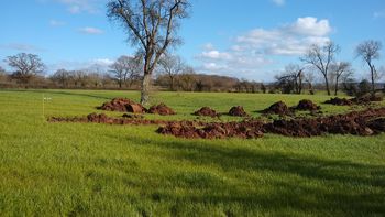
This collection comprises images and GIS data form an archaeological evaluation of land at Laynes Wood, Highleadon, Gloucestershire carried out by Cotswold Archaeology during February and March 2022. A total of 87 trenches were excavated.
Two distinct areas of archaeological activity were identified (Areas A and B), both of which correlated with the results of the preceding geophysical survey. Elsewhere, evidence for archaeological activity was much more limited and comprised ditches and ponds.
The identified archaeological activity in the northern land parcels, Area A, correlated closely with geophysical evidence for a series of rectilinear features, in the form of enclosures, suggestive of agricultural activity and located on a ridge of locally high ground. Although early/ mid 1st to 2nd-century Roman artefacts were present, the recovered assemblage is more typically dominated by 2nd to 4th-century, or broadly dated Roman, ceramics. Evidence for iron working residues was also recovered.
To the south of Red Brook, the proposed development area was dominated by low lying land associated with the flood plain. Sequences of alluvium of c.1.5m in depth were identified during this evaluation. Further geoarchaeological investigations were subsequently carried out by ARCA and will be reported on separately by that organisation.
The Roman activity identified in the southern land parcels, Area B, comprised a series of ditches with further evidence for iron working residue being present.
