
Data from a Trial Trench Evaluation at Copthall North Gate 2, West Ruislip, Hillingdon, Greater London, 2022 (HS2 Phase One)
Archaeology Wales, High Speed Two Ltd., 2024. https://doi.org/10.5284/1119017. How to cite using this DOI
Data copyright © High Speed Two Ltd. unless otherwise stated
This work is licensed under a The Open Government Licence (OGL).

Primary contact
High Speed Two Ltd.
2 Snowhill
Queensway
Birmingham
B4 6GA
United Kingdom
Tel: 08081 434 434
Resource identifiers
- ADS Collection: 6317
- DOI:https://doi.org/10.5284/1119017
- How to cite using this DOI

Introduction
This collection comprises the scanned paper archive (trench sheets, registers, drawings) and digital photos from a trial trenching evaluation carried out by Archaeology Wales at Copthall North Gate 2, West Ruislip in May 2022. The spreadsheets and specialist reports created during the post-excavation phase of the project are also included.
Project Summary
The evaluation forms part of Phase One of the High Speed 2 (HS2) rail project, which was granted Royal Assent in 2017 as the High-Speed Rail (London - West Midlands) Act. Phase One runs 230 km from Euston Station in London to Curzon Street in Birmingham.
This particular evaluation was preceded by two further phases of conducted across Copthall North; the first being undertaken by Archaeology Wales in December 2021, which identified no features or artefacts of archaeological significance; and the second by Archaeology Wales in 2022, which identified no features or artefacts of archaeological significance.
The general aims and objectives of the project were:
- To determine the presence/absence of previously unknown archaeological assets in the evaluation areas by a programme of trial trench evaluation.
- To archaeologically excavate and record all significant archaeological features within the evaluation areas, in order to clarify the nature, date, extent and survival of any remains revealed and thus contribute to understanding of their heritage significance. The evaluation was to provide a permanent archaeological record for the purposes of contributing to specific GWSI: HERDS Specific Objectives (see below).
- To obtain dating and environmental evidence (where possible) through retrieval of artefactual and Eco factual evidence.
- To carry out post-excavation assessment and analysis of recovered material.
The evaluation was designed to address the following Knowledge Creation Objectives determined by CSJV ahead of two previous phases of work:
- KC5: Identify settlement location and developing models for settlement patterns for the Mesolithic, Neolithic and early Bronze Age.
- KC6: Understanding the evidence for change in the environment and management of the landscape for the Mesolithic and early Neolithic Periods.
- KC7: Exploring the degree of continuity that existed between Late Mesolithic and Neolithic communities in terms of population mobility and subsistence strategies.
- KC11: Does the high density of prehistoric settlement evidence in the Colne Valley reflect a genuine focus of activity or does it reflect a bias in the archaeological record?
- KC14: Identify sequences of environmental change for the Late Upper Palaeolithic- Early Mesolithic transition through investigation of sites in the Colne Valley and other locations along the route.
- KC34: Undertake research and investigation into medieval manorial complexes. What was their origin, development and impact on the landscape?
- KC35 Investigate the impacts on rural communities of social and economic shocks in the mid C14th and thereafter and their contribution to settlement desertion.
- KC40: Identify patterns of change within medieval rural settlement from 11th to mid- 14th century
Re-Use Value Statement
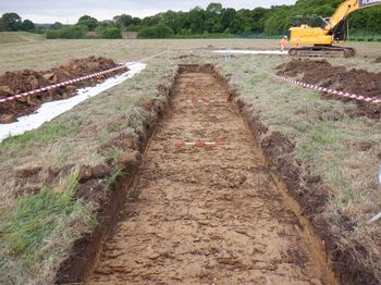
There were no archaeological features encountered within the nine trenches excavated in this area of the Northern Sustainable Placement Area. As such, the dataset holds no further re-use potential.
