
Abberton to Wormingford Pipeline route: Colchester Borough. Archaeological Evaluation
Birmingham Archaeology, 2017. https://doi.org/10.5284/1045795. How to cite using this DOI
Data copyright © University of Birmingham unless otherwise stated
This work is licensed under the ADS Terms of Use and Access.

Primary contact
Historic England
1 Waterhouse Square
138-142 Holborn
London
EC1N 2ST
UK
Tel: 01793 414700
Fax: 01793 414707
Resource identifiers
- ADS Collection: 2951
- DOI:https://doi.org/10.5284/1045795
- How to cite using this DOI


Introduction
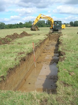
Birmingham Archaeology was commissioned by Essex and Suffolk Water to undertake a programme of trial trenching ahead of a proposed new pipeline between Wormingford to Abberton. The length of the route between Abberton and Wormingford is approximately 17.50km, although the archaeological evaluation was focused upon four discrete areas along the route (Wormingford, Fordham, Stanway and Birch). These locations were selected by the Archaeological Officer for Colchester Borough Council based on information located within the Sites and Monument Record. The trench locations were targeted on cropmark anomalies where possible.
During construction the methodology requires a working easement approximately 25-30m in width to be stripped of topsoil along the entire route. In addition, further areas will be stripped close to road junctions to allow larger working areas to be established.
The aims of the evaluation was to confirm the nature and date of the cropmark features recorded within the EHER and to clarify the depths of topsoil and subsoil along the route to assist the Colchester and Ipswich Museum Service to develop further mitigation strategies. The finds assessment provided by the specialists in conjunction with the stratigraphic sequences from the evaluation trenches have resulted in a number of archaeological sites being identified within the four evaluated areas. Although some isolated Roman, Medieval and post-medieval pottery has been recovered, it is the prehistoric evidence which has produced the greatest amount of information and offers significant potential to advance our understanding of the prehistoric periods in this region.
Given the construction methodology associated with this scheme, the evaluation has demonstrated that archaeological remains do exist within the working easement of the pipe route and will be impacted upon during the development phase of the project. It is clear from the results that specific areas along the route contain dense or complex archaeological deposits (for example Wormingford Trenches 7,8 and 14, Stanway Trenches 39-41, Fordham Trench 18 and Birch Trenches 66, 76-81).
However, in most of these areas there may be a significant depth of subsoil to protect the archaeological remains in situ during the easement topsoil strip which will be implemented during stage 1 of the works. It is generally accepted that 250mm of subsoil deposit would serve to protect underlying remains during topsoil removal in dry conditions. It is probable that further mitigation may be required in specific areas of the route around Colchester in the form of watching brief, excavation of pipe trench, and controlled strip, map and sample.
