CBA Research Reports
Council for British Archaeology, 2000. (updated 2020) https://doi.org/10.5284/1000332. How to cite using this DOI
Data copyright © Council for British Archaeology unless otherwise stated
This work is licensed under the ADS Terms of Use and Access.
Primary contact
Council for British Archaeology
92 Micklegate
York
YO1 6JX
UK
Tel: 01904 671417
Resource identifiers
- ADS Collection: 281
- DOI:https://doi.org/10.5284/1000332
- How to cite using this DOI
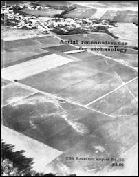
Aerial reconnaissance for archaeology
D R Wilson (editor)
CBA Research Report No 12 (1975)
ISBN 0 900312 29 7
Abstract

Papers from a symposium held in April 1974. Techniques of remote sensing and survey are treated by R J A Jones and R Evans (factors controlling development of soil and crop marks); D R Wilson (photographic techniques, equipment and procedures), J N Rinker (emulsions), W A Baker (infra-red) and I Scollar (manual or computer transformation of extreme oblique views to maps/plans). In the section on archaeological interpretation, D R Wilson illustrates some pitfalls, and is followed by writers on three different regions: R Agache (N France), C Leva and J J Hus (Belgium - low-level photography and magnetic/electrical checking on the ground of features seen from the air), and H C Bowen (development of landscape in S England). Section III is on availability and use of air-photographic information: J Hampton (organisation in Britain, especially the National Monuments Record), D Baker (relevance to planners) D Benson (Oxford region), C C Taylor (field archaeology) and H Thorpe (documentary and field study of Wormleighton). The need for a central air-photographic interpretation and dissemination centre is put by P J Fowler.
Contents
- Title pages
- Foreword by Professor Glyn Daniel (p vii)
- Preface by Dr Graham Webster (p viii)
- Resolutions of the Symposium (p viii)
- The Organizing Committee (p ix)
- PART I: TECHNIQUES OF REMOTE SENSING AND SURVEY
- Soil and crop marks in the recognition of archaeological sites by air photography by R J A Jones and R Evans (p 1)
- Photographic techniques in the air by D R Wilson (p 12)
- Some technical aspects of film emulsions in relation to the analysis and interpretation of aerial photographs by Jack N Rinker (p 32)
- Infra-red techniques by W A Baker (p 46)
- Transformation of extreme oblique aerial photographs to maps or plans by conventional means or by computer by Irwin Scollar (p 52)
- PART II: ARCHAEOLOGICAL INTERPRETATION AND RESULTS
- Some pitfalls in the interpretation of air photographs by D R Wilson (p 59)
- Aerial reconnaissance in northern France by Roger Agache (p 70)
- Recent archaeological discoveries in Belgium by low-level
aerial photography and geophysical survey
- Part 1: Aerial reconnaissance and low-level photography for archaeology by C. Léva (p 81)
- Part 2: Magnetic and electrical survey - powerful aids for the location and confirmation of archaeological features seen on air photographs by J J Hus (p 98)
- Air photography and the development of the landscape in central parts of southern England by H C Bowen (p 103)
- PART III: AVAILABILITY AND USE OF INFORMATION FROM AIR PHOTOGRAPHS
- The organization of aerial photography in Britain by John Hampton (p 118)
- Problems of town and country planners by David Baker (p 125)
- The application of aerial photography in the Oxford region by Don Benson (p 132)
- Aerial photography and the field archaeologist by C C Taylor (p 136)
- Air, ground, document by Harry Thorpe (p 141)
- The distant view by P J Fowler (p 154)
Download report
| Aerial reconnaissance for archaeology (CBA Research Report 12) | 19 Mb |


