
Sewer Diversion, Gloucester Bus Station, Station Road, Archaeological Recording, (OASIS ID: cotswold2-297916)
Cotswold Archaeology, 2019. https://doi.org/10.5284/1050905. How to cite using this DOI
Data copyright © Cotswold Archaeology unless otherwise stated
This work is licensed under a Creative Commons Attribution 4.0 International License.

Primary contact
Cotswold Archaeology
Building 11
Cotswold Business Park
Cirencester
GL7 6BQ
UK
Tel: 01285 771022
Fax: 01285 771033
Resource identifiers
- ADS Collection: 3393
- DOI:https://doi.org/10.5284/1050905
- How to cite using this DOI
Introduction
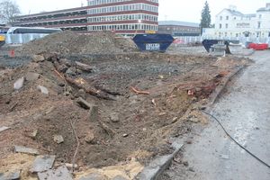
A programme of archaeological recording was undertaken by Cotswold Archaeology between October 2017 and March 2018 during groundworks associated with the redevelopment of Gloucester Bus Station, Station Road, Gloucester. Extra-mural activities associated with both the Roman and Medieval town were identified. However, no activities that could be directly attributed to Whitefriars or the postulated Civil War defences were identified during the current works. A possible early alignment of the River Twyver was stratigraphically the earliest feature recorded. Subsequent to this, walls, associated footings, and contemporary surfacing representing early to mid Roman suburban occupation was revealed. Evidence for their demolition was also identified, as was the subsequent creation of hardstanding in the southern extent of the site.
A medieval ditch and a number of pits, the latter containing 15th-century leather cobbling waste, were revealed in the southern part of the site. These were sealed by a later medieval/Early post-medieval cultivation soil. Within the central and northern extent of the development area silty clays containing 14th to 16th-century ceramics were cut by a series of gullies and postholes suggestive of horticultural or agricultural activity that most probably post-dates the dissolution of Whitefriars. Evidence for walls, culverts (brick and stone) and surfacing associated with the former cattle market was identified in all of the observed trenches. This activity was superseded by evidence for the construction of Grosvenor House and the former bus station.
