
Land off Chilton Road, Long Crendon, Buckinghamshire. Archaeological Evaluation (OASIS ID: cotswold2-317182)
Cotswold Archaeology, 2018. https://doi.org/10.5284/1048315. How to cite using this DOI
Data copyright © Cotswold Archaeology unless otherwise stated
This work is licensed under the ADS Terms of Use and Access.

Primary contact
Cotswold Archaeology
Building 11
Cotswold Business Park
Cirencester
GL7 6BQ
UK
Tel: 01285 771022
Fax: 01285 771033
Resource identifiers
- ADS Collection: 3244
- DOI:https://doi.org/10.5284/1048315
- How to cite using this DOI
Introduction
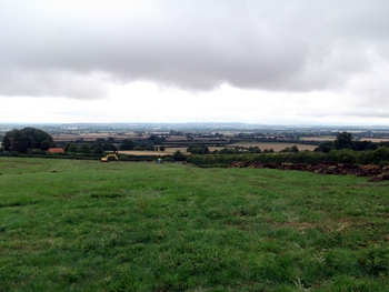
In August 2015, Cotswold Archaeology carried out an archaeological evaluation of land off Chilton Road, Long Crendon, Buckinghamshire. The evaluation, which was commissioned by CgMs Consulting, acting on behalf of Gladman Developments Ltd, was undertaken to identify and record potential remains of archaeological and historical significance in advance of the submission of a planning application for development.
The evaluation was preceded by a desk-based assessment and geophysical survey of the site, the latter detecting three concentric curvilinear anomalies in the northern corner that were interpreted as the remains of an Iron Age hillfort. Previously, the presence of the hillfort had been tentatively suggested by cropmarks immediately to the north-east of the site, which had led to the site being included within an Archaeological Notification Area by Aylesbury Vale District Council. The evaluation confirmed the presence of the hillfort ditches and recovered a small assemblage of Late Bronze Age/Iron Age pottery sherds and fragments of animal bone from excavated features. Features within the hillfort included a possible internal enclosure ditch or second inner ditch and three shallow pits. The largely ploughed-out remains of medieval/post-medieval ridge and furrow ploughing, which once formed part of the open field system surrounding the village of Long Crendon, were recorded in all but three of the trial trenches. Two post-medieval/modern agricultural ditches were also encountered, one of which may correspond with a boundary shown on the Enclosure Award map of 1827.
