
Day of Archaeology Archive
Lorna-Jane Richardson, Matthew Law, Andrew Dufton, Kate Ellenberger, Stuart Eve, Tom Goskar, Jess Ogden, Daniel Pett, Andrew Reinhard, 2018. (updated 2021) https://doi.org/10.5284/1048331. How to cite using this DOI
Data copyright © Individual Authors unless otherwise stated
This work is licensed under a Creative Commons Attribution-ShareAlike 4.0 International License.


Resource identifiers
- ADS Collection: 3016
- DOI:https://doi.org/10.5284/1048331
- How to cite using this DOI

Iain Fraser (RCAHMS) - Aberdeenshire
Year: 2013 Author: Historic Environment Scotland Categories: Landscape Archaeology, Archaeological Prospection, Buildings, Day of Archaeology 2013
Tags: Scotland, #myarchaeology, Mavisbank, River Ugie, Royal Commission on the Ancient and Historical Monuments of Scotland, James Ferguson, Grasslands, John Bolton, Water-meadow, Aberdeenshire, Archaeology, RCAHMS, Iain Fraser
| Historic Environment Scotland (2013): Iain Fraser (RCAHMS) - Aberdeenshire. https://doi.org/10.5284/1079795 | 376 Kb | ||
The images from the original post have been archived and are also available to download. In certain cases images can not be disseminated if they do not adhere to our sensitive data policy.

|
Aberdeenshire ‘Contains Ordnance Survey data © Contains Ordnance Survey data © Crown and database right 2011’ (doa_image7370.jpg) |
JPG | 106 Kb |

|
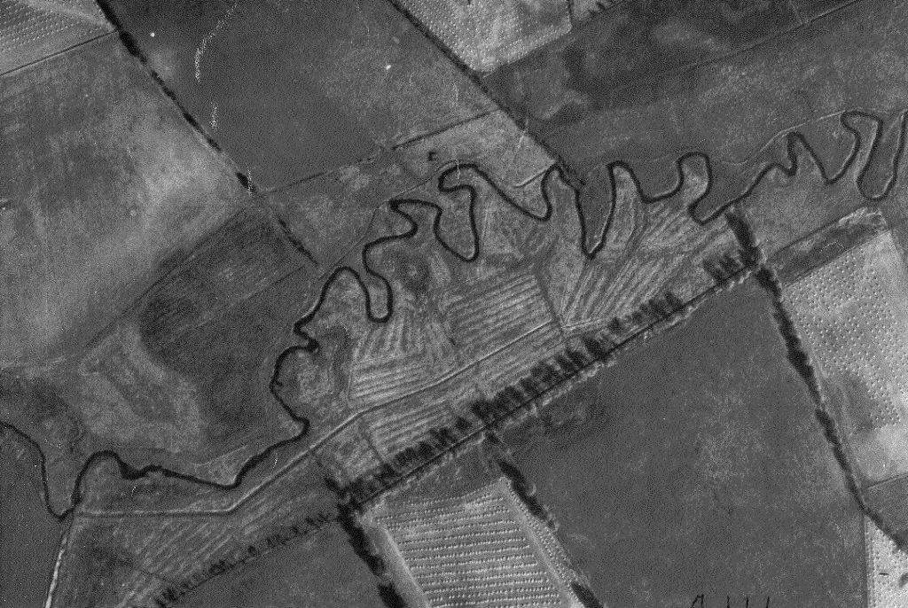
Vertical aerial photograph of the meadows at Baluss, Longisde, 1988, showing the pattern of rigs and drains. Copyright NCAP (doa_image7371.jpg) |
JPG | 140 Kb |

|
Aerial photograph of meadows at Inverquhomery. Copyright NCAP (doa_image7372.jpg) |
JPG | 193 Kb |

|
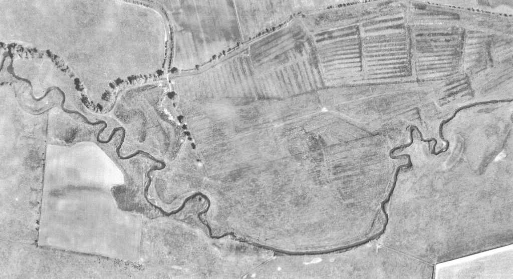
Aerial photograph of meadows at Mavisbank. Copyright NCAP (doa_image7373.jpg) |
JPG | 154 Kb |

|
Two simple bridges at Mavisbank constructed of granite sleepers, providing access over the drains to the rigs. Copyright Iain Fraser (doa_image7374.jpg) |
JPG | 169 Kb |

|
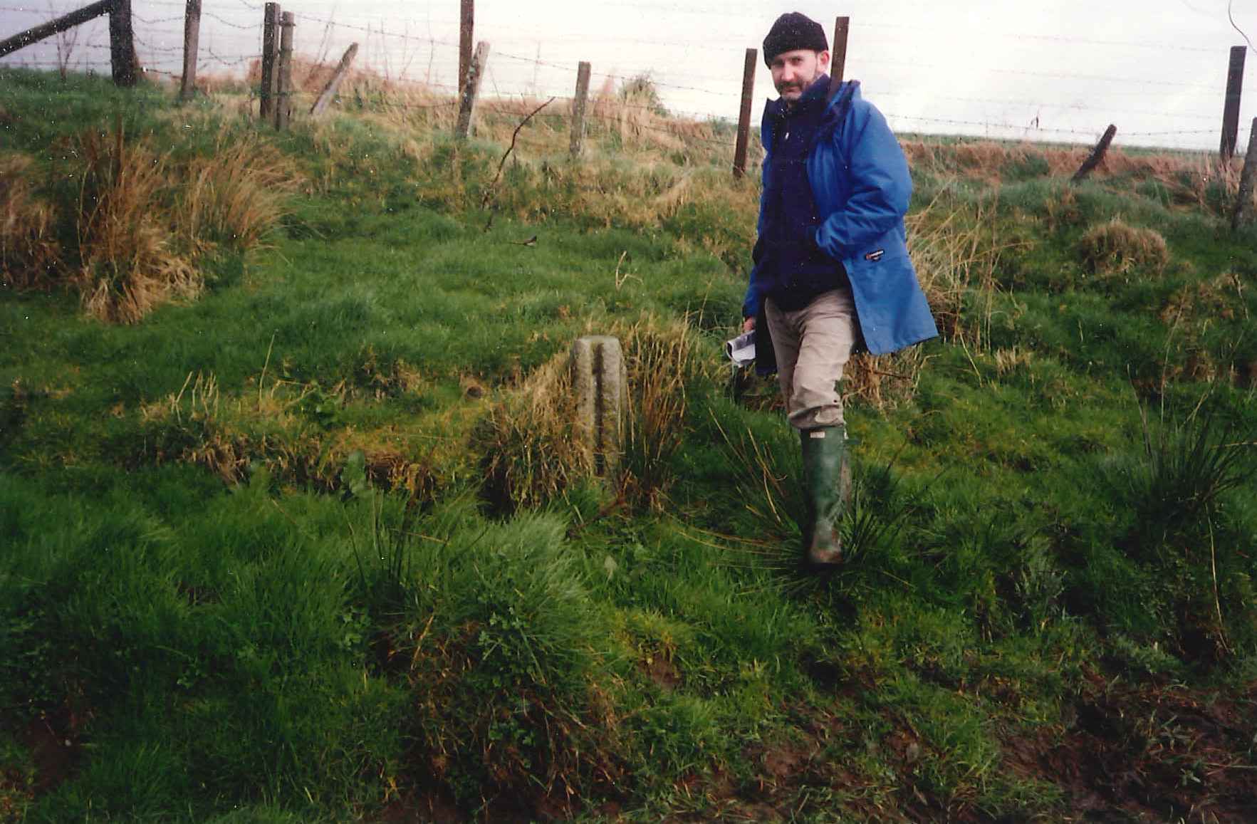
The slotted stone pillar of a sluice gate to control the flow of water over the meadow. Copyright Iain Fraser (doa_image7387.jpg) |
JPG | 167 Kb |
