
Defence of Britain Archive
Council for British Archaeology, 2002. (updated 2006) https://doi.org/10.5284/1000327. How to cite using this DOI
Data copyright © Council for British Archaeology unless otherwise stated
This work is licensed under the ADS Terms of Use and Access.

Primary contact
Council for British Archaeology
92 Micklegate
York
YO1 6JX
England
Tel: +44 (0)1904
Fax: 671417
Resource identifiers
- ADS Collection: 324
- DOI:https://doi.org/10.5284/1000327
- How to cite using this DOI
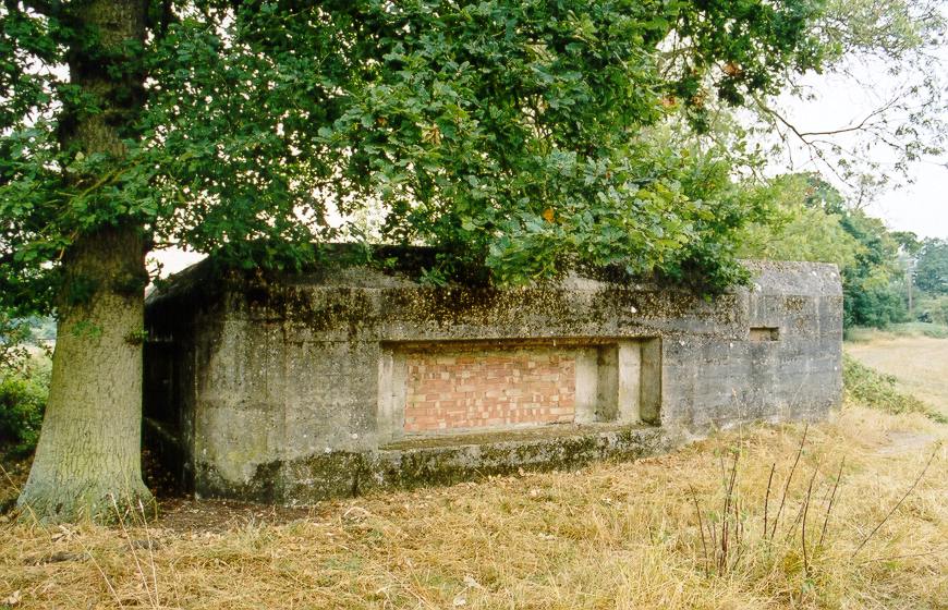
Type 28A twin embrasure anti-tank pillbox, built to the W of the anti-tank ditch.
(Source: Article 1994/12)
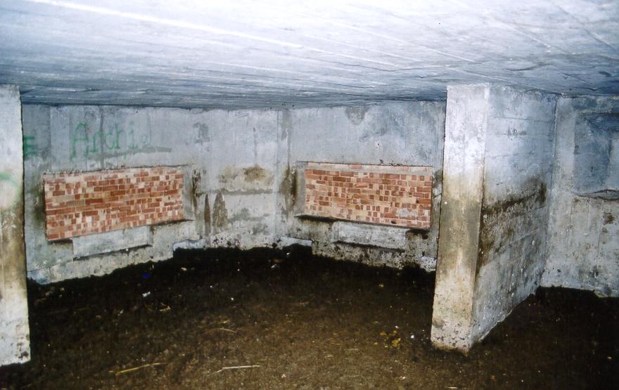
Massive square anti-tank gun emplacement with two large embrasures for 2pdr. anti-tank gun, facing E and N respectively. The embrasures are blocked in with brick, but the entrance (on the S side) is open. The corners of the emplacement are 'cut off' and the roof edge chamfered. The W and S faces show evidence of having been fired at with a high velocity weapon. Inside, there is a dividing wall creating a side chamber with two embrasures for LMG fire. In addition, there are two LMG embrasures in the main body of the emplacement. Used as cattle shelter. Public access, and interior - next to footpath.
(Source: Field Visit 2003/09/03)
Rectangular structure plotted from OS 1:2500 sheet.
(Source: Map 1969)
| Type of site | PILLBOX (TYPE FW3/28A) |
|---|---|
| Location | E of the River Pang, on footpath running W-E from Sulham Hill to Sulham Lane, N of Oaklands Farm. |
| Area |
Tidmarsh, Berkshire, England |
| Grid reference |
SU 63800 74762
|
| Period | WW2 |
| Condition | Good |
| Materials | Reinforced Concrete |
| Recorder | Foot, William (English Heritage Defence Areas Project) |
| Defence grouping |
GHQ Line: Red (Sulham Valley sector) - Length of the GHQ Stop Line: Red running between the Rivers Thames and Kennet, along the line of the Sulham Valley west of Reading. |
| Photographs |
|
| DOB site reference: | S0002681 |
| Original Reference | 8028 |
| Reference |
1994/12 Sulham Valley: A Heavy Concentration of Anti-Tank Pillboxes 1999 Ironside's Line |
| Event |
Field Visit, On 1998/07/05 Construction, In the period 1940 1941 Field Visit, During 1994 Field Visit, On 2003/09/03 |
