
Defence of Britain Archive
Council for British Archaeology, 2002. (updated 2006) https://doi.org/10.5284/1000327. How to cite using this DOI
Data copyright © Council for British Archaeology unless otherwise stated
This work is licensed under the ADS Terms of Use and Access.

Primary contact
Council for British Archaeology
92 Micklegate
York
YO1 6JX
England
Tel: +44 (0)1904
Fax: 671417
Resource identifiers
- ADS Collection: 324
- DOI:https://doi.org/10.5284/1000327
- How to cite using this DOI
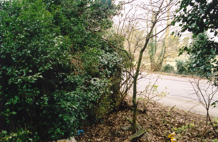
Rectangular pillbox by the road - heavily overgrown and hard to see. It faces towards Canterbury.
(Source: Field Visit 2001/01/23)
Rectangular structure plotted from OS 1:2500 sheet.
(Source: Map 1970)
Probably a rectangular type 23 pillbox with square, open central well for anti-aircraft fire - of the type most often found in Lincolnshire. Heavily overgrown and with rubbish piled around. Concrete-faced.
(Source: Field Visit 2004/02/10)
Rectangular-shaped pillbox plotted from air photograph.
(Source: Air Photograph 1955/06/06)
| Type of site | PILLBOX (TYPE FW3/23) |
|---|---|
| Location | On the bend of the A28 road on the NE side of Sarre. |
| Area |
Sarre, Kent, England |
| Grid reference |
TR 25880 65041
(Scale: 1:2500
, 1970)
|
| Period | WW2 |
| Condition | Bad |
| Materials | Reinforced Concrete |
| Threats |
Type: Plant growth (Long Term) Detail: The pillbox is very heavily overgrown. |
| Recorder | Guy, John A. (Defence of Britain Project) |
| Defence grouping |
Sarre nodal point - Defences of Sarre Category 'A' nodal point. Cassini ref. R7083. [Source: List of Nodal Points in Eastern Command, 1940 - PRO WO 199/544]. |
| Photographs |
|
| DOB site reference: | S0013474 |
| Reference |
1955/06/06 58/1779 (fr.49) |
| Event |
Construction, In the period 1940 1941 Field Visit, On 2001/01/23 Field Visit, On 2004/02/10 |
