
Defence of Britain Archive
Council for British Archaeology, 2002. (updated 2006) https://doi.org/10.5284/1000327. How to cite using this DOI
Data copyright © Council for British Archaeology unless otherwise stated
This work is licensed under the ADS Terms of Use and Access.

Primary contact
Council for British Archaeology
92 Micklegate
York
YO1 6JX
England
Tel: +44 (0)1904
Fax: 671417
Resource identifiers
- ADS Collection: 324
- DOI:https://doi.org/10.5284/1000327
- How to cite using this DOI
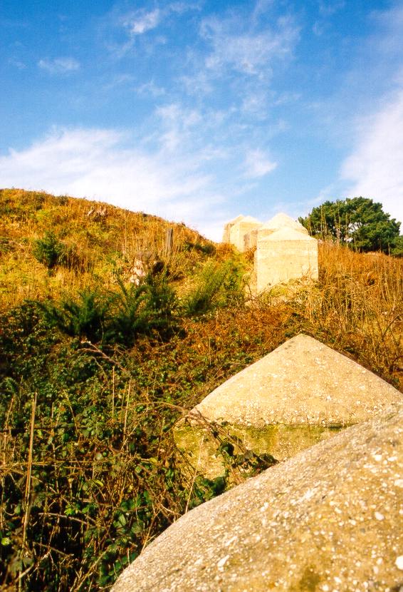
20 anti-tank blocks aligned NW-SE across the gully to the SE of Studland Bay House. They were positioned to block the route from the beach inland. Five of the blocks lie to the N of the stream in the gully and 15 to the S. 2 blocks have slipped into the stream bed. Each block is 1.2m wide and projects on average 1.5m from the ground, with a low pointed pyramid top.
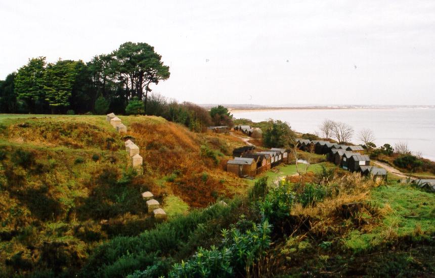
A similar line of blocks existed below the Middle Beach car park at SZ 037828 but they have now been reused in the beach defences NW of Redend Point.
(Source: Field Visit 1995/10)
16 x anti-tank blocks (6ft square), two of which are double. Five are to the S of the stream and eleven to the N. Two have fallen into the gully and have broken.
(Source: Field Visit 1993/04/06)
At least 14 x anti-tank blocks shutting off sea end of valley leading from beach. Plotted from air photograph. They were still present in 1953.
(Source: Air Photograph 1941/08/16)
Anti-tank cubes (4ft x 4ft x 5ft high, with conical caps) in a line across a steep-sided gully. Some 20 blocks survive.
(Source: Field Visit 2003/01/19)
| Type of site | CUBE |
|---|---|
| Location | In a gully at the NW end of the Middle Beach car park, Studland. |
| Area |
Studland, Dorset, England |
| Grid reference |
SZ 0355 8301
(Scale: 1:10000
)
|
| Period | WW2 |
| Condition | Good |
| Materials | Concrete |
| Recorder | Foot, William (English Heritage Defence Areas Project) |
| Defence grouping |
Dorset coast defences - Defences of the Dorset coast line and immediate hinterland. |
| Photographs |
|
| DOB site reference: | S0007719 |
| Associated Identifier | National Trust SMR (ref: 112575) |
| Reference |
1941/08/16 SZ 0382/3 (fr.46) |
| Event |
Field Visit, During 1995/10 Construction, In the period 1940 1941 Field Visit, On 1993/04/06 Field Visit, On 2003/01/19 |
