
Defence of Britain Archive
Council for British Archaeology, 2002. (updated 2006) https://doi.org/10.5284/1000327. How to cite using this DOI
Data copyright © Council for British Archaeology unless otherwise stated
This work is licensed under the ADS Terms of Use and Access.

Primary contact
Council for British Archaeology
92 Micklegate
York
YO1 6JX
England
Tel: +44 (0)1904
Fax: 671417
Resource identifiers
- ADS Collection: 324
- DOI:https://doi.org/10.5284/1000327
- How to cite using this DOI
Type 28a anti-tank gun emplacement, with brick shuttering.
(Source: Book 1999)
Rectangular structure plotted from OS 1:2500 sheet.
(Source: Map 1973)
Type 28A anti-tank gun emplacement. Shuttered in part with end-on bricks. The doorway is blocked to half its height: this appears to have been done a long time ago. Very overgrown. Main embrasure faces S.
(Source: Field Visit 2003/02/04)
Square structure plotted from air photograph.
(Source: Air Photograph 1946/07/12)
Anti-tank gun emplacement. Ref. 46.
(Source: Document 1940/12)
| Type of site | PILLBOX (TYPE FW3/28A) |
|---|---|
| Location | N of the Semington Brook, between Whaddon and Semington. |
| Area |
Semington, Wiltshire, England |
| Grid reference |
ST 89080 61507
(Scale: 1:2500
, 1973)
|
| Period | WW2 |
| Condition | Fair |
| Materials | Clay Brick, Reinforced Concrete |
| Threats |
Type: Plant growth (Long Term) Detail: Pillbox is very overgrown. |
| Recorder | Alexander, Colin (Pillbox Study Group) |
| Defence grouping |
GHQ Line: Blue - Section of GHQ Stop Line running from near Melksham to Reading. |
| Photographs |
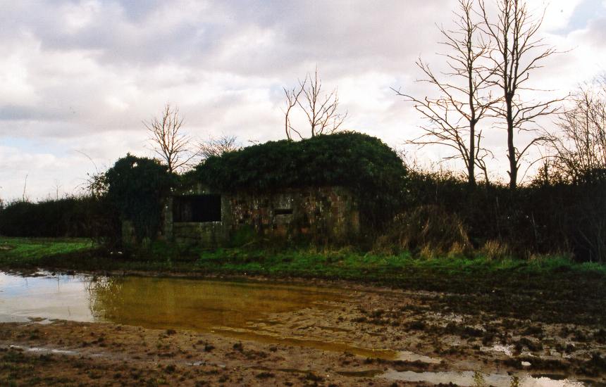
(1)- exterior view |
| DOB site reference: | S0008689 |
| Reference |
1999 Ironside's Line 1940/12 [copy of map of 4th Bn. Wiltshire Home Guard showing defence positions on the Kennet & Avon Canal] 1946/07/12 106G/UK/1661 (fr.3182) |
| Event |
Construction, In the period 1940 1941 Field Visit, On 2003/02/04 |
