
England's Historic Seascapes: Liverpool Bay Pilot Area
Wessex Archaeology, 2006. https://doi.org/10.5284/1000010. How to cite using this DOI
Data copyright © Historic England unless otherwise stated
This work is licensed under the ADS Terms of Use and Access.


Primary contact
Wessex Archaeology
Portway House
Old Sarum Park
Salisbury
SP4 6EB
UK
Tel: 01722 326867
Fax: 01722 337562
Resource identifiers
- ADS Collection: 745
- ALSF Project Number: 3783
- DOI:https://doi.org/10.5284/1000010
- How to cite using this DOI

England's Historic Seascapes: Liverpool Bay Pilot Area
ALSF Project Number 3783
Wessex Archaeology, 2006
Interactive Map
Map Viewer
The map below shows the Liverpool Bay study area divided into Character Areas. Use the buttons below to view the map divided into Character Types. Click on an area of the map to view more information on the geographic character area.
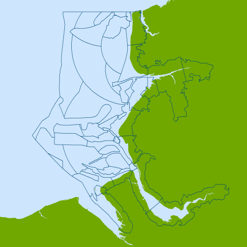
Character Types
Key:
 Coastal environment
 Coastal industry
 Coastal military
 Coastal recreation
 Coastal settlement
 Fisheries
 Intrusive industry
 Maritime safety
 Navigation activity
 Navigation feature
 Navigation hazard
 Non-intrusive industry
 Ports and harbours
 Prehistoric land surface
 UK coast
Copyright information
Derived from 1:250,000 scale BGS Digital Data under licence No. 2004/167.
British Geological Survey © NERC This product has been derived in part from material obtained from the UK Hydrographic Office with the permission of the Controller of Her Majesty's Stationery Office and UK Hydrographic Office www.ukho.gov.uk
© British Crown and SeaZone Solutions Ltd, 2004. All rights reserved. Data Licence No. 122004.007.
NOT TO BE USED FOR NAVIGATION.
Digital Map Data © (2004) XYZ Digital Map Company.
