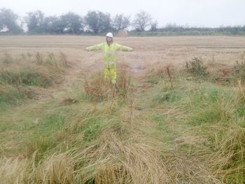
Land adjacent to Glebe Farm, Coventry Road, Lutterworth: Archaeological monitoring of boreholes (OASIS ID: headland3-369514)

Brett Archer, 2019. https://doi.org/10.5284/1058966. How to cite using this DOI

Digital Object Identifiers

Digital Object Identifiers (DOIs) are persistent identifiers which can be used to consistently and accurately reference digital objects and/or content. The DOIs provide a way for the ADS resources to be cited in a similar fashion to traditional scholarly materials. More information on DOIs at the ADS can be found on our help page.

Citing this DOI

The updated Crossref DOI Display guidelines recommend that DOIs should be displayed in the following format:

https://doi.org/10.5284/1058966
Sample Citation for this DOI

Brett Archer (2019) Land adjacent to Glebe Farm, Coventry Road, Lutterworth: Archaeological monitoring of boreholes (OASIS ID: headland3-369514) [data-set]. York: Archaeology Data Service [distributor] https://doi.org/10.5284/1058966

Data copyright © Headland Archaeology Ltd unless otherwise stated

This work is licensed under a Creative Commons Attribution 4.0 International License.
Creative Commons License


Headland Archaeology Ltd logo

Primary contact

Headland Archaeology Ltd
13 Jane Street
Edinburgh
EH6 5HE
UK

Send e-mail enquiry

Resource identifiers

Digital Object Identifiers

Digital Object Identifiers (DOIs) are persistent identifiers which can be used to consistently and accurately reference digital objects and/or content. The DOIs provide a way for the ADS resources to be cited in a similar fashion to traditional scholarly materials. More information on DOIs at the ADS can be found on our help page.

Citing this DOI

The updated Crossref DOI Display guidelines recommend that DOIs should be displayed in the following format:

https://doi.org/10.5284/1058966
Sample Citation for this DOI

Brett Archer (2019) Land adjacent to Glebe Farm, Coventry Road, Lutterworth: Archaeological monitoring of boreholes (OASIS ID: headland3-369514) [data-set]. York: Archaeology Data Service [distributor] https://doi.org/10.5284/1058966

Introduction

Land adjacent to Glebe Farm, Coventry Road, Lutterworth: Archaeological monitoring of boreholes (OASIS ID: headland3-369514)

Archaeological borehole monitoring was undertaken by Headland Archaeology on land adjacent to Glebe Farm, Coventry Road, Lutterworth. Evidence suggesting an earlier route for the watercourse slightly to the south of its current position to the west of the boreholing area were produced along with the suggestion that intermittent and conjoining water sources contributed to deposit a sequence of alluvial deposits at the west end of the works area. No deposits or materials suitable to aid in paleoenvironmental reconstruction were evident.


ADS logo
Data Org logo
University of York logo