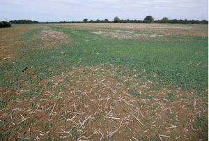
Land adjacent to M1, Courteenhall, Northamptonshire: Geophysical Survey (OASIS ID: headland5-328784)

Sam Harrison, 2019. https://doi.org/10.5284/1056107. How to cite using this DOI

Digital Object Identifiers

Digital Object Identifiers (DOIs) are persistent identifiers which can be used to consistently and accurately reference digital objects and/or content. The DOIs provide a way for the ADS resources to be cited in a similar fashion to traditional scholarly materials. More information on DOIs at the ADS can be found on our help page.

Citing this DOI

The updated Crossref DOI Display guidelines recommend that DOIs should be displayed in the following format:

https://doi.org/10.5284/1056107
Sample Citation for this DOI

Sam Harrison (2019) Land adjacent to M1, Courteenhall, Northamptonshire: Geophysical Survey (OASIS ID: headland5-328784) [data-set]. York: Archaeology Data Service [distributor] https://doi.org/10.5284/1056107

Data copyright © Sam Harrison unless otherwise stated

This work is licensed under a Creative Commons Attribution 4.0 International License.
Creative Commons License


Headland Archaeology Ltd logo

Primary contact

Headland Archaeology Ltd
13 Jane Street
Edinburgh
EH6 5HE
UK

Send e-mail enquiry

Resource identifiers

Digital Object Identifiers

Digital Object Identifiers (DOIs) are persistent identifiers which can be used to consistently and accurately reference digital objects and/or content. The DOIs provide a way for the ADS resources to be cited in a similar fashion to traditional scholarly materials. More information on DOIs at the ADS can be found on our help page.

Citing this DOI

The updated Crossref DOI Display guidelines recommend that DOIs should be displayed in the following format:

https://doi.org/10.5284/1056107
Sample Citation for this DOI

Sam Harrison (2019) Land adjacent to M1, Courteenhall, Northamptonshire: Geophysical Survey (OASIS ID: headland5-328784) [data-set]. York: Archaeology Data Service [distributor] https://doi.org/10.5284/1056107

Introduction

Land adjacent to M1, Courteenhall, Northamptonshire: Geophysical Survey (OASIS ID: headland5-328784)

Headland Archaeology (UK) Ltd undertook a geophysical (magnetometer) survey of a 5 hectare site adjacent to the M1 at Courteenhall, Northamptonshire, to provide information on the archaeological potential of the site in advance of the construction of a proposed poultry shed and associated infrastructure. The survey has not identifed any anomalies of any archaeological potential with the dataset dominated by inear anomalies refecting medieval and/or post medieval ploughing, land division and modern land drainage. A service pipe has been identifed in the south of the site. Therefore, on the basis of the geophysical survey, the archaeological potential of the site is assessed as low, corroborating the results of the Desk-Based Heritage Assessment.


ADS logo
Data Org logo
University of York logo