
Pitcarmick Excavations 1993-5
Martin Carver, John Barrett, Jane Downes, 2013. https://doi.org/10.5284/1021677. How to cite using this DOI
This work is licensed under the ADS Terms of Use and Access.


Primary contact
Prof
Martin
Carver
Department of Archaeology
University of York
King's Manor
Exhibition Square
York
YO1 7EP
England
Resource identifiers
- ADS Collection: 1562
- DOI:https://doi.org/10.5284/1021677
- How to cite using this DOI


Downloads
The archive is divided between the report below and its supporting figures:
To access the report, left click the link and choose to either open or save the file.
Report
| Pitcarmick Online Report | DOCX | 415 Kb |
Please click the links below to access the supporting material for the Pitcarmick online report.
ATLAS-Location Figures | ALBUM-Photographs | Specialist Figures
Location Figures
To access the images, either left click to view the PDF online or right-click to download.
|
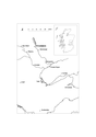
Figure 01 Location Map |
73 Kb | |
|
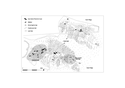
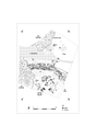
Figure 02 Plan of structures designated at Pitcarmick North (RCAHMS 1990,77), monuments 154-4B with map by Janet Hooper. |
363 Kb | |
|
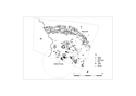
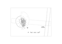
Figure 03 Location of the excavations reported here. |
120 Kb | |
|
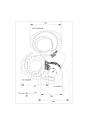
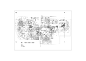
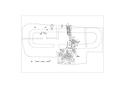
Figure 04 Area A, composite plan |
78 Kb | |
|
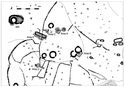
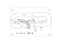
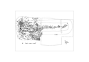
Figure 05 Area B, showing plans of Structures B1-3 as extrapolated from excavations and surface indications. |
329 Kb | |
|
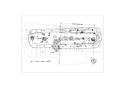
Figure 06 Area B: general plan of excavated area with context numbers and distribution of objects |
258 Kb | |
|
Figure 07 Plan of contexts and objects internal to Structure B1. |
120 Kb | |
|
Figure 08 Area C, composite plan of Structure C1, with identified contexts and distribution of objects |
119 Kb | |
|
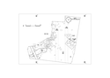
Figure 09 Area D, composite plan |
62 Kb | |
|
Figure 10 Area E, composite plan |
362 Kb | |
|
Figure 11 Area E, contexts relating to Structure E1 (Pictish) |
233 Kb | |
|
Figure 12 Area E, contexts relating to Structure E2 (Medieval) |
207 Kb | |
|
Figure 13 Area E, contexts relating to the post-medieval period. |
113 Kb |
