
Sheffield Castle 1927-2018
John Moreland, Dawn Hadley, 2020. https://doi.org/10.5284/1074899. How to cite using this DOI
Data copyright © Prof John Moreland, Museums Sheffield, Prof Dawn Hadley unless otherwise stated
This work is licensed under a Creative Commons Attribution 4.0 International License.


Primary contact
Prof
Dawn
Hadley
University of York
King's Manor
Exhibition Square
York
YO1 7EP
England
Resource identifiers
- ADS Collection: 3740
- DOI:https://doi.org/10.5284/1074899
- How to cite using this DOI


Downloads
"1976.1064 S28 S20 S32" white paper folder
Metadata
| Image metadata (PDFs) - The Museums Sheffield Archive | CSV | 186 Kb |
|
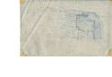
Contour map drawn by Leslie Butcher and overlain on Ordnance Survey 1:1250 map of Castle Hill (undated)
(Drawer_8_022_map_overlay.pdf) |
847 Kb | |

|
Handwritten note by Leslie Butcher (undated)
(Drawer_8_021_drawing_metadata.pdf) |
585 Kb | |

|
Plan of proposed street from Waingate to Blonk Street (March 1929)
(Drawer_8_026-26a_construction_drawing.pdf) |
1 Mb | |

|
Plan of the site of Sheffield Castle prior to the building on Castle Hill Market (7 Aug 1922)
(Drawer_8_023_annotated_map.pdf) |
686 Kb | |

|
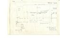
Profile drawing of Castle Hill by City Architect W. G. Davies (30 Apr 1928)
(Drawer_8_024_annotated_section.pdf) |
885 Kb | |
|
Sketch by Pauline Beswick of castle walls visible through the paved slope above Castlegate in May 1972
(Drawer_8_025_plan.pdf) |
815 Kb |
