
Valdoe Assessment Survey
Matthew Pope, 2010. https://doi.org/10.5284/1000112. How to cite using this DOI
Data copyright © Dr Matthew Pope unless otherwise stated
This work is licensed under the ADS Terms of Use and Access.


Primary contact
Dr
Matthew
Pope
Institute of Archaeology
University College London
Gower Street
London
WC1E 6BT
UK
Tel: 01273 426830
Resource identifiers
- ADS Collection: 980
- ALSF Project Number: 4620
- DOI:https://doi.org/10.5284/1000112
- How to cite using this DOI

Introduction
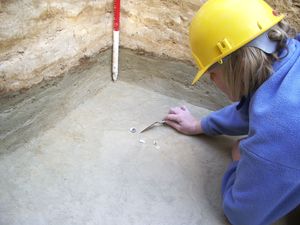
The Valdoe Quarry lies on the Goodwood Estate, near Chichester in West Sussex. Topographically it occupies an almost identical position to the original Boxgrove site situated some 6km to the east. Between 2001 and 2003 the Raised Beach Mapping Project identified the presence of archaeologically sensitive deposits across the Goodwood Estate identical to those preserving half million year old butchery sites and human remains at Boxgrove.
In 2006, a new project, funded through the Aggregates Levy Sustainability Fund, was established. This project, the Valdoe Assessment Survey, aimed to determine the full extent of the palaeolandsurfaces within the vicinity of the nearby quarry, to determine the degree to which the quarry had impacted upon these deposits and to develop a plan for the future management of this unique and precious scientific resource.
The project also looks at the wider distribution of the palaeolandsurface across the Goodwood Estate and into the Lavant Valley. This part of the county has produced a large quantity of Palaeolithic surface finds which may be largely derived from subcrops of the Slindon Formation.
