
Valdoe Assessment Survey
Matthew Pope, 2010. https://doi.org/10.5284/1000112. How to cite using this DOI
Data copyright © Dr Matthew Pope unless otherwise stated
This work is licensed under the ADS Terms of Use and Access.


Primary contact
Dr
Matthew
Pope
Institute of Archaeology
University College London
Gower Street
London
WC1E 6BT
UK
Tel: 01273 426830
Resource identifiers
- ADS Collection: 980
- ALSF Project Number: 4620
- DOI:https://doi.org/10.5284/1000112
- How to cite using this DOI

Overview
The Valdoe is now recognised as an important Middle Pleistocene locale within Southern Britain. It is located only 6km from the key site of Boxgrove, internationally recognised for the study of early human behaviour in a unique geological and palaeoenvironmental context preserving unparalleled in situ remains. Through the implementation of the RBMP (Raised Beach Mapping Project) it was determined that sediments identical in nature to those at Boxgrove are discontinuously spread over a 26km wide strip of the West Sussex Coastal Plain. The Valdoe Quarry sits at the heart of this area, an active sand and gravel quarry operated by Dudman's Ltd since the mid-nineties. It is sited immediately to south of the 40m Westbourne-Arundel Raised Beach (WARB) and within an area rich in Palaeolithic surface finds. As a direct result of the RBMP it was possible to suggest that, during later quarter of the 20 th Century, hectares of sediments identical to those preserving in-situ archaeology at Boxgrove were removed during commercial sand and gravel extraction at the Valdoe Quarry.
In 2006 a final phase of gravel extraction was planned at the site, aimed at removing a strip of intact deposits in the north-eastern part of the quarry. Deposits likely to contain in-situ archaeology were being removed during this process. As permissions were given for this extraction prior to the implementation of PPG16, no part of the planning legislation could be invoked to prevent this quarrying operation. The quarry management were however highly co-operative and sensitive to the importance of the archaeology; they agreed that an archaeological survey could take place during the gravel extraction phase, prior to any impact on the underlying archaeological horizons. Therefore the Valdoe Assessment Survey was conceived to provide:
- A geological survey of the threatened area.
- Detailed environmental sampling of the threatened sediments.
- Test pit excavations of in situ palaeolandsurfaces.
- An assessment report including recommendations for future mitigation.
- Outreach directed at professional, amateur and curatorial bodies at both a local and a national level
Fieldwork during the first phase of the Project (January-April 2006) confirmed the presence of in-situ palaeolandsurfaces identical to those recorded at Boxgrove within the Valdoe Quarry and its immediate environs. This allowed the team to establish that 9 hectares of the palaeolandsurface had been lost during earlier extraction phases and that a further 9000 m2 were threatened in two zones of planned gravel extraction. While it was possible to negotiate preservation in-situ at one of these localities, this was not possible at the latter. The Valdoe Contingency Phase was therefore conceived and implemented in October 2006 to carry out a limited sampling exercise of this threatened area ahead of extraction. A complete record of the sediment sequence was made in this area, environmental samples were collected and the palaeolandsurfaces sieved for artefacts.
The Assessment Phase has underlined the importance of the site with the specialist team highlighting the following key directions for immediate follow-up analysis:
- Evidence for in situ knapping scatters and isolated flakes being present across the area. Analysis of these can add to our understanding of the behaviour of British Archaic Homo Sapiens.
- An unparalleled microfauna offering a type sequence for the Upper Coastal Plain and our first indication of local estuarine habitats.
- An unprecedented molluscan fauna with species of unique biostratigraphical significance for northern Europe.
- A chance to utilise these indicators, alongside pollen evidence, to produce a detailed palaoenvironmental reconstruction of the Valdoe palaeolandscape.
Preliminary investigation of sediment samples show these hold great potential for building up a detailed picture of the palaeoenvironment at the site; pollen, molluscs, small mammals and microfauna appear to be preserved here in a combination unique to known sediments of the Slindon Formation, offering the possibility to develop a detailed environmental and behavioural profile for the Valdoe habitat set within the context of the wider Boxgrove palaeolandscape. The work has demonstrated that future investigations in this landscape, combined with renewed research at the main Boxgrove site, will continue to drive our behavioural understanding of Middle Pleistocene hominids in northern Europe.
The digital archive
The digital archive currently consists of the following resources:
- A combined volume of specialist reports, including
- Micropalaeontological Report (John Whittaker)
- Assessment of vertebrate remains from Valdoe Pit, West Sussex (Simon Parfitt)
- Pollen Analysis (Phil Gibbard & Sylvia Peglar)
- Molluscan Analysis (Richard Preece)
- Amino Acid Racimization (Kirsty Penkman)
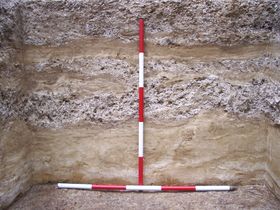
- Site photographs
- Sediment logs
- Lithics spreadsheets
Non-digital Archive and Publications
In addition to the digital material contained within the archive, the project also produced the following outputs:
| Lectures |
|---|
| Paper at Conference: Geoarchaeology 2006. Exeter. 'The Valdoe Assessment Survey'. |
| Paper at Conference: Theoretical Archaeology Group (TAG) 2006. Exeter. 'Palaeolandscape and human behaviour at the Valdoe, West Sussex'. |
| Meetings / Technical forums |
| ALSF meeting. Pulborough March 2006. 'The Valdoe Assessment Survey'. |
The Archaeology Data Service (ADS) do not hold any further information regarding these non-digital outputs, any queries should be directed to the depositor.
