Chargrove Orchard, Land at Up Hatherley Way, Cheltenham, Gloucestershire. Archaeological Evaluation (OASIS ID: cotswold2-317824)

Cotswold Archaeology, 2018. https://doi.org/10.5284/1048312. How to cite using this DOI

Digital Object Identifiers

Digital Object Identifiers (DOIs) are persistent identifiers which can be used to consistently and accurately reference digital objects and/or content. The DOIs provide a way for the ADS resources to be cited in a similar fashion to traditional scholarly materials. More information on DOIs at the ADS can be found on our help page.

Citing this DOI

The updated Crossref DOI Display guidelines recommend that DOIs should be displayed in the following format:

https://doi.org/10.5284/1048312
Sample Citation for this DOI

Cotswold Archaeology (2018) Chargrove Orchard, Land at Up Hatherley Way, Cheltenham, Gloucestershire. Archaeological Evaluation (OASIS ID: cotswold2-317824) [data-set]. York: Archaeology Data Service [distributor] https://doi.org/10.5284/1048312

Data copyright © Cotswold Archaeology unless otherwise stated

This work is licensed under the ADS Terms of Use and Access.
Creative Commons License


Cotswold Archaeology logo

Primary contact

Cotswold Archaeology
Building 11
Kemble Enterprise Park
Cirencester
GL7 6BQ
UK
Tel: 01285 771022
Fax: 01285 771033

Send e-mail enquiry

Resource identifiers

Digital Object Identifiers

Digital Object Identifiers (DOIs) are persistent identifiers which can be used to consistently and accurately reference digital objects and/or content. The DOIs provide a way for the ADS resources to be cited in a similar fashion to traditional scholarly materials. More information on DOIs at the ADS can be found on our help page.

Citing this DOI

The updated Crossref DOI Display guidelines recommend that DOIs should be displayed in the following format:

https://doi.org/10.5284/1048312
Sample Citation for this DOI

Cotswold Archaeology (2018) Chargrove Orchard, Land at Up Hatherley Way, Cheltenham, Gloucestershire. Archaeological Evaluation (OASIS ID: cotswold2-317824) [data-set]. York: Archaeology Data Service [distributor] https://doi.org/10.5284/1048312

Introduction

Chargrove Orchard, Land at Up Hatherley Way, Cheltenham, Gloucestershire. Archaeological Evaluation (OASIS ID: cotswold2-317824)

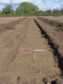
An archaeological evaluation was undertaken by Cotswold Archaeology in September and October 2017 at Chargrove Orchard, land at Up Hatherley Way, Gloucestershire. A total of sixty trenches were excavated.

In the north-west extent of the site, a ditch and pit potentially dating to the medieval period were identified. Both appeared to be heavily truncated and did not correlate with previously identified geophysical survey anomalies.

Remnants of undated furrows were identified across the site.


ADS logo
Data Org logo
University of York logo