
England's Historic Seascapes: Southwold to Clacton
Oxford Archaeology (South), 2007. https://doi.org/10.5284/1000277. How to cite using this DOI
Data copyright © Historic England unless otherwise stated
This work is licensed under the ADS Terms of Use and Access.


Primary contact
Oxford Archaeology (South)
Janus House
Osney Mead
Oxford
OX2 0ES
UK
Tel: 01865 263800
Fax: 01865 793496
Resource identifiers
- ADS Collection: 746
- ALSF Project Number: 4729
- DOI:https://doi.org/10.5284/1000277
- How to cite using this DOI
England's Historic Seascapes:
Southwold to Clacton
ALSF Project Number 4729
Oxford Archaeology, 2007
Cutler Area
Primary Subcharacter Type:
Sailing area
Main Character / current form and use
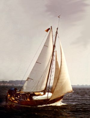
The Cutler area is predominantly characterised as a navigational hazard or feature. Its shoreward portion is a well-used recreational sailing area, for coastal routes, to and from Orford Haven, and entry/exit into the Deben estuary. The area is also a potential recreational dive site.
Due to its proximity to Harwich the area is subject to Harwich Haven regulations and traffic separation and is covered by Vessel traffic services. It is subject to cautionary status due to submarine cables and high speed craft.
The overlying geology is predominantly gravelly, muddy sand with pockets of gravel. The depth of the overall area ranges from 0 m to 15 m, increasing to the east although the depth on the Cutler sandbank itself is 2-5 m, making it hazardous for large vessels. The tidal range in the character area is within the range of 3-4 m at Mean Spring Tide (DTI 2004). The Cutler acts as a sink for sediment and is comprised of an elongate train of sandwaves composed of coarse to medium shelly sand.
Historic Character and archaeological potential
The character area is has long been known as a navigational hazard or feature and was part of the 19th and 20th century coastal route. Three shipwrecks are located within the area, two of which are dangerous. HMS Arethusa (built 1912) is on the Cutler Bank itself, whereas the other vessels are west of the anomaly. All three vessels were sunk by WW1 mines, two naval ships within the course of duty. HMS Arethusa is particularly notable as the name ship of her class of light cruisers and was the flotilla leader for the Harwich destroyer flotillas. She fought at the battles of Heligoland Bight (1914) and Dogger Bank (1915) before she struck a mine in 1916 and drifted ashore (wikipedia).
One of the vessels, the Sheaf Field was unfortunate to hit a German laid mine while carrying coal from the Tyne to London. The two different types of shipwreck illustrate the role of the East Anglian coast as significant to both defence of Britain and coastal trading.
The area has potential to contain submerged prehistoric landscapes, features or artefacts, particularly considering its location in the area likely to have been coastal for thousands of years.
Character perceptions
The general perception of the area is as a coastal sailing route and navigational hazard, the area is generally avoided by larger shipping. Its proximity to the mouth of the Deben also indicates it is considered to be one of the routes into this estuarine region.
Bibliography
DTI, 2004, Mean Spring Tidal Range: Atlas of UK Marine Renewable Energy Resources. Department of Trade and Industry 2004
Wikipedia. Available at: http://en.wikipedia.org/wiki/Main_Page (07/03/2007)
