
England's Historic Seascapes: Southwold to Clacton
Oxford Archaeology (South), 2007. https://doi.org/10.5284/1000277. How to cite using this DOI
Data copyright © Historic England unless otherwise stated
This work is licensed under the ADS Terms of Use and Access.


Primary contact
Oxford Archaeology (South)
Janus House
Osney Mead
Oxford
OX2 0ES
UK
Tel: 01865 263800
Fax: 01865 793496
Resource identifiers
- ADS Collection: 746
- ALSF Project Number: 4729
- DOI:https://doi.org/10.5284/1000277
- How to cite using this DOI
England's Historic Seascapes:
Southwold to Clacton
ALSF Project Number 4729
Oxford Archaeology, 2007
East of Dunwich Bay
Primary Subcharacter Type:
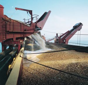
Dredging (aggregates)
Main Character / current form and use
The East of Dunwich Bay area is predominantly characterised as a commercial shipping route. The character area appears to contain more densely positioned routes than the East of Southwold area which is located in deeper waters. It is likely that this area therefore typifies the busy coastal trade around East Anglia. The type of vessels known to transit the area include ferries, gas carriers, tankers and bulk and cargo ships (Jones et al nd). The character area falls into a wider precautionary area under the jurisdiction of Great Yarmouth Port Operations, warning of changing depths and submarine cables and pipelines.
The depth range of the character area is predominantly 20-30 m. However small regions increase in depth up to 50 m to the east and south. To the west the area gradually becomes shallower closer to the coast, to a minimum depth of 5 m. The overlying geology of the area is gravelly muddy sand with the exception of patches of gravel in the east and centre of the area. The tidal range is within the range of 1-3 m at Mean Spring Tide (DTI 2004).
Secondary characteristics of the area include a small area of aggregate dredging activity which appears to be unnamed. Dredging activity is related to market demand, therefore activity can be sporadic and difficult to predict (Rogers 1997). This affects fishing activity as actively dredged areas are temporarily closed to commercial fishing. A secondary Royal Yacht Association (RYA) route runs through the west of the character area, heading around the coast. The west of the area is also a potential recreational dive site.
Historic Character and archaeological potential
Historical sources are scarce for this character area, which contains no remarkable navigational features. However, at least 50 wrecks are thought to be located within the area including three Royal Navy ships, 29 of which are considered dangerous. Named wrecks include HMS Donside, mined off Lowestoft and HMS Whooper, also mined.
The potential for shipwreck archaeology in the character area is quite high, with many concentrated in the central part. In addition, the area has potential to contain submerged prehistoric landscapes, features or artefacts, having been dry land prior to 8000 BP. However, no investigation work is known to have been done in this area.
Character perceptions
The area will certainly be recognised by shipping communities involved in coastal trade. The extent of the use of these areas for current dredging is unknown. Land based communities may recognise this particular area of sea, as a sailing or diving area. The area is somewhat overshadowed by the Dunwich Bay area to the west with its wealth of maritime archaeology.
Bibiliography
DTI, 2004, Mean Spring Tidal Range: Atlas of UK Marine Renewable Energy Resources. Department of Trade and Industry, 2004
Jones, L. A., Coyle, M. D., Evans, D., Gilliland, P.M., & Murray, A. R., Southern North Sea Marine Natural Area Profile: A contribution to regional planning and management of the seas around England. Peterborough: English Nature.
Rogers, S. I., 1997, A review of closed areas in the United Kingdom Exclusive Economic Zone. CEFAS Science Series Technical Report No. 106
Wikipedia. Available at: http://en.wikipedia.org (15/03/2007)
