
England's Historic Seascapes: Southwold to Clacton
Oxford Archaeology (South), 2007. https://doi.org/10.5284/1000277. How to cite using this DOI
Data copyright © Historic England unless otherwise stated
This work is licensed under the ADS Terms of Use and Access.


Primary contact
Oxford Archaeology (South)
Janus House
Osney Mead
Oxford
OX2 0ES
UK
Tel: 01865 263800
Fax: 01865 793496
Resource identifiers
- ADS Collection: 746
- ALSF Project Number: 4729
- DOI:https://doi.org/10.5284/1000277
- How to cite using this DOI
England's Historic Seascapes:
Southwold to Clacton
ALSF Project Number 4729
Oxford Archaeology, 2007
East of Southwold
Primary Subcharacter Type:
Submarine cable/pipeline
Main Character / current form and use
The area defined as East of Southwold is mainly a region of commercial shipping. It is delineated from the North Caution Area to the east as the majority of this area falls within the jurisdiction of Great Yarmouth Port Operations. To the west its boundary approximately represents a change in depth range from 20-30 m to 30-50 m. Shipping is less intense in this character area than those either side, with clearly defined shipping routes and avoided areas. Tracks cross, representing routes to and from Great Yarmouth and the Haven ports, as well as those simply passing through the area. Vessels recorded as transiting the area include ferries, tankers, gas carriers and bulk carriers (Jones et al nd). The character area is part of a larger caution area as a result of submarine cables and pipelines and changing depths.
The depth range within the character area is mainly 30-50 m, though isolated areas decrease in depth to 20-30 m. The overlying geology is predominantly gravelly muddy sand with patches of gravel. The tidal range in the character area is mainly within the range of 1-2 m at Mean Spring Tide (DTI 2004).
Secondary characteristics of the area are submarine pipelines and cables and aggregate dredging activity. The latter is a small area known as East of Southwold, for which this character area was named. The area is leased by United Marine Dredging and Cemex UK Marine (RMC Marine). Dredging activity is related to market demand, therefore activity can be sporadic and difficult to predict (Rogers 1997). This affects fishing activity as actively dredged areas are temporarily closed to commercial fishing.
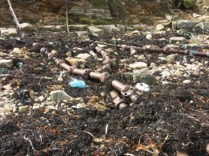
Submarine cables include Concerto North and South which connect the UK to the Netherlands and Belguim and are maintained by Interoute and Flute Ltd, Hermes 1 maintained by GTS Network Services and a large cable running north-south through the area, connecting the United States with the UK, Germany and the Netherlands, maintained by Global Crossing. The gas supply pipeline, connecting Bacton to Zeebruge in the Netherlands runs northwest - southeast through the far east of the character area and is maintained by UK Deal.
Historic Character and archaeological potential
Little is known about the historic character of the area and the lack of navigational features means it generally does not feature on historic Admiralty charts. A total of 30 wrecks are known to be located within the character area, mainly within the western portion, five of which are classified as dangerous. Named vessels include minelaying German submarine UB16, torpedoed and sunk by a British submarine, Eta, Lapwing and Greenland, all mined. In addition the remains of a British trawler, Halifax, and a British cargo vessel, Robert, are monument points. An aircraft is thought to have crashed in this area in 1971.
The potential for shipwreck archaeology in the area is quite high. In addition, the area has potential to contain submerged prehistoric landscapes, features or artefacts, having been dry land prior to 8000 BP. However, no investigation work is known to have been done in this area.
Character perceptions
The area is only likely to be recognised by shipping communities and those involved with dredging. The extent of the use of these areas for current dredging is unknown. No recreational use of the area is documented and it is unlikely that land based communities will recognise this particular area of open sea, approximately 24 km off the Suffolk coast .
Bibliography
DTI, 2004, Mean Spring Tidal Range: Atlas of UK Marine Renewable Energy Resources. Department of Trade and Industry, 2004
Jones, L. A., Coyle, M. D., Evans, D., Gilliland, P.M., & Murray, A. R., Southern North Sea Marine Natural Area Profile: A contribution to regional planning and management of the seas around England. Peterborough: English Nature.
Rogers, S. I., 1997, A review of closed areas in the United Kingdom Exclusive Economic Zone. CEFAS Science Series Technical Report No. 106
