
England's Historic Seascapes: Southwold to Clacton
Oxford Archaeology (South), 2007. https://doi.org/10.5284/1000277. How to cite using this DOI
Data copyright © Historic England unless otherwise stated
This work is licensed under the ADS Terms of Use and Access.


Primary contact
Oxford Archaeology (South)
Janus House
Osney Mead
Oxford
OX2 0ES
UK
Tel: 01865 263800
Fax: 01865 793496
Resource identifiers
- ADS Collection: 746
- ALSF Project Number: 4729
- DOI:https://doi.org/10.5284/1000277
- How to cite using this DOI
England's Historic Seascapes:
Southwold to Clacton
ALSF Project Number 4729
Oxford Archaeology, 2007
East Swin and Sunk Sand
Primary Subcharacter Type:
Channel
Main Character / current form and use
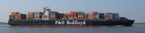
This area is one of several pairings of sandbank and channel off the North Essex coast which form a series of treacherous navigational features and hazards in one of the major approaches to the Thames. The pairings are considered together due to the dynamic nature of sandbanks. The East Swin or 'King's Channel' is heavily used to approach both the Port of London and the Crouch Estuary in Essex. It runs parallel to Gunfleet sands (see Gunfleet Sands and Wallet character area) and is bordered by Sunk Sand and Sunk Head to the south-east. The possibility of grounding on either side of the East Swin is a well known hazard and 27 obstructions are located in the area, one of which is the remains of Sunk Head Tower (see link). The channel is restricted to vessels with less than a 6 m draft and typical users can include ferries, cargo ships and tankers (Jones et al 2002). The channel is particularly used by yachts entering the Crouch estuary when the Wallet becomes difficult to navigate. A series of Royal Yacht association (RYA) sailing routes cross the area. The area is also a potential recreational dive site.
Whilst the overall depth of the area can reach up to 30 m, the depth over Sunk Sand can be as little as 0-2 m. The geology is predominantly gravelly muddy sand with gravel in the deeper areas. (DTI 2004). Remnants of elbow formation are found in the East Swin. The tidal range in the character area is mainly within the range of 4-5 m at Mean Spring Tide.
The south-western part of the area (covering the part of East Swin, closest to the Thames Estuary) falls within the jurisdiction of the Port of London Authority (PLA), while the northern tip falls within the Harwich regulatory system. As such the area encompasses a number of caution areas including draught restrictions, changing depths, high speed craft and submarine cables. The Harwich area is subject to traffic separation and all is covered by Vessel Traffic Services (VTS). Adjoining the PLA area is a large pilot boarding area which serves the Thames, Medway and Haven ports.
The character area is varied in its uses. The East Swin is a known fishing area. The northern half of the area falls within the Gunfleet military area (see Gunfleet Sands and Wallet) and also contains an explosives dump and the Inner Sunk Anchorage for vessels of under 10.5 m draft approaching London or Harwich http://www.hha.co.uk/). A small part of the sunk head dredging extension falls within the area (see The Sunk character area).
Historic Character and archaeological potential
East Swin or Kings Channel has long been known as a shipping channel and is recorded on the Admiralty chart of 1855. Its heavy use is illustrated by the known shipwrecks within the character area which number 46 in total. Many of the named examples were mined or torpedoed and include vessels on coastal routes such as the Kankakee, bound for London from Newcastle. Additionally, some of the ships were on longer routes including the Terukuni Maru, travelling from Tokyo to London and the Stad Maastricht, from London to the USA. Overall, these demonstrate the importance of the area for shipping and maritime heritage in general and for defence of the east coast. The latter is also evident in the remains of the Sunk Head Maunsell sea fort (see link).
The area has potential to contain submerged prehistoric landscapes, features or artefacts, having been dry land prior to 8000 BP. However, no investigation work is known to have been done in this area.
Character perceptions
The character area is commonly perceived as a heavily used shipping route and navigational hazard and is known to the sailing, shipping and fishing community. Onshore the area is less well known, particularly when compared to the nearby Gunfleet Sands. The area has a long established history for both coastal trade and heavy shipping and Sunk Sand is notorious as an area to be avoided.
Bibiliography
DTI, 2004, Mean Spring Tidal Range: Atlas of UK Marine Renewable Energy Resources. Department of Trade and Industry, 2004
Jones, L. A., Coyle, M. D., Evans, D., Gilliland, P.M., & Murray, A. R., Southern North Sea Marine Natural Area Profile: A contribution to regional planning and management of the seas around England. Peterborough: English Nature.
Bob Le-Roi. Available at: http://www.bobleroi.co.uk (07/03/2007)
Harwich Haven Authority. Available at: http://www.hha.co.uk/ (06/03/2007)
Offshore Echoes. Available at: http://www.offshoreechos.com/ (07/03/2007)
Wikipedia. Available at: http://en.wikipedia.org (15/03/2007)
