
England's Historic Seascapes: Southwold to Clacton
Oxford Archaeology (South), 2007. https://doi.org/10.5284/1000277. How to cite using this DOI
Data copyright © Historic England unless otherwise stated
This work is licensed under the ADS Terms of Use and Access.


Primary contact
Oxford Archaeology (South)
Janus House
Osney Mead
Oxford
OX2 0ES
UK
Tel: 01865 263800
Fax: 01865 793496
Resource identifiers
- ADS Collection: 746
- ALSF Project Number: 4729
- DOI:https://doi.org/10.5284/1000277
- How to cite using this DOI
England's Historic Seascapes:
Southwold to Clacton
ALSF Project Number 4729
Oxford Archaeology, 2007
Hollesley Bay
Primary Subcharacter Type:
Sailing area
Main Character / current form and use
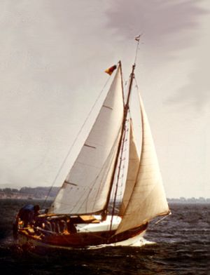
This character area is intimately associated with the Alde/Ore and Butley estuaries as a result of its proximity, running parallel to entrance to these waterways. The Hollesley Bay offshore area acts as a feeder area in and out of Orford Haven and as such is predominantly a recreational area. A number of Royal Yacht Association tertiary routes converge just to the west of Orford Haven, heading out along the coast in both directions and out to sea. The area is coastal and avoided by larger vessels but is a known commercial fishing ground. The area is also a potential recreational dive site.
Due to its proximity to Harwich the area is subject to Harwich Haven regulations and traffic separation and is covered by Vessel Traffic Services (VTS). It is subject to cautionary status due to submarine cables and high-speed craft.
The geology is predominantly gravelly muddy sand with patches of gravel, the depth increases from 0 m to 10 m. The tidal range in the character area is within the range of 2-4 m at Mean Spring Tide (DTI 2004).
Historic Character and archaeological potential
Little is known about the historical character of the Hollesley Bay offshore region, which was named after the small settlement of Hollesley, c 1.5 miles inland. In recent history the area functioned in much the same way as it does today, as the feeder area from Orford Haven and the estuaries. Its close proximity to the coastline means it was unlikely to have been used for commercial coastal trade in the 18th and 19th centuries.
During the Napoleonic wars in the early 19th century a floating battery with four guns was stationed in Hollesley Bay for defensive purposes. Considering the wider context of the whole coastline the area would also have been significant for defence in both World Wars. A number of WW1 and WW2 defences are located on the adjacent coastline (see South of Orford character area)
In total, two known wrecks are located within the character area and a further seabed obstruction has been reported by fishermen nearby. The location of these wrecks close to the mouth of the Alde/Ore and Butley estuaries indicates they were probably lost on their way in or out of the area and may be recreational vessels.
The area has potential to contain submerged prehistoric landscapes, features or artefacts, particularly considering its location in the area likely to have been coastal for thousands of years.
Character perceptions
The area is seen as an offshore region connected to the Alde/Ore and Butley estuaries and along with these features is visible from Orford Castle.
Bibliography
DTI, 2004, Mean Spring Tidal Range: Atlas of UK Marine Renewable Energy Resources. Department of Trade and Industry, 2004
Wikipedia. Available at: http://en.wikipedia.org (15/03/2007)
