
England's Historic Seascapes: Southwold to Clacton
Oxford Archaeology (South), 2007. https://doi.org/10.5284/1000277. How to cite using this DOI
Data copyright © Historic England unless otherwise stated
This work is licensed under the ADS Terms of Use and Access.


Primary contact
Oxford Archaeology (South)
Janus House
Osney Mead
Oxford
OX2 0ES
UK
Tel: 01865 263800
Fax: 01865 793496
Resource identifiers
- ADS Collection: 746
- ALSF Project Number: 4729
- DOI:https://doi.org/10.5284/1000277
- How to cite using this DOI
England's Historic Seascapes:
Southwold to Clacton
ALSF Project Number 4729
Oxford Archaeology, 2007
Inner Harwich Haven
Primary Subcharacter Type:
Channel
Main Character / current form and use
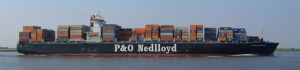
Inner Harwich Haven is primarily characterised as a busy shipping interchange. The character area incorporates the inner part of the administrative region under the control of Harwich Haven Authority (HHA) within which all traffic enters and exists the ports of Harwich and Felixstowe. Overall the area has a depth range of 0 m to 10 m with recorded depths of 7.5-9.5 m alongside Parkeston Quay (Harwich International Port). The tidal range in the character area is within the range of 3-4 m at Mean Spring Tide (DTI 2004). Harwich Deep Water Channel runs through the centre of the area, approaching the ports, and is dredged to a depth of 14.5 m.
As a significant shipping zone the area is subject to the Harwich regulatory system and a number of cautionary restrictions including proximity to high-speed craft, and submarine cables. Anchoring is also forbidden around the channel. Traffic separation schemes are in place and the area is covered by Harwich Vessel Traffic Services (VTS). A recent survey commissioned by the Marine and Coastguard Agency (MCA) showed that over a period of 28 days 1443 merchant vessels, 193 ferries, and 101 tankers transited Harwich Haven, either entering or departing the port, or passing through on other routes (MCA/Safetec 2002).
The predominant sediment in the area is muddy gravel and sand. A number of seabed features are evident in this area including small sandbanks and rock outcrops making navigation into the port treacherous. Cork Spit and Andrews Spit have been dredged for shingle in the past. Stone Banks and Felixstowe Ledges are a product of cemented volcanic ash within the London Clay. Halliday Rock Flats which have a depth of 0 m - 2 m are specifically used as a recreation area for power craft. Many of the features are marked with buoys to aid navigation including Platters, Wadgate Ledge, Felixstowe Ledges and Stone Banks. The Medusa Channel is a wide shallow channel avoided by larger shipping (see link). The character area is a primary sailing route for the Royal Yacht Association (RYA). The area is also popular for recreational fishing, especially off Felixstowe and Shotley (http://www.leader-lines.com/). The area is a potential recreational dive site.
Historic Character and archaeological potential
The character area is within a zone of high potential for submerged Prehistoric remains as a consequence of its proximity to the coast. This zone is one of rapid erosion over the last two millennia suggesting a variety of archaeological remains may be located within the haven. However, constant dredging for the ports of Harwich and Felixstowe may have destroyed some evidence.
Overall 16 obstructions are recorded in the area including 12 wrecks. The majority of these illustrate the significance of Harwich in the two World Wars. A total of four of the vessels belonged to the Royal Navy, including the remains of a WW2 Lancaster Bomber, HMS Gypsy (see link), HMS Sisapon and HMS Tunisian lie within this area. All the recorded ships were mined within the wars. Part of this area was a controlled minefield between 1939 and 1945.
Character perceptions
The character area of the Harwich Inner Haven is viewed as a busy shipping hub which can be difficult to navigate and is closely controlled by the HHA. The area has been important as a harbour approach since the medieval period and its role as a military haven is firmly entrenched within its character. Today perceptions of the area are changing as the port becomes increasingly important within Europe and the European Union.
Bibliography
DTI, 2004, Mean Spring Tidal Range: Atlas of UK Marine Renewable Energy Resources. Department of Trade and Industry, 2004
Maritime Coastguard Agency, SAFETEC, May 2002, Maritime Traffic Survey of the Thames Estuary and Approaches: Vessel Traffic Survey. Maritime Coastguard Agency
Barker, R. HMS Gypsy. Available at: http://www.raybaker.co.uk/poems/GIPSY.htm (07/03/2007)
Leader Lines. Available at: http://www.leader-lines.com (07/03/2007)
Wikipedia. Available at: http://en.wikipedia.org (15/03/2007)
