
England's Historic Seascapes: Southwold to Clacton
Oxford Archaeology (South), 2007. https://doi.org/10.5284/1000277. How to cite using this DOI
Data copyright © Historic England unless otherwise stated
This work is licensed under the ADS Terms of Use and Access.


Primary contact
Oxford Archaeology (South)
Janus House
Osney Mead
Oxford
OX2 0ES
UK
Tel: 01865 263800
Fax: 01865 793496
Resource identifiers
- ADS Collection: 746
- ALSF Project Number: 4729
- DOI:https://doi.org/10.5284/1000277
- How to cite using this DOI
England's Historic Seascapes:
Southwold to Clacton
ALSF Project Number 4729
Oxford Archaeology, 2007
North Caution Area
Primary Subcharacter Type:
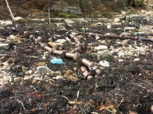
Submarine cable/pipeline
Main Character / current form and use
The North Caution Area is predominantly characterised as an area of dense shipping, particularly in its eastern portion. The presence of submarine cables and a gas pipeline which run through the area has resulted in the application of a precautionary zone. A number of major shipping routes cross in this character area which is transited by ferries, bulk carriers, tankers and gas carriers (Jones et al nd). The western area is less heavily used but ferry routes are located within it.
The gas supply pipeline, connecting Bacton to Zeebruge in the Netherlands runs northwest - southeast through the character area and is maintained by UK Deal. This crosses network cables known as Concerto North which connects the UK to the Netherlands and is maintained by Interoute and Flute Ltd and Hermes1 maintained by GTS Network Services. In addition to being subject to a pipeline precaution the area is covered by Vessel Traffic Services (VTS). The character area is not known to hold any recreational activity.
The depth range of the character area is predominantly 30-50 m, though a small pocket of gravel decreases to 20-30 m, and to the west of the area depths ranging between 50 and 100 m are recorded. The overlying geology is gravelly muddy sand. The tidal range in the character area is within the range of 1-2 m at Mean Spring Tide (DTI 2004).
Historic Character and archaeological potential
Little is known about the historic character of the area, which is in many cases too far offshore to be included on historic Admiralty charts. The eastern part of the area was defensively mined as part of a large coastal barrier during WW2 (Foynes 1994).
Considering this there are surprisingly few known wrecks in view of the size of the character area. This may be a consequence of the depth of the area and lack of investigation. In total 15 wrecks are known, one of which is considered dangerous. Named wrecks include the Kaunas which struck a mine en-route from Ghent to Hartlepool, the Maryland mined travelling from south America to Denmark and the Remke, sunk by a submarine.
The potential exists for shipwreck archaeology although it is not expected to be high. Any surviving vessels may be well preserved as a consequence of their depth. In addition, the area has potential to contain submerged prehistoric landscapes, features or artefacts, having been dry land prior to 8000 BP. However, no investigation work is known to have been done in this area.
Character perceptions
The North Caution Area is generally known to the shipping community as a continental sea route. As an area of open sea, approximately 40 km from the Suffolk coast the area is unlikely to be known by local land-based communities. Currently available information indicates the area has not been intensively investigated.
Bibliography
DTI, 2004, Mean Spring Tidal Range: Atlas of UK Marine Renewable Energy Resources. Department of Trade and Industry, 2004
Foynes, J. P., 1994, Battle of the East Coast (1939-1945). J. P. Foynes
Jones, L. A., Coyle, M. D., Evans, D., Gilliland, P.M., & Murray, A. R., Southern North Sea Marine Natural Area Profile: A contribution to regional planning and management of the seas around England. Peterborough: English Nature.
Wikipedia. Available at: http://en.wikipedia.org (15/03/2007)
