
England's Historic Seascapes: Southwold to Clacton
Oxford Archaeology (South), 2007. https://doi.org/10.5284/1000277. How to cite using this DOI
Data copyright © Historic England unless otherwise stated
This work is licensed under the ADS Terms of Use and Access.


Primary contact
Oxford Archaeology (South)
Janus House
Osney Mead
Oxford
OX2 0ES
UK
Tel: 01865 263800
Fax: 01865 793496
Resource identifiers
- ADS Collection: 746
- ALSF Project Number: 4729
- DOI:https://doi.org/10.5284/1000277
- How to cite using this DOI
England's Historic Seascapes:
Southwold to Clacton
ALSF Project Number 4729
Oxford Archaeology, 2007
Orwell Estuary
Primary Subcharacter Type:
Channel

Main Character / current form and use
The Orwell estuary has a mix of characteristics incorporating industry, recreation and nature conservation. Arguably its industrial function is its most significant as it forms a major source of income for Ipswich and Suffolk. A considerable amount of large traffic transits the estuary at all times of the day and year. (Suffolk County Council 2006). In addition, the Orwell is one of the most popular sailing centres outside the south coast with 3000 boats based in its waters, six sailing clubs and five marinas, including Ipswich, Levington Creek and Woolverstone. The estuary also supports canoeing, sail boarding, water-skiing and use of personal watercraft. (Suffolk Coasts and Heaths Unit, 2004 35). Walking, birdwatching and wildfowling are popular onshore.
The majority of the Orwell Estuary and surrounding areas is recognised as an Area of Outstanding Natural Beauty (AONB), a Special Protected Area (SPA), a RAMSAR site, European Marine Site (EMS), a Site of Special Scientific Interest (SSSI) and an Environmentally Sensitive Area (ESA). The estuary is of international importance for large numbers of wintering birds including waders and wildfowl, attracted by extensive areas of mudflats, saltmarshes and grazing marsh (Suffolk Coasts and Heaths Unit 2004, 5). It also supports nationally scarce saltmarsh plants and invertebrate species.
The majority of the character area falls under the jurisdiction of the Port of Ipswich, although the mouth of the estuary is within the realm of Harwich Haven Authority (HHA). As such the industrial component of the estuary is subject to a number of restrictions including high speed craft, submarine cables, traffic separation and is covered by vessel traffic services, speed limits apply.
The character area extends from Horseshoe Weir in Ipswich to Harwich, a distance of approximately 15km. The Orwell is less constrained by man than many of the estuaries in this area. Measurements from Admiralty charts and the latest survey show that 6 km2 of the area is intertidal flats, 0.5 km2 is saltmarsh and 5 km2 is subtidal (Hutchinson Ports (UK) Ltd, 2003). The estuary is generally accreting, though saltmarsh erosion is still taking place (Hutchinson Ports (UK) Ltd 2003, 118). Generally, the depth of the estuary reaches up to 5 m, though the central shipping canal is dredged to a depth of 5.6 m and berths at Ipswich can be over 8 m deep. Wave heights measure approximately 0.1-0.2 m (Hutchinson Ports (Uk) Ltd 2003). The estuary is well monitored by HHA due to capital dredge and investment projects (Suffolk Coast and Heath Unit 2004, 13).
Other activities taking place in the Orwell include both commercial and recreational fishing and occasionally dispute arises between the two (ESFJC). Commercial fishing is usually carried out by the Harwich fishing fleet, including trawling and net fishing for sole, brown shrimp, bass, mullet and eel (Suffolk Coast and Heath 2004, 31). Commercial vessels over 15.24 m in length are prohibited in inshore areas. Recreational fishing is carried out from boats and targets Codling and Whiting (http://www.leader-lines.com/). Additionally, recreational dive boats are launched from Levington Marina, heading up to 30 miles offshore, from Aldeburgh in the north to Kentish Knock in the south.
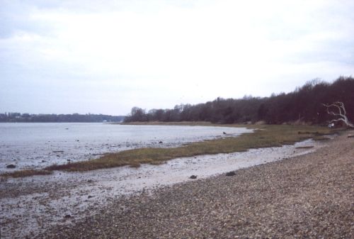
Caption: View of Orwell estuary from Trimley marshes
Photo courtesy:Oxford Archaeology
Historic Character and archaeological potential
The character area has a rich maritime history and high archaeological potential. Ipswich was an important centre in the Saxon period and was particularly significant for shipbuilding and trade in the medieval and post medieval periods (see link). Trading centres and hards existed along the length of the estuary. Butterman's Bay near Pin Mill (see link) is so called due to its role in the dairy trade with the Channel Isles. Trade also included sailing ships, riggers and steamers with grain, timber and fertiliser from as far as South America and the West Indies. Goods were taken by barges to the Ipswich Docks (Edwards 1991, 18). A total of four wrecks are located in the Orwell Estuary, north of Felixstowe, one is identified as the Danish merchant steamship Skagerak.
Settlement evidence in the character area dates back as far as the Paleaolithic; an Acheulian handaxe was found on the bed of the river during the construction of the Seven Arches Bridge. Potential exists for a high level of prehistoric features including submerged landscapes, although the estuary is dredged on a regular basis, possibly impacting on their survival.
A recent intertidal survey conducted by Suffolk County Council found the remains of banks, seawalls, quays, hulks, jetties, sluices, pillboxes, hards, post groups and alignments (Suffolk County Council 2006) The survey also located Roman, Medieval and post medieval pottery and flint. Historic buildings are common in the character area and 434 listed buildings exist including Freston tower, a six-storey 16th century folly which looks out over the River.
Character perceptions
The character area is important to the local community for a number of reasons. As a result of its location at the head of the estuary, Ipswich is the regional centre for Suffolk. The river and docks at Ipswich have traditionally brought wealth to the region.
The area was important for smuggling, as illustrated by the notorious cat house in Woolverstone. The house faced the river and a cat was placed in its window to signify all was under control ashore (Hay & Hay 1972). This area of the rive is known as Cathouse Point.
Bibliography
DTI, 2004, Mean Spring Tidal Range: Atlas of UK Marine Renewable Energy Resources. Department of Trade and Industry, 2004
Foynes, J. P., 1994, Battle of the East Coast (1939-1945). J. P. Foynes
Jones, L. A., Coyle, M. D., Evans, D., Gilliland, P.M., & Murray, A. R., Southern North Sea Marine Natural Area Profile: A contribution to regional planning and management of the seas around England. Peterborough: English Nature.
Wikipedia. Available at: http://en.wikipedia.org (15/03/2007)
Eastern Sea Fisheries Joint Committee Annual Report 2005, 2005, Sea Fisheries Joint Committee
Edwards, R., 1991, The Suffolk Coast. Terence Dalton Ltd
Hedges, A. A. C., 1974, East Coast Shipping (History in Camera). Shire Publications Ltd.
Hay, D. & Hay, J. 1972, East Anglia from the Sea. E Stanford
Hutchinson Ports (UK) Ltd, November 2003. Felixstowe South Reconfiguration Environmental Statement. Hutchinson Ports (UK) Ltd.
Suffolk Coasts & Heaths Unit, 2004, The Stour and Orwell Estuaries: Management Plan. Suffolk Coasts & Heath Unit
Suffolk County Council, 2006, Suffolk Intertidal Field Survey Assessment Report, v. 1. Suffolk County Council
Ransome, A., 1937, We didn't mean to go to sea. Red Fox
Wheatley, K., 1990, National Maritime Museum Guide to Maritime Britain. Webb & Bower
Wren, W. J., 1976, Ports of the Eastern Counties: The Development of Harbours on the Coast of the Eastern Counties From Boston in Lincolnshire to Rochford in Essex. Dalton
Leader Lines. Available at: http://www.leader-lines.com/ (07/03/2007)
Wikipedia. Available at: http://en.wikipedia.org/wiki/Main_Page (07/03/2007)
