
England's Historic Seascapes: Southwold to Clacton
Oxford Archaeology (South), 2007. https://doi.org/10.5284/1000277. How to cite using this DOI
Data copyright © Historic England unless otherwise stated
This work is licensed under the ADS Terms of Use and Access.


Primary contact
Oxford Archaeology (South)
Janus House
Osney Mead
Oxford
OX2 0ES
UK
Tel: 01865 263800
Fax: 01865 793496
Resource identifiers
- ADS Collection: 746
- ALSF Project Number: 4729
- DOI:https://doi.org/10.5284/1000277
- How to cite using this DOI
England's Historic Seascapes:
Southwold to Clacton
ALSF Project Number 4729
Oxford Archaeology, 2007
Shipway and Shipwash
Primary Subcharacter Type:
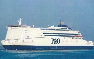
Ferry route
Main Character / current form and use
The Shipway and Shipwash area is one of several pairings of sandbank and channel off the Suffolk coast near Orford which form a series of treacherous navigational features and hazards in the approach to the Harwich Haven ports and Alde/Ore, Butley and Deben estuaries. The pairings are considered together due to the dynamic nature of sandbanks. This area is bordered to the west by Sledway and Bawdsey Bank to the east is open sea.
The character area is predominantly a navigational feature and hazard. Shipway is a channel constrained by Shipwash to the east and Bawdsey Bank to the west which leads into open sea to the north and east of Shipwash. It is part of the palaeochannel of the Stour. It is mainly used by ferries, though it is also used as a potential exit route for deep draught vessels avoiding the southern approach to the Harwich Deep Water Channel. The area to the east of Shipwash is much more heavily used as the main route from Black Deep (see Black Deep and Long Sand character area) and consequently the Thames Estuary. Recent surveys showed that around 9,942 vessels per annum transited the Shipway channel, to or from the Harwich haven ports, most then bearing east to the open sea and the continent (UKHO 2006a). In contrast, a similar survey at the southern end of Shipwash, showed that 16,862 vessels transited the area, using the deeper water channel to the east (UKHO 2006b). Incoming vessels were funnelled into the Sunk Precautionary Area and Harwich Deep Water Channel, outbound into the open sea. Traffic included merchant ships, ferries, tankers and containers.
Shipwash is a hazard to shipping. The depth across the area is generally around 10-20 m, increasing to 30 m east. However, over Shipwash depths decrease from 10 m to drying. This is compounded by an area of sandwaves to the north at the entrance to Shipway up to 5.8 m high, found to be shoaling and migrating north-northeast at a rate of 20 m per year. A further area of sandwaves to the south, around South Ship Head and to the east of Shipwash are as much as 7 m high and migrating in the same direction at a rate of 40 m per year. South Ship Head itself is a product of cemented volcanic ash within the London clay. Around North Ship Head there are two areas of water turbulence. Generally, the overlying geology consists of gravelly muddy sand with gravel in the deeper areas. The tidal range in the character area is within the range of 3-4 m at Mean Spring Tide (DTI 2004).
As a result of its proximity to the ports of Harwich and Felixstowe and particularly the entrance to the Harwich Deep Water Channel, the area comes within the jurisdiction of the Harwich regulatory system. It is subject to restrictions concerned with high speed craft, submarine cables and traffic separation and is covered by Vessel Traffic Services (VTS).
The area is commercially fished, usually in late Summer and Autumn, mainly for sole but also for roker, bass and cod.
The area is crossed east-west by a Royal Yacht Association route heading into Orford Haven and out to the open sea, a second route follows the channel to the east of Shipwash. The area is also a potential recreational dive site.
Historic Character and archaeological potential
Shipwash and Shipway are marked as navigational features on the Admiralty chart of 1855. The historic character as a shipping route is demonstrated by the large number of wrecks located within the character area. Overall 42 known wrecks are recorded including five Royal Navy vessels. All the named vessels were sunk during the two World Wars through collision with mines, bombing, or torpedoes. As with many of the areas close to the east coast indicating this area was important for the defence of Britain.
The character area therefore has high potential for shipwrecks. In addition the area has potential to contain submerged prehistoric landscapes, features or artefacts, having been dry land prior to 8000 BP. However, no investigation work is known to have been done in this area.
The Albert Close fishing chart of 1953 records that this area was good sole ground in the summer.
Character perceptions
The character area within a wider area of treacherous sandbanks, sandwaves and heavy shipping to be carefully navigated by marine traffic. The danger of the area is illustrated by an incident in 1999 when a ferry using the shipping channel east of Shipwash was swamped by a wave which broke over the sandbank. One life was lost in the incident (http://www.marinelog.com).
Bibliography
DTI, 2004, Mean Spring Tidal Range: Atlas of UK Marine Renewable Energy Resources. Department of Trade and Industry, 2004
UKHO, 1953, Close�s Fishermen�s Chart of the North Sea United Kingdom Hydrographic Office
UKHO, February 2006, Thames Estuary North Shipwash: Assessment on the Analysis of Routine Resurvey Area TE2A from the 2005 Survey. UKHO
UKHO, March 2006, Thames Estuary South Ship Head: Assessment on the Analysis of Routine Resurvey Area TE3 from the 2005 Survey. UKHO
Marine Log. Available at: http://www.marinelog.com (06/03/2007)
Wikipedia. Available at: http://en.wikipedia.org/wiki/Main_Page (07/03/2007)
