
England's Historic Seascapes: Southwold to Clacton
Oxford Archaeology (South), 2007. https://doi.org/10.5284/1000277. How to cite using this DOI
Data copyright © Historic England unless otherwise stated
This work is licensed under the ADS Terms of Use and Access.


Primary contact
Oxford Archaeology (South)
Janus House
Osney Mead
Oxford
OX2 0ES
UK
Tel: 01865 263800
Fax: 01865 793496
Resource identifiers
- ADS Collection: 746
- ALSF Project Number: 4729
- DOI:https://doi.org/10.5284/1000277
- How to cite using this DOI
England's Historic Seascapes:
Southwold to Clacton
ALSF Project Number 4729
Oxford Archaeology, 2007
South Orford Coastal Marsh
Primary Subcharacter Type:
Reclaimed Land
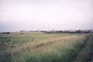
Main Character / current form and use
The predominant character of this area is reclaimed land. The majority of the area was reclaimed from salt marshes before the 17th century and then modified after 1700 by filling in curvilinear dykes and replacing them with straight ones (Williamson 2006). The character area is differentiated from the surrounding areas of the Deben, Alde and Ore estuaries by its direct association with the open coast, rather than the estuaries and through its lack of protected status. The area is part of the Suffolk Heritage Coast, known for its beauty and wildlife.
The Hollesley Bay Prison is located within this character area, named after the adjacent coastal inlet (see link).
The immediate coastal waters in this area have a maximum depth of 5 m. The overlying geology is generally gravelly muddy sand.
Historic Character and archaeological potential
The area has a known Heritage resource and a likely high archaeological potential. The area contains Six Scheduled Ancient Monuments and a number of scattered finds. One of the most notable sites is that excavated 600 m to the east of Cedar Court by Suffolk County Council. Cropmarks were excavated including enclosures, pits and postholes and prehistoric flints and a large quantity of Iron Age and Roman pottery recovered.
Like much of the coastline and immediate coastal waters along this stretch, the character area was important for defence both in the 19th and 20th century. A total of four Martello Towers survive, including one now used as a residence. Other features include pill boxes, gun emplacements, a monitoring post, an anti-aircraft battery dating to 1944-5, anti-tank cubes, an infantry strongpoint and an enclosed minefield. Two gun emplacements are linked by a passageway which allows access to a central war shelter. A well-preserved scaffolding obstacle survives on the beach.
The current character of the area as reclaimed land also illustrates its historical character. The present land surface clearly shows reclamation and periods of agricultural change.
Character perceptions
The character area is probably best known today as the location of the infamous Hollesley Bay Open Prison (see link). The establishment is notorious for the number of inmates who abscond every year. However, it is also within the Suffolk Heritage Coast and is an area of recreation and natural beauty.
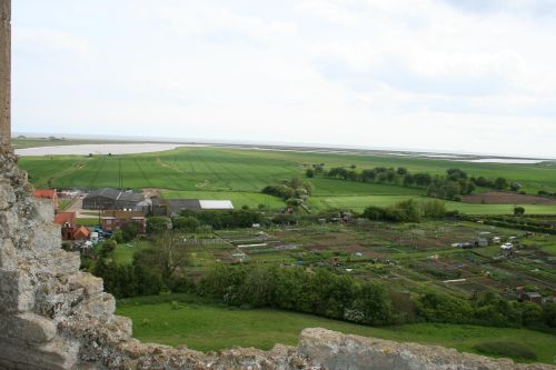
Caption: View of River Orford and southern Orford Ness from Orford Castle
Photo courtesy: Oxford Archaeology
Bibliography
Field, J. 1992, Learning Through Labour: Training, unemployment and the State, 1890-1939. University of Leeds
Williamson, T., 2006, England�s Landscape: East Anglia. English Heritage
Wikipedia. Available at: http://en.wikipedia.org/wiki/Main_Page (07/03/2007)
