
England's Historic Seascapes: Southwold to Clacton
Oxford Archaeology (South), 2007. https://doi.org/10.5284/1000277. How to cite using this DOI
Data copyright © Historic England unless otherwise stated
This work is licensed under the ADS Terms of Use and Access.


Primary contact
Oxford Archaeology (South)
Janus House
Osney Mead
Oxford
OX2 0ES
UK
Tel: 01865 263800
Fax: 01865 793496
Resource identifiers
- ADS Collection: 746
- ALSF Project Number: 4729
- DOI:https://doi.org/10.5284/1000277
- How to cite using this DOI
England's Historic Seascapes:
Southwold to Clacton
ALSF Project Number 4729
Oxford Archaeology, 2007
The Sunk
Primary Subcharacter Type:
Safety area (offshore)
Main Character / current form and use
The Sunk area is predominantly characterised as a navigational hazard within an area of heavy shipping. It is located at the top of the Harwich Deep Water Channel, around 16 km to 28 km offshore. The character area is dominated by the 'Sunk Precautionary Area', delineated in 2002, which is an area of sandwaves with the potential to become an obstacle to shipping and to impact on traffic routing. The area is composed of gravelly muddy sand with pure gravel away from the sandbanks. The sandwaves are up to 7 m high and both symmetrical and asymmetrical in form (UKHO 2006). These features are slowly migrating in a south-westerly direction and have a tendency to shoal slightly. The tidal range in the character area is within the range of 3-4 m at Mean Spring Tide (DTI 2004).
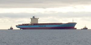
The area falls within the jurisdiction of the Harwich Haven Authority (HHA) and contains the Sunk and Harwich deep water tracks. It is subject to precautions including high speed craft and traffic separation and is covered by Vessel Traffic Services VTS). The Sunk functions as a crossroads for shipping with constant streams of commercial traffic transiting east-west, to and from Harwich, Felixstowe, Ipswich and the continent, and north-south to and from Scandinavia to the Thames and beyond (UKHO 2006). A number of leisure sailing routes also traverse the area. The COAST database indicates more than 16,665 vessels transit the area per annum including ferries, container and merchant vessels and tankers (UKHO 2006). Vessels of up to 14 m draught are known to use the area and depths above the sandwaves are close to critical to such vessels, being less than 15 m in places. The Harwich Deep Water Channel is dredged to 14.5 m and the sandwaves do not extend above this. The maximum depth in the area is c 30 m. The character area also contains the Sunk deep water anchorage for ships entering the haven ports.
The area is extensively dredged for aggregates by both United Marine Dredging and Britannia Aggregates , incorporating the Thames, Thames Estuary and Sunk Head extension areas. Although the area is a fishing ground, this activity is sporadically interrupted as dredged areas are temporarily closed (Rogers 1997). The western half of the character area also falls into the Gunfleet military zone (see Gunfleet Sands and Wallet character area). The area is also a potential recreational dive site.
A recent survey commissioned by the Maritime and Coastguard Agency (MCA) identified the area as an area of concern in terms of volume of traffic and room for emergency manoeuvring (MCA/Safetec 2002). The convergence of a number of shipping routes, outlined above, in addition to the presence of vessels boarding or landing pilots and vessels anchored in the Sunk deepwater anchorage can be problematic (ibid). There are proposals for new traffic routing measures in the area which will include an Outer Sunk Precautionary Area, a single two-way recommended deep water track leading into and out of the character area and a two way corridor for pilot exempt vessels. This may increase traffic within the area. In addition, in light of the forthcoming London Gateway Project - a proposed redevelopment of the former Shell Haven Refinery on the north side of the Thames Estuary, the increased size of shipping expected at the new terminal may lead to dredging in the Sunk deep water track (UKHO 2006).
Historic Character and archaeological potential
The Sunk character area is not marked as a hazard on available historic charts up to 1905 and knowledge of its morphology may be relatively recent. However due to its position close to the entrance to Harwich Harbour the area is likely to have been used for shipping for many years. A total of 48 wrecks are located in the area, 36 of which are considered dangerous. The Albert Close fishing chart of 1953 records that this area was good sole ground in the summer.
The area was heavily mined in both World Wars and the majority of named wrecks were mined or torpedoed. This includes five Royal Navy vessels, HMS Resono, HMS Commandant, HMS Lord Airedale HMTB No.10 and HMTB NO.11, a vessel of the Royal Netherlands Navy and two German U boats. Coastal craft known to have been wrecked in this area include Bonnington Court, en route from Ipswich to the Tyne and Monitoria on passage from the Humber to London. International journeys are represented by ships such as the Wearside, mined on passage between Newcastle and Genoa.
In addition to the high archaeological potential in relation to shipwrecks, the area has potential to contain submerged prehistoric landscapes, features or artefacts, having been dry land prior to 8000 BP. However, no investigation work is known to have been done in this area.
Character perceptions
The area is generally perceived as a busy shipping crossroad and navigational hazard to sea-users, both commercial and leisure. It is unlikely to be known to local coastal communities though its location links it intimately with Harwich Haven. Proposed traffic measures and dredging may serve to make the area busier but are unlikely to greatly change its character.
Bibliography
DTI 2004. Mean Spring Tidal Range: Atlas of UK Marine Renewable Energy Resources. Department of Trade and Industry, 2004
Maritime Coastguard Agency, SAFETEC, May 2002, Maritime Traffic Survey of the Thames Estuary and Approaches: Vessel Traffic Survey. Maritime Coastguard Agency
Rogers, S. I., 1997, A review of closed areas in the United Kingdom Exclusive Economic Zone. CEFAS Science Series Technical Report No. 106
UKHO, January 2006, Thames Estuary Black Deep: Assessment of the Analysis of Routine Resurvey Area TE6A from the 2005 Survey. UKHO
UKHO, February 2006, Thames Estuary Sunk: Assessment on the Analysis of Routine Resurvey Area TE3A from the 2005 Survey. UKHO
UKHO, March 2006, Thames Estuary Long Sand Head: Assessment on the Analysis of Routine Resurvey Area TE5A from the 2005 Survey. UKHO
Wikipedia. Available at: http://en.wikipedia.org (15/03/2007)
