13-51 Eskdale Road and 47-63 Station Road, Stoke Mandeville, Buckinghamshire. Archaeological Evaluation (OASIS ID: heritage1-257684)

The Heritage Network, 2018. https://doi.org/10.5284/1048304. How to cite using this DOI

Digital Object Identifiers

Digital Object Identifiers (DOIs) are persistent identifiers which can be used to consistently and accurately reference digital objects and/or content. The DOIs provide a way for the ADS resources to be cited in a similar fashion to traditional scholarly materials. More information on DOIs at the ADS can be found on our help page.

Citing this DOI

The updated Crossref DOI Display guidelines recommend that DOIs should be displayed in the following format:

https://doi.org/10.5284/1048304
Sample Citation for this DOI

The Heritage Network (2018) 13-51 Eskdale Road and 47-63 Station Road, Stoke Mandeville, Buckinghamshire. Archaeological Evaluation (OASIS ID: heritage1-257684) [data-set]. York: Archaeology Data Service [distributor] https://doi.org/10.5284/1048304

Data copyright © The Heritage Network unless otherwise stated

This work is licensed under the ADS Terms of Use and Access.
Creative Commons License


The Heritage Network logo

Primary contact

Alison Hudson
The Heritage Network
11 Furmston Court
Icknield Way
Letchworth
SG6 1UJ

Send e-mail enquiry

Resource identifiers

Digital Object Identifiers

Digital Object Identifiers (DOIs) are persistent identifiers which can be used to consistently and accurately reference digital objects and/or content. The DOIs provide a way for the ADS resources to be cited in a similar fashion to traditional scholarly materials. More information on DOIs at the ADS can be found on our help page.

Citing this DOI

The updated Crossref DOI Display guidelines recommend that DOIs should be displayed in the following format:

https://doi.org/10.5284/1048304
Sample Citation for this DOI

The Heritage Network (2018) 13-51 Eskdale Road and 47-63 Station Road, Stoke Mandeville, Buckinghamshire. Archaeological Evaluation (OASIS ID: heritage1-257684) [data-set]. York: Archaeology Data Service [distributor] https://doi.org/10.5284/1048304

Introduction

13-51 Eskdale Road and 47-63 Station Road, Stoke Mandeville, Buckinghamshire. Archaeological Evaluation (OASIS ID: heritage1-257684)

In order to investigate the archaeological potential of a proposed residential development site on land to the r/o 13-51 Eskdale Road and 47-63 Station Road, Stoke Mandeville, Bucks. the Heritage Network was commissioned to undertake field evaluation of the site by trial trenching.

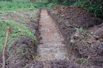
Ten trenches were located in three defined areas, which were sited to avoid nesting birds. Each trench measured 15m in length and between 1.80m and 2m in width. No features, deposits or finds of archaeological significance were encountered. A number of modern field drains were revealed in Trenches 4 and 7 and a modern demolition spread, presumably relating to an outbuilding such as a shed, was exposed in Trench 3.

One abraded fragment of late post-medieval peg tile was recovered during the sampling of the topsoil. This was discarded on site. No other finds were encountered during the sampling of the top and subsoils. On the basis of the results of the evaluation, the risk that the proposed development might have a negative impact on remains of archaeological significance may be considered to be Low for all periods.


ADS logo
Data Org logo
University of York logo