
National Historic Seascape Characterisation Consolidation
LUC (Land Use Consultants), 2018. https://doi.org/10.5284/1046273. How to cite using this DOI
Data copyright © Historic England unless otherwise stated
This work is licensed under the ADS Terms of Use and Access.

Primary contact
Diana
Manson
Associate Director
GIS & Visualisation
LUC (Land Use Consultants)
12th Floor
Colston Tower
Colston Street
Bristol
BS14XE
England
Resource identifiers
- ADS Collection: 2958
- DOI:https://doi.org/10.5284/1046273
- How to cite using this DOI

Introduction
Partly as a result of the recognition that there was increasing development pressure in the marine environment, English Heritage’s (now Historic England’s) statutory curatorial responsibilities were extended to England’s share of Territorial Waters in 2002, and the Marine and Coastal Access Act 2009 was enacted, defining, amongst other matters, England’s Inshore and Offshore Regions. In response to this, English Heritage (EH) extended its land-based Historic Landscape Characterisation (HLC) programme to the coast and seas, developing and testing a national method for Historic Seascape Characterisation (HSC).
National coverage was undertaken in eight separate implementation projects from 2008 to 2015. The eventual need for integrating these separate implementation projects was recognised from the start, so accordingly all projects worked to the national HSC methodology.
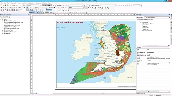
This project consolidated the eight existing HSC implementation projects into a single national database. The project provided a single, consistent National HSC database, with accompanying guidance documents, making it a streamlined and efficient evidence base for managing the marine and coastal historic environment. The main challenge addressed in this project related to inconsistencies across the projects, which were inevitable given the considerable differences in the character of the historic seascape across the different project areas, the number of different people involved, and the increasing availability of data sources over the years. Furthermore, the GIS data required extensive ‘cleaning’ to eliminate overlaps, streamline terminology and ensure consistency at project boundaries.
The outputs include:
- National HSC Consolidation Project Report
- Technical Advice Note
- User Guide
- Historic Seascape Characterisation Thesaurus (compiled by Historic England)
- NHSC database with accompanying MXD, layer files and style file (symbology) and file structure (detailed in full in the Technical Advice Note)
- Symbology style sheets
The database and project MXD has been developed to be a user-friendly GIS product with hyperlinks from the GIS data to National Perspective texts. The GIS data package is not part of the archive, but can be requested from Listing Information Services at Historic England via the contact details below:
Neil Guiden
Listing Information Services
Historic England
The Engine House
Swindon
Office: 01793 414840
