
West Coast Palaeolandscapes Survey Main
University of Birmingham, Dyfed Archaeological Trust, 2013. https://doi.org/10.5284/1018087. How to cite using this DOI
Data copyright © University of Birmingham unless otherwise stated
This work is licensed under the ADS Terms of Use and Access.


Primary contact
Prof
Vince
Gaffney
Chair in Landscape Archaeology
School of Archaeological and Forensic Sciences
University of Birmingham
Edgbaston
Birmingham
B15 2TT
UK
Resource identifiers
- ADS Collection: 1198
- ALSF Project Number: 5238
- DOI:https://doi.org/10.5284/1018087
- How to cite using this DOI


Downloads
Project report
The final project report is available as two versions, with and without Appendix 1 respectively.
|
West Coast Palaeolandscapes Survey, by - Simon Fitch and Vince Gaffney with contributions from Eleanor Ramsey and Emma Kitchin. VISTA Centre, University of Birmingham: 2012 Version including Appendix |
13 Mb | |
|
|
West Coast Palaeolandscapes Survey, by - Simon Fitch and Vince Gaffney with contributions from Eleanor Ramsey and Emma Kitchin. 2012 Version not including Appendix |
12 Mb |
Project GIS - documentation
| ADS GIS file metadata for georectified images | 187 Kb | |
| ADS GIS documentation | 305 Kb | |
| ADS GIS file metadata | 173 Kb |
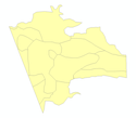
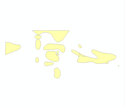
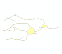
Project GIS - shapefiles
The zip files contain the ESRI shapefiles (.shp, .sbx, shx, .sbn, .prj and .dbf). The files should be used in conjunction with the documentation provided.
|
BC Landscape Characterisation | ZIP | 10 Kb |
|
BC broad area features | ZIP | 11 Kb |

|
Bristol Channel 2D features | ZIP | 278 Kb |
|
Bristol Channel 3D features | ZIP | 49 Kb |

|
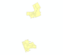
LANDSCAPE AREAS OF LIVERPOOL BAY region | ZIP | 6 Kb |
|
LANDSCAPE CHARACTER AREAS OF WEST COAST PALAEOLANDSCAPES region | ZIP | 14 Kb |
|
LANDSCAPE FEATURES OF WEST COAST PALAEOLANDSCAPES region | ZIP | 151 Kb |
|
LB Landscape Characterisation | ZIP | 9 Kb |

|
LB broad area features | ZIP | 7 Kb |
|
Liverpool Bay 2D features | ZIP | 476 Kb |
|
Liverpool Bay 3D features | ZIP | 107 Kb |
|
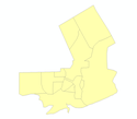
MANAGEMENT AREAS OF WEST COAST PALAEOLANDSCAPES region | ZIP | 13 Kb |
|
RelativeTopographyBC | ZIP | 26 Kb |
|
RelativeTopographyLB | ZIP | 36 Kb |
|
STUDY AREAS | ZIP | 7 Kb |
|
STUDY AREA OF WEST COAST PALAEOLANDSCAPES region | ZIP | 7 Kb |
|
SURVIVAL OF ARCHAEOLOGICAL DEPOSITS OF WEST COAST PALAEOLANDSCAPES region | ZIP | 13 Kb |
|
interpolated features BC | ZIP | 39 Kb |
Project GIS - images
The zip files contain GeoTiff (.tif, .tifw, .aux, .xml). The files should be used in conjunction with the documentation provided.
|
ArchPSBristolChannel | ZIP | 149 Kb |
|
ArchPSLiverpoolBay | ZIP | 155 Kb |
|
bc raster1 | ZIP | 421 Kb |
|
lb raster1 | ZIP | 272 Kb |
